Category:Maps of Yorkshire
Jump to navigation
Jump to search
Wikimedia category | |||||
| Upload media | |||||
| Instance of | |||||
|---|---|---|---|---|---|
| Category combines topics | |||||
| Yorkshire | |||||
historic county of England    | |||||
| Instance of | |||||
| Location |
| ||||
| Capital | |||||
| Has part(s) |
| ||||
| Population |
| ||||
| Area |
| ||||
| official website | |||||
 | |||||
Subcategories
This category has the following 7 subcategories, out of 7 total.
Media in category "Maps of Yorkshire"
The following 62 files are in this category, out of 62 total.
-
 A literary map of Yorkshire by JL Carr.jpg 1,920 × 1,777; 983 KB
-
 Ainsty and the City of York.png 83 × 82; 888 bytes
-
 BRADLEY(1890) p03.56 - Rivers of Yorkshire.jpg 1,235 × 1,272; 367 KB
-
 BRADLEY(1890) p05.64 - Rivers of Yorkshire.jpg 1,306 × 1,285; 396 KB
-
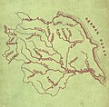
 BRADLEY(1890) p06.68 - Map of the Yorkshire Rivers.jpg 1,336 × 1,291; 459 KB
-
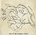
 BRADLEY(1890) p07.42 - The Rivers of Yorkshire.jpg 1,269 × 1,310; 351 KB
-
 Brigantia-Brigantium map.png 260 × 290; 5 KB
-
 Coastal erosion on the Yorkshire Coast.svg 512 × 384; 926 KB
-
 Craven District-Yorkshire-map-relief 2.jpg 1,039 × 791; 263 KB
-
 Craven District-Yorkshire-map-roads.jpg 1,039 × 791; 313 KB
-
 Detail from a literary map of Yorkshire by JL Carr.jpg 3,285 × 2,708; 2.04 MB
-
 East Riding locator in England.svg 1,108 × 1,345; 302 KB
-
 EnglandWestRidingPre1974.png 200 × 244; 25 KB
-
 EnglandYorkshire1851.svg 956 × 1,265; 136 KB
-
 EnglandYorkshireHumber.png 200 × 247; 15 KB
-
 EnglandYorkshireTrad.png 200 × 250; 28 KB
-
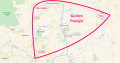 Golden Triangle (Yorkshire).svg 1,704 × 890; 1.58 MB
-
 Honour of Richmond.png 492 × 291; 6 KB
-
 HUNTON(1855) p262 - Map of Yorkshire.jpg 2,032 × 1,199; 532 KB
-
 Kingdom of Jorvik.png 278 × 245; 20 KB
-
 Kingdom of Jórvik.svg 278 × 245; 61 KB
-
 Lifeboat Stations Yorkshire.svg 1,536 × 1,152; 3.23 MB
-
 Map (47869354091).jpg 4,032 × 3,024; 2.29 MB
-
 Map of Yorkshire.png 4,328 × 5,480; 433 KB
-
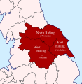
 New and Old Divisions in colour.png 389 × 344; 31 KB
-
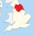
 North Riding locator in England.svg 1,108 × 1,345; 302 KB
-
 North York Moors National Park map.svg 1,425 × 1,200; 1.11 MB
-
 North,west,east&southyorkshire.png 800 × 680; 77 KB
-
 Nottinghamshire Lincolnshire Yorkshire exclaves.jpg 3,120 × 4,160; 4.48 MB
-
 Ordnance Survey Quarter-inch sheet 11 North Midlands and Yorkshire, published 1964.jpg 9,601 × 8,904; 10.65 MB
-
 Ordnance Survey Sheet SE 43 53 Sherburn in Elmet, Published 1973.jpg 15,808 × 7,431; 42.49 MB
-
 Parisiorum-Parisii map.png 199 × 201; 3 KB
-
 South West Yorks green belt.svg 1,170 × 1,312; 3.75 MB
-
 The Yorkshire coast and the Cleveland hills and dales; (1892) (14597282900).jpg 1,670 × 2,052; 289 KB
-
 The Yorkshire coast and the Cleveland hills and dales; (1892) (14597342198).jpg 1,702 × 2,602; 912 KB
-
 Vale of Pickering Location.jpg 3,383 × 1,235; 130 KB
-
 WARD(1892) p67 - Basin of the Yorkshire Ouse.jpg 1,228 × 1,032; 264 KB
-
 West Riding locator in England.svg 1,108 × 1,345; 302 KB
-
 Whitby Parliamentary Constituency 1885-1918.gif 351 × 280; 5 KB
-
 Yorksgeology japanease.jpg 549 × 451; 94 KB
-
 Yorksgeology.jpg 549 × 451; 55 KB
-
 Yorkshire - British Isles.svg 1,250 × 1,835; 1,002 KB
-
 Yorkshire Administrative Map 1832.png 2,410 × 2,000; 690 KB
-
 Yorkshire Brit Isles Sect 3.svg 939 × 677; 972 KB
-
 Yorkshire Dales National Park map 2016.svg 1,153 × 1,448; 1.08 MB
-
 Yorkshire Dales National Park map.svg 1,157 × 1,345; 1.01 MB
-
 Yorkshire Map.png 4,967 × 4,967; 4.38 MB
-
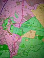
 Yorkshire Places of Interest.png 3,507 × 2,480; 1.54 MB
-
 Yorkshire Ridings Brit Isles section.svg 402 × 412; 1.23 MB
-
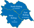
 Yorkshire Ridings.png 572 × 484; 6 KB
-
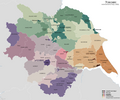
 Yorkshire Ridings.svg 1,001 × 829; 324 KB
-
 Yorkshire UK 1851 locator map.svg 1,108 × 1,345; 310 KB
-
 Yorkshire UK locator map.svg 1,108 × 1,345; 303 KB
-
 Yorkshire Wapentakes.svg 1,000 × 828; 4.09 MB
-
 Yorkshire-Drainage.jpg 738 × 600; 227 KB
-
 YorkshireBrit3.PNG 698 × 491; 28 KB
-
 YorkshireCounties.png 351 × 297; 30 KB
-
 Yorkshiremap.png 2,569 × 2,729; 160 KB
-
 ヨークシャーの地図-1972年の分割.png 360 × 259; 274 KB
-
 ヨークシャーの地図-1990年のヨークシャーアンドザハンバー.png 361 × 260; 276 KB
-
 ヨークシャーの地図-ヨークシャーアンドザハンバーの下位区分.png 364 × 260; 278 KB
-
 ヨークシャーの地図-古典的な3ライディング.png 360 × 260; 275 KB


_p03.56_-_Rivers_of_Yorkshire.jpg)
_p05.64_-_Rivers_of_Yorkshire.jpg)
_p06.68_-_Map_of_the_Yorkshire_Rivers.jpg)
_p07.42_-_The_Rivers_of_Yorkshire.jpg)


.svg)

_p262_-_Map_of_Yorkshire.jpg)


.jpg)


_(14597282900).jpg)
_(14597342198).jpg)
_p67_-_Basin_of_the_Yorkshire_Ouse.jpg)


