Category:Maps of Cambridgeshire
Jump to navigation
Jump to search
Wikimedia category | |||||
| Upload media | |||||
| Instance of | |||||
|---|---|---|---|---|---|
| Category combines topics | |||||
| Cambridgeshire | |||||
ceremonial county of England, UK | |||||
| Instance of | |||||
| Location |
| ||||
| Capital | |||||
| Population |
| ||||
| Area |
| ||||
| Different from | |||||
| Said to be the same as | Cambridgeshire (historic county of England, ceremonial county of England, 1844) | ||||
 | |||||
Subcategories
This category has the following 11 subcategories, out of 11 total.
E
- Election maps of Cambridgeshire (185 F)
H
- Hundreds of Cambridgeshire (20 F)
M
- Maps of Isle of Ely (12 F)
O
Media in category "Maps of Cambridgeshire"
The following 61 files are in this category, out of 61 total.
-
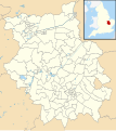
Camb.svg 1,129 × 1,385; 107 KB
-
Cambridge location map.svg 1,319 × 1,266; 160 KB
-
Cambridge UK ward map 2010 (blank).svg 1,319 × 1,266; 115 KB
-
Cambridge UK ward map 2010 coloured.svg 1,030 × 1,130; 150 KB
-
Cambridgeshire - British Isles.svg 1,250 × 1,835; 1,024 KB
-
Cambridgeshire Banham Draft.png 202 × 237; 5 KB
-
Cambridgeshire Brit Isles Sect 5.svg 809 × 743; 939 KB
-
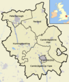
Cambridgeshire Constabulary districts.png 202 × 237; 4 KB
-
Cambridgeshire districts.png 600 × 714; 385 KB
-
Cambridgeshire dykes.svg 1,978 × 1,393; 387 KB
-
Cambridgeshire Hundreds 1830.png 1,652 × 2,338; 272 KB
-
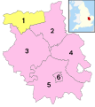
Cambridgeshire numbered districts.svg 1,125 × 1,266; 639 KB
-
Cambridgeshire outline map with UK.png 600 × 714; 342 KB
-
Cambridgeshire UK constituency map (blank).svg 1,125 × 1,266; 938 KB
-
Cambridgeshire UK district map (blank).svg 1,125 × 1,266; 894 KB
-
Cambridgeshire UK electoral division map (blank).svg 1,125 × 1,266; 1.34 MB
-
Cambridgeshire UK electoral division map 2013 (blank).svg 1,125 × 1,266; 1.16 MB
-
Cambridgeshire UK electoral division map 2017 (blank).svg 1,125 × 1,266; 1.29 MB
-
Cambridgeshire UK location map.svg 1,125 × 1,266; 1.79 MB
-
Cambridgeshire UK locator map 2010.svg 1,108 × 1,345; 302 KB
-
Cambridgeshire UK parish map (blank).svg 1,125 × 1,266; 2.11 MB
-
Cambridgeshire UK PCC election 2024.svg 1,125 × 1,266; 895 KB
-
Cambridgeshire UK relief location map.jpg 1,998 × 2,251; 421 KB
-
Cambridgeshire UK ward map (blank).svg 1,125 × 1,266; 1.7 MB
-
Cambridgeshire1832Map.png 1,446 × 2,000; 410 KB
-
CambridgeshireBrit5.PNG 625 × 569; 26 KB
-
Caxton and Arrington RD 1894.png 1,665 × 1,422; 53 KB
-
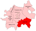
Chesterton RD 1894.png 1,665 × 1,422; 52 KB
-
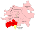
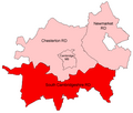
Chesterton RD 1934.png 1,665 × 1,422; 44 KB
-
Coton-village-footpaths-map.JPG 1,600 × 1,200; 143 KB
-
East West Rail Consortium Central map.jpg 731 × 482; 37 KB
-
England Police Forces (Cambridgeshire).svg 1,108 × 1,345; 312 KB
-
EnglandCambridgeshire.png 200 × 247; 22 KB
-
EnglandPeterborough.png 200 × 247; 16 KB
-
EnglandPoliceCambridgeshire.png 2,165 × 2,670; 88 KB
-
Fens-OMC.jpg 514 × 432; 45 KB
-
Flendish Hundred.png 1,200 × 1,698; 722 KB
-
Historical Administrative Boundaries in Cambridgeshire.svg 1,000 × 1,000; 3.47 MB
-
Cambridgeshire Hundreds.svg 999 × 1,513; 377 KB
-
Huntingdonshire Hundreds 1830.png 1,648 × 2,336; 990 KB
-
Huntingdonshire UK ward map 2010 (blank).svg 1,055 × 1,266; 573 KB
-
LIDAR image of Barton, Cambridgeshire, 1m resolution, with buildings.tiff 2,000 × 1,000; 1.91 MB
-
Linton RD 1894.png 1,665 × 1,422; 52 KB
-
Melbourn RD 1894.png 1,665 × 1,422; 54 KB
-
National Grid square TF at 1 in 250 000 scale.gif 4,000 × 4,000; 2.36 MB
-
National Grid square TF at 1 in 250 000 scale.png 4,000 × 4,000; 1.92 MB
-
Newmarket RD 1934.png 1,665 × 1,422; 43 KB
-
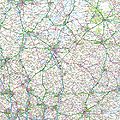
Ordnance Survey 1-250000 - TF.jpg 4,000 × 4,000; 6.07 MB
-
Ordnance Survey 1-250000 - TL.jpg 4,000 × 4,000; 8.45 MB
-
OS Street View TL46NE.tif 5,000 × 5,000; 2.42 MB
-
Peterborough UK ward map 2010 (blank).svg 1,425 × 850; 374 KB
-
Peterborough UK ward map 2016 (blank).svg 1,425 × 850; 470 KB
-
Slystyn Chambridgeshire.png 600 × 714; 385 KB
-
South Cambridgeshire RD 1934.png 1,665 × 1,422; 43 KB
-
Swavesey RD 1894.png 1,665 × 1,422; 52 KB
-
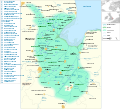
The Fens England map.svg 1,740 × 1,585; 1.6 MB
-
Thriplowmap.jpg 400 × 386; 56 KB
-
Ukmap-cambs-s.png 145 × 173; 6 KB
-
Wicken Fen NT map.svg 988 × 1,318; 1,009 KB
-
Wicken Fen SSSI Map.svg 751 × 583; 403 KB
-
Wisbech1885.png 377 × 500; 19 KB


