Category:Maps of Lancashire
Jump to navigation
Jump to search
Wikimedia category | |||||
| Upload media | |||||
| Instance of | |||||
|---|---|---|---|---|---|
| Category combines topics | |||||
| Lancashire | |||||
ceremonial county in North-West England, United Kingdom | |||||
| Instance of | |||||
| Part of | |||||
| Location |
| ||||
| Capital | |||||
| Population |
| ||||
| Area |
| ||||
| Different from | |||||
| Said to be the same as | Lancashire (historic county of England, ceremonial county of England, 1844) | ||||
| official website | |||||
 | |||||
Subcategories
This category has the following 10 subcategories, out of 10 total.
Media in category "Maps of Lancashire"
The following 43 files are in this category, out of 43 total.
-
Adlington, Blackburn, Cherry Tree, Chorley, Hincaster Ingleton & Wennington RJD 103.jpg 2,677 × 1,723; 680 KB
-
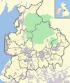
Bowland & Lancs labelled with UK.png 600 × 714; 356 KB
-
Bowland & Lancs with UK.png 600 × 714; 350 KB
-
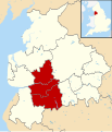
Central Lancashire.svg 1,116 × 1,305; 1.25 MB
-
Cumbria and Lancashire.png 543 × 939; 174 KB
-
England Police Forces (Lancashire).svg 1,108 × 1,345; 312 KB
-
EnglandPoliceLancashire.png 2,165 × 2,670; 88 KB
-
Historical and current boundaries of Lancashire.png 847 × 1,236; 191 KB
-
Lancashire - British Isles.svg 1,250 × 1,835; 1,024 KB
-
Lancashire - Coastal Way.png 835 × 1,225; 135 KB
-
Lancashire Brit Isles Sect 3.svg 939 × 677; 1,012 KB
-
Lancashire Ceremonial Numbered.png 200 × 250; 6 KB
-
Lancashire Ceremonial Numbered.svg 512 × 546; 320 KB
-
Lancashire Map.png 4,967 × 4,967; 4.32 MB
-
Lancashire numbered districts.svg 1,116 × 1,305; 1.28 MB
-
Lancashire outline map with UK-2.png 600 × 714; 383 KB
-
Lancashire outline map with UK.png 600 × 714; 423 KB
-
Lancashire railway map.svg 1,116 × 1,305; 1.53 MB
-
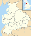
Lancashire UK constituency map (blank).svg 1,116 × 1,305; 1.3 MB
-
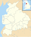
Lancashire UK district map (blank).svg 1,116 × 1,305; 1.25 MB
-
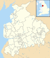
Lancashire UK electoral division map (blank).svg 1,116 × 1,305; 1.78 MB
-
Lancashire UK electoral division map 2017 (blank).svg 1,116 × 1,305; 1.72 MB
-
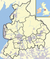
Lancashire UK location map.svg 1,116 × 1,305; 2.3 MB
-
Lancashire UK locator map 2010.svg 1,108 × 1,345; 302 KB
-
Lancashire UK relief location map.jpg 1,998 × 2,338; 578 KB
-
Lancashire UK ward map (blank).svg 1,116 × 1,305; 2.5 MB
-
LancashireNumbered.png 200 × 250; 22 KB
-
Location relief map United Kingdom Forest of Bowland.jpg 725 × 709; 125 KB
-
Location relief map United Kingdom Forest of Bowland.svg 946 × 924; 2.61 MB
-
M61 motorway junctions map.svg 409 × 500; 1.93 MB
-
Map of River irwell.png 1,444 × 2,567; 305 KB
-
Ordnance Survey 1-250000 - SD.jpg 4,000 × 4,000; 7.12 MB
-
OS Map extract SD73+SD83.jpg 3,138 × 921; 2.63 MB
-
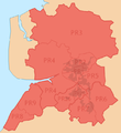
PR postcode area locator map.png 644 × 702; 74 KB
-
PR postcode area.png 636 × 693; 92 KB
-
PRESTON (post town) locator map.png 644 × 703; 76 KB
-
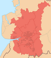
Preston Travel to Work Area 2007.png 602 × 696; 72 KB
-
Preston Urban Area locator map.png 643 × 703; 65 KB
-
Preston Urban Area within Central Lancashire.png 469 × 712; 70 KB
-
Rivers of Lancashire.png 600 × 714; 400 KB
-
Topography of Lancashire.png 682 × 812; 235 KB

