Category:Maps of Leicestershire
Appearance
Wikimedia category | |||||
| Upload media | |||||
| Instance of | |||||
|---|---|---|---|---|---|
| Category combines topics | |||||
| Leicestershire | |||||
ceremonial county in England | |||||
| Pronunciation audio | |||||
| Instance of | |||||
| Named after | |||||
| Location |
| ||||
| Capital | |||||
| Population |
| ||||
| Area |
| ||||
| Different from | |||||
| Said to be the same as | Leicestershire (historic county of England, ceremonial county of England, 1844) | ||||
 | |||||
Subcategories
This category has the following 7 subcategories, out of 7 total.
Media in category "Maps of Leicestershire"
The following 43 files are in this category, out of 43 total.
-
4096x4096 1-10K Map of Castle Donington and Surrounding Areas.png 4,096 × 4,096; 31.69 MB
-
Bottesford - Leicestershire dot.png 417 × 599; 122 KB
-
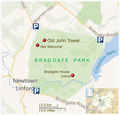
Bradgate Park annotated map.png 567 × 543; 259 KB
-
Bradgate park general map.png 653 × 442; 350 KB
-
Bradgate park general map.svg 512 × 724; 1.17 MB
-
Bradgate park geology map.png 529 × 397; 264 KB
-
Castle Donington - Leicestershire dot.png 1,802 × 2,589; 319 KB
-
Charnwood wildlife and geology sites map.svg 712 × 580; 2.69 MB
-
Chronicle Distribution Map.png 757 × 611; 204 KB
-
England Police Forces (Leicestershire).svg 1,108 × 1,345; 312 KB
-
EnglandPoliceLeicestershire.png 486 × 599; 98 KB
-
Leicestershire Hundreds.svg 1,001 × 1,017; 450 KB
-
Leicester Urban Area 1981.svg 1,375 × 1,375; 49 KB
-
Leicester Urban Area 1991.svg 1,375 × 1,375; 54 KB
-
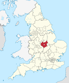
Leicestershire & Rutland.png 200 × 247; 25 KB
-
Leicestershire - British Isles.svg 1,250 × 1,835; 1,024 KB
-
Leicestershire Brit Isles Sect 5.svg 809 × 743; 939 KB
-
Leicestershire districts transparent overlay.svg 355 × 380; 177 KB
-
Leicestershire districts.png 800 × 558; 466 KB
-
Leicestershire Map.png 615 × 500; 15 KB
-
Leicestershire numbered districts.png 200 × 208; 4 KB
-
Leicestershire numbered districts.svg 1,425 × 1,123; 685 KB
-
Leicestershire outline map with UK.png 800 × 558; 454 KB
-
Leicestershire Rutland Parliamentary Constituencies 2023.svg 299 × 229; 108 KB
-
Leicestershire UK district map (blank).svg 1,425 × 1,123; 1,021 KB
-
Leicestershire UK electoral division map (blank).svg 1,425 × 1,123; 1.36 MB
-
Leicestershire UK electoral division map 2017 (blank).svg 1,425 × 1,123; 1.39 MB
-
Leicestershire UK location map.svg 1,425 × 1,123; 2.23 MB
-
Leicestershire UK locator map 2010.svg 1,108 × 1,345; 302 KB
-
Leicestershire UK parish map (blank).svg 1,425 × 1,123; 2.07 MB
-
Leicestershire UK PCC election 2024.svg 785 × 651; 379 KB
-
Leicestershire UK relief location map.jpg 1,999 × 1,574; 365 KB
-
Leicestershire UK ward map (blank).svg 1,425 × 1,123; 1.78 MB
-
LeicestershireBrit5.PNG 625 × 569; 26 KB
-
LeicestershireNumbered.png 200 × 199; 14 KB
-
LeicsLeicester.png 200 × 199; 12 KB
-
Map of Charnwood Forest NCA73 area.jpg 1,130 × 915; 518 KB
-
Map of Countesthorpe village.png 686 × 500; 178 KB
-
NuneatonUrbanArea.svg 455 × 328; 23 KB
-
Ordnance Survey 1-250000 - SK.jpg 4,000 × 4,000; 9.31 MB
-
Ordnance Survey 1-250000 - SP.jpg 4,000 × 4,000; 9.22 MB
-
Sketch-map of the geology of Leicestershire Richardson 1931.jpg 3,812 × 3,178; 2.69 MB
-
Slystyn Leicestershire.png 800 × 558; 466 KB


