Category:20th-century maps of London
Jump to navigation
Jump to search
Ceremonial counties of England: Bedfordshire · Berkshire · Buckinghamshire · Cambridgeshire · Cheshire · Cornwall · Derbyshire · Devon · Dorset · Durham · Essex · Gloucestershire · Greater London · Hampshire · Herefordshire · Hertfordshire · Isle of Wight · Kent · Lancashire · Leicestershire · Lincolnshire · Norfolk · Northamptonshire · Northumberland · Nottinghamshire · Oxfordshire · Rutland · Shropshire · Somerset · Staffordshire · Suffolk · Surrey · Warwickshire · Wiltshire · Worcestershire
City-counties:
Former historic counties: Cumberland · Middlesex · Sussex · Westmorland · Yorkshire
Other former counties:
City-counties:
Former historic counties: Cumberland · Middlesex · Sussex · Westmorland · Yorkshire
Other former counties:
Subcategories
This category has the following 6 subcategories, out of 6 total.
- 1900s maps of London (28 F)
- 1930s maps of London (14 F)
- 1940s maps of London (17 F)
- 1950s maps of London (9 F)
Media in category "20th-century maps of London"
The following 6 files are in this category, out of 6 total.
-
 London and Central Scotland, 1967.jpg 1,817 × 1,817; 1.8 MB
-
 London 1300 Historical Atlas William R Shepherd (died 1934).PNG 700 × 536; 644 KB
-
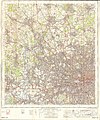 Ordnance Survey One-Inch Sheet 160 London N.W., Published 1963.jpg 8,290 × 9,967; 13.83 MB
-
 Ordnance Survey One-Inch Sheet 171 London SE, Published 1964.jpg 8,317 × 9,976; 13.72 MB
-
 Ordnance Survey Quarter-inch sheet 17 South-East England, published 1962.jpg 9,592 × 8,915; 12.13 MB
-
 Sketch of London where amulet necklaces were found Wellcome L0051628.jpg 6,666 × 4,992; 5.73 MB

.PNG)


