Category:20th-century maps of Hertfordshire
Jump to navigation
Jump to search
Ceremonial counties of England: Bedfordshire · Berkshire · Buckinghamshire · Cambridgeshire · Cheshire · Cornwall · Derbyshire · Devon · Dorset · Durham · Essex · Gloucestershire · Greater London · Hampshire · Herefordshire · Hertfordshire · Isle of Wight · Kent · Lancashire · Leicestershire · Lincolnshire · Norfolk · Northamptonshire · Northumberland · Nottinghamshire · Oxfordshire · Rutland · Shropshire · Somerset · Staffordshire · Suffolk · Surrey · Warwickshire · Wiltshire · Worcestershire
City-counties:
Former historic counties: Cumberland · Middlesex · Sussex · Westmorland · Yorkshire
Other former counties:
City-counties:
Former historic counties: Cumberland · Middlesex · Sussex · Westmorland · Yorkshire
Other former counties:
Media in category "20th-century maps of Hertfordshire"
The following 7 files are in this category, out of 7 total.
-
 The Victoria history of the county of Hertford (1902) (20606080338).jpg 1,790 × 2,654; 916 KB
-
 The Victoria history of the County of Hertford BHL22082609.jpg 2,248 × 3,412; 1.09 MB
-
 East Barnet 1910s Ordnance Survey map.jpg 9,450 × 5,850; 6.85 MB
-
 Watford Cassiobury map 1920.png 2,998 × 1,438; 4.43 MB
-
 Hemel hempsted midland map1924.png 1,862 × 1,495; 1.88 MB
-
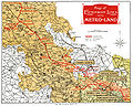 Metro-land-map.jpg 1,507 × 1,200; 2.25 MB
-
 RAF airfield map.jpg 450 × 405; 107 KB
_(20606080338).jpg)


