Category:20th-century maps of Cambridgeshire
Jump to navigation
Jump to search
Ceremonial counties of England: Bedfordshire · Berkshire · Buckinghamshire · Cambridgeshire · Cheshire · Cornwall · Derbyshire · Devon · Dorset · Durham · Essex · Gloucestershire · Greater London · Hampshire · Herefordshire · Hertfordshire · Isle of Wight · Kent · Lancashire · Leicestershire · Lincolnshire · Norfolk · Northamptonshire · Northumberland · Nottinghamshire · Oxfordshire · Rutland · Shropshire · Somerset · Staffordshire · Suffolk · Surrey · Warwickshire · Wiltshire · Worcestershire
City-counties:
Former historic counties: Cumberland · Middlesex · Sussex · Westmorland · Yorkshire
Other former counties:
City-counties:
Former historic counties: Cumberland · Middlesex · Sussex · Westmorland · Yorkshire
Other former counties:
Media in category "20th-century maps of Cambridgeshire"
The following 8 files are in this category, out of 8 total.
-
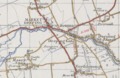 Historical map showing Deeping Gate.PNG 581 × 380; 455 KB
-
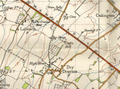
 Toseland 20th Century Map.PNG 907 × 563; 945 KB
-
 Wentworth 20th century map.png 534 × 530; 510 KB
-
 Ordnance Survey One-Inch Sheet 123 Spalding, Published 1946.jpg 10,924 × 12,746; 14.15 MB
-
 Bar hill, npe 1948.png 642 × 477; 620 KB
-

-
 Ordnance Survey Sheet TL 34 (52 34) Royston, Published c1949.jpg 7,636 × 8,826; 10.89 MB
-
 Ordnance Survey One-Inch Sheet 134 Huntingdon & Peterborough, Published 1946.jpg 10,967 × 12,765; 14.72 MB


_Royston,_Published_c1949_cropped_Meldreth_and_Cement_works.jpg)
_Royston,_Published_c1949.jpg)
