Category:20th-century maps of Staffordshire
Jump to navigation
Jump to search
Ceremonial counties of England: Bedfordshire · Berkshire · Buckinghamshire · Cambridgeshire · Cheshire · Cornwall · Cumbria · Derbyshire · Devon · Dorset · County Durham · East Riding of Yorkshire · East Sussex · Essex · Gloucestershire · London · Greater Manchester · Hampshire · Herefordshire · Hertfordshire · Isle of Wight · Kent · Lancashire · Leicestershire · Lincolnshire · Merseyside · Norfolk, England · North Yorkshire · Northamptonshire · Northumberland · Nottinghamshire · Oxfordshire · Rutland · Shropshire · Somerset · South Yorkshire · Staffordshire · Suffolk · Surrey · Tyne and Wear · Warwickshire · West Midlands (county) · West Sussex · West Yorkshire · Wiltshire · Worcestershire
City-counties: Bristol · City of London
Former historic counties: Cumberland · Huntingdonshire · County of London · Middlesex · North Riding of Yorkshire · Sussex · West Riding of Yorkshire · Westmorland · Yorkshire
Other former counties: Avon · Cambridgeshire and Isle of Ely · Cleveland · East Suffolk · Hereford and Worcester · Hexhamshire · Humberside · Huntingdon and Peterborough · Isle of Ely · Parts of Holland · Parts of Kesteven · Parts of Lindsey · Soke of Peterborough · West Suffolk
Media in category "20th-century maps of Staffordshire"
The following 8 files are in this category, out of 8 total.
-
 1911 Britannica - South Staffordshire.png 1,344 × 1,349; 2.15 MB
-
 Smethick Alcester & Broom Walsall RJD 89.jpg 2,868 × 1,788; 601 KB
-
 Special reports on the mineral resources of Great Britain (1915) (14784619325).jpg 2,578 × 2,536; 505 KB
-
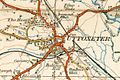 Uttoxeter 1921.JPG 622 × 416; 56 KB
-
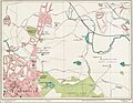
 St Edwards Hospital 1925 map.png 1,042 × 613; 811 KB
-
 Street Atlas of Birmingham - 1939 - Sheet 02 - West Bromwich (north).jpg 1,000 × 779; 354 KB
-
 Street Atlas of Birmingham - 1939 - Sheet 03 - Hamstead area.jpg 758 × 1,000; 448 KB
-
 Street Atlas of Birmingham - 1939 - Sheet 06 - Smethwick.jpg 1,000 × 773; 520 KB


_(14784619325).jpg)


.jpg)

