Category:1930s maps of London
Jump to navigation
Jump to search
Media in category "1930s maps of London"
The following 14 files are in this category, out of 14 total.
-
 Lange diercke sachsen europaeische landschaften london.jpg 1,250 × 932; 658 KB
-
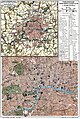
 London map - Bacon - 1934.jpg 1,920 × 1,522; 572 KB
-
 Ordnance Survey One-Inch Sheet 114 SW London and Windsor, Published 1934.jpg 13,539 × 9,026; 14.45 MB
-
 London in Brockhaus 1937.jpg 2,242 × 1,683; 2.15 MB
-
 Extract of 1930 map of Edgware & Mill Hill.png 975 × 272; 407 KB
-
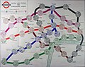 Map of London tube stations - 1935 - Edward Stanford Ltd.jpg 1,920 × 1,518; 389 KB
-
 Ordnance Survey Half-Inch Map of Greater London, Published 1935.jpg 12,591 × 16,151; 29.49 MB
-
 Ordnance Survey One-Inch Sheet 106 NW London and Watford (contour), Published 1935.jpg 13,554 × 11,612; 17.66 MB
-
 Ordnance Survey One-Inch Sheet 106 NW London and Watford, Published 1935.jpg 13,555 × 11,544; 18.54 MB
-
 Ordnance Survey One-Inch Sheet 107 London and Epping Forest, Published 1935.jpg 13,553 × 11,758; 19.72 MB
-
 Ordnance Survey One-Inch Sheet 115 S.E. London & Sevenoaks, Published 1932.jpg 11,923 × 8,908; 13.35 MB
-
 Ordnance Survey One-Inch Sheet 115 SE London and Dartford, Published 1934.jpg 13,606 × 8,998; 14.76 MB
-

-
 БСЭ1. Лондон.jpg 1,059 × 1,577; 1.25 MB


,_Published_1935.jpg)


.jpg)
