Category:20th-century maps of Hampshire
Jump to navigation
Jump to search
Ceremonial counties of England: Bedfordshire · Berkshire · Buckinghamshire · Cambridgeshire · Cheshire · Cornwall · Derbyshire · Devon · Dorset · Durham · Essex · Gloucestershire · Greater London · Hampshire · Herefordshire · Hertfordshire · Isle of Wight · Kent · Lancashire · Leicestershire · Lincolnshire · Norfolk · Northamptonshire · Northumberland · Nottinghamshire · Oxfordshire · Rutland · Shropshire · Somerset · Staffordshire · Suffolk · Surrey · Warwickshire · Wiltshire · Worcestershire
City-counties:
Former historic counties: Cumberland · Middlesex · Sussex · Westmorland · Yorkshire
Other former counties:
City-counties:
Former historic counties: Cumberland · Middlesex · Sussex · Westmorland · Yorkshire
Other former counties:
Media in category "20th-century maps of Hampshire"
The following 29 files are in this category, out of 29 total.
-
 A history of Hampshire and the Isle of Wight (Page 530) BHL20977807.jpg 2,274 × 3,380; 1.17 MB
-
 A history of Hampshire and the Isle of Wight (Page 531) BHL20977808.jpg 2,274 × 3,380; 1.29 MB
-
 A history of Hampshire and the Isle of Wight (Page 532) BHL20977809.jpg 2,274 × 3,380; 1.38 MB
-
 A history of Hampshire and the Isle of Wight (Page 533) BHL20977810.jpg 2,274 × 3,380; 1.32 MB
-
 A history of Hampshire and the Isle of Wight (Page 534) BHL20977811.jpg 2,274 × 3,380; 1.25 MB
-
 A history of Hampshire and the Isle of Wight (Page 535) BHL20977812.jpg 2,274 × 3,380; 1.34 MB
-
 A history of Hampshire and the Isle of Wight (Page 536) BHL20977813.jpg 2,274 × 3,380; 1.32 MB
-
 A history of Hampshire and the Isle of Wight (Page 537) BHL20977814.jpg 2,274 × 3,380; 1.35 MB
-
 A history of Hampshire and the Isle of Wight (Page 538) BHL20977815.jpg 2,274 × 3,380; 1.29 MB
-
 A history of Hampshire and the Isle of Wight (Page 539) BHL20977816.jpg 2,274 × 3,380; 1.3 MB
-
 A history of Hampshire and the Isle of Wight (Page 540) BHL20977817.jpg 2,274 × 3,380; 1.14 MB
-
 A history of Hampshire and the Isle of Wight (Page 541) BHL20977818.jpg 2,274 × 3,380; 1,024 KB
-
 A history of Hampshire and the Isle of Wight (Page 472) BHL20977735.jpg 1,788 × 1,599; 1.08 MB
-
 The birds of Hampshire and the Isle of Wight BHL47307508.jpg 2,412 × 3,386; 1.28 MB
-
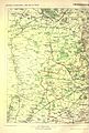
 South East Hampshire Gunther.jpg 790 × 811; 228 KB
-
 Fair oak park map.png 782 × 465; 767 KB
-
 BritishCassiniGridMilitaryMap.jpg 4,150 × 2,443; 4.65 MB
-
 Bassett and Bassett Green locations.png 639 × 328; 424 KB
-
 Ordnance Survey One-Inch Sheet 141 Southampton Portsmouth and Isle of Wight, Published 1936.jpg 16,475 × 12,403; 22.84 MB
-

-

-

-
 Horsea island map 1945.jpg 455 × 359; 148 KB
-
 Langstone map 1945.jpg 492 × 330; 138 KB
-
 Ordnance Survey One-Inch Sheet 180 The Solent, Published 1945.jpg 8,163 × 9,570; 10.68 MB
-
 Longmoor campmap 1947.png 1,930 × 1,437; 5.14 MB
-
 Ordnance Survey One-Inch Sheet 180 The Solent, Published 1966.jpg 8,160 × 9,943; 10.51 MB
-
 Ordnance Survey One-Inch Sheet 180 The Solent, Published 1971.jpg 10,957 × 13,121; 42.48 MB
-
 S East Geology.jpg 547 × 649; 92 KB
_BHL20977807.jpg)
_BHL20977808.jpg)
_BHL20977809.jpg)
_BHL20977810.jpg)
_BHL20977811.jpg)
_BHL20977812.jpg)
_BHL20977813.jpg)
_BHL20977814.jpg)
_BHL20977815.jpg)
_BHL20977816.jpg)
_BHL20977817.jpg)
_BHL20977818.jpg)
_BHL20977735.jpg)


.jpg)
.jpg)
.jpg)


