Category:20th-century maps of Norfolk, England
Jump to navigation
Jump to search
Ceremonial counties of England: Bedfordshire · Berkshire · Buckinghamshire · Cambridgeshire · Cheshire · Cornwall · Derbyshire · Devon · Dorset · Durham · Essex · Gloucestershire · Greater London · Hampshire · Herefordshire · Hertfordshire · Isle of Wight · Kent · Lancashire · Leicestershire · Lincolnshire · Norfolk · Northamptonshire · Northumberland · Nottinghamshire · Oxfordshire · Rutland · Shropshire · Somerset · Staffordshire · Suffolk · Surrey · Warwickshire · Wiltshire · Worcestershire
City-counties:
Former historic counties: Cumberland · Middlesex · Sussex · Westmorland · Yorkshire
Other former counties:
City-counties:
Former historic counties: Cumberland · Middlesex · Sussex · Westmorland · Yorkshire
Other former counties:
Media in category "20th-century maps of Norfolk, England"
The following 12 files are in this category, out of 12 total.
-
 The ancestry of Abraham Lincoln (1909) (14595733997).jpg 1,712 × 1,322; 804 KB
-
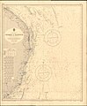
 Admiralty Chart No 1094 Outer Gabbard to Outer Dowsing, Published 1912.jpg 11,097 × 16,208; 55.23 MB
-
 Lowestoft & Yarmouth RJD 43.jpg 1,688 × 2,707; 800 KB
-

-
 Lowestoftmap 1921.jpg 2,544 × 3,504; 1.26 MB
-
 Ordnance Survey One-Inch Sheet 58 Cromer, Published 1922.jpg 12,210 × 8,487; 8.2 MB
-
 20th Century Map of Beetley.png 871 × 553; 1.02 MB
-
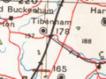 OS MAP OF TIBENHAM.png 431 × 323; 261 KB
-
 Burnham marketmap 1946.png 1,029 × 1,037; 2.6 MB
-
 Ordnance Survey Sheet TM 17 (62 17) Eye, Published 1947.png 7,632 × 9,748; 89 MB
-
 Admiralty Chart No 1504 Cromer to Harwich, Published 1962.jpg 11,273 × 13,645; 42.34 MB
-
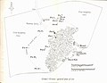 Grime's Graves Clarke 1963 General Plan.jpg 3,924 × 3,049; 1.52 MB
_(14595733997).jpg)


_Eye,_Published_1947.png)

