Category:SVG maps of Wyoming
Jump to navigation
Jump to search
States of the United States: Alabama · Alaska · Arizona · Arkansas · California · Colorado · Connecticut · Delaware · Florida · Georgia · Hawaii · Idaho · Illinois · Indiana · Iowa · Kansas · Kentucky · Louisiana · Maine · Maryland · Massachusetts · Michigan · Minnesota · Mississippi · Missouri · Montana · Nebraska · Nevada · New Hampshire · New Jersey · New Mexico · New York · North Carolina · North Dakota · Ohio · Oklahoma · Oregon · Pennsylvania · Rhode Island · South Carolina · South Dakota · Tennessee · Texas · Utah · Vermont · Virginia · Washington · West Virginia · Wisconsin · Wyoming – Washington, D.C.
American Samoa · Guam · Northern Mariana Islands · Puerto Rico – Navassa Island · Palmyra Atoll
American Samoa · Guam · Northern Mariana Islands · Puerto Rico – Navassa Island · Palmyra Atoll
A collection of maps of Wyoming or portions thereof in SVG format.
Subcategories
This category has the following 2 subcategories, out of 2 total.
Media in category "SVG maps of Wyoming"
The following 33 files are in this category, out of 33 total.
-
 2014 Wyoming gubernatorial election results map by county.svg 810 × 624; 15 KB
-
 2018 Wyoming House of Representatives election results map.svg 1,200 × 940; 359 KB
-
 2020 Wyoming House of Representatives election results map.svg 1,200 × 940; 359 KB
-
 2022 Wyoming House of Representatives election results map.svg 1,200 × 940; 581 KB
-
 2022 Wyoming House of Representatives election results with margins.svg 3,062 × 1,693; 625 KB
-
 41st parallel US.svg 959 × 593; 66 KB
-
 45th parallel US-as.svg 959 × 593; 66 KB
-
 45th parallel US-bn.svg 959 × 593; 66 KB
-
 45th parallel US.svg 959 × 593; 66 KB
-
 Blank Map of Wyoming, with counties labeled and labels for values.svg 5,892 × 4,514; 67 KB
-
 COVID-19 in Wyoming.svg 512 × 392; 32 KB
-
 Front Range Urban Corridor.svg 723 × 843; 265 KB
-
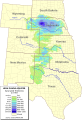
 High plains fresh groundwater usage 2000.svg 747 × 946; 1.48 MB
-
 I-25 Wyoming-1.svg 325 × 1,120; 139 KB
-
 I-25 Wyoming-2.svg 325 × 813; 71 KB
-
 I-25 Wyoming-full.svg 1,903 × 3,495; 478 KB
-
 LGBT flag map of Wyoming.svg 5,883 × 4,500; 5 KB
-
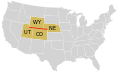
 Map of USA WY.svg 286 × 186; 167 KB
-
 Ogallala saturated thickness 1997-sattk97-v2.svg 656 × 960; 1.36 MB
-

-

-
 Wyoming counties by race.svg 221 × 183; 22 KB
-
 Wyoming county map, cb 500k.svg 810 × 624; 12 KB
-
 Wyoming Hispanic population percentage by county.svg 627 × 480; 30 KB
-
 Wyoming House 2022 retirements.svg 1,200 × 940; 581 KB
-
 Wyoming House of Representatives districts party map, 66th Legislature.svg 1,200 × 940; 361 KB
-
 Wyoming House of Representatives districts party map, 67th Legislature.svg 1,200 × 940; 581 KB
-
 Wyoming Köppen.svg 1,260 × 1,305; 798 KB
-
 Wyoming Locator Map with US.svg 2,102 × 2,045; 364 KB
-
 Wyoming map of Köppen climate classification.svg 1,900 × 1,305; 118 KB
-
 Wyoming racial and ethnic map.svg 221 × 183; 20 KB
-
 Wyoming state senate Map Current.svg 800 × 459; 1.68 MB
-
 Wyoming Toad current range map.svg 512 × 392; 87 KB


