Category:SVG maps of Alaska
Jump to navigation
Jump to search
States of the United States: Alabama · Alaska · Arizona · Arkansas · California · Colorado · Connecticut · Delaware · Florida · Georgia · Hawaii · Idaho · Illinois · Indiana · Iowa · Kansas · Kentucky · Louisiana · Maine · Maryland · Massachusetts · Michigan · Minnesota · Mississippi · Missouri · Montana · Nebraska · Nevada · New Hampshire · New Jersey · New Mexico · New York · North Carolina · North Dakota · Ohio · Oklahoma · Oregon · Pennsylvania · Rhode Island · South Carolina · South Dakota · Tennessee · Texas · Utah · Vermont · Virginia · Washington · West Virginia · Wisconsin · Wyoming – Washington, D.C.
American Samoa · Guam · Northern Mariana Islands · Puerto Rico – Navassa Island · Palmyra Atoll
American Samoa · Guam · Northern Mariana Islands · Puerto Rico – Navassa Island · Palmyra Atoll
A collection of maps of Alaska or portions thereof in SVG format.
Subcategories
This category has only the following subcategory.
Media in category "SVG maps of Alaska"
The following 57 files are in this category, out of 57 total.
-
 2009 Yukon Quest map.svg 464 × 399; 61 KB
-
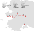 2015 Iditarod checkpoints.svg 1,594 × 1,429; 30 KB
-

-
 Alaska administrative units - ru.svg 1,768 × 975; 179 KB
-
 Alaska area compared to conterminous US.svg 1,184 × 758; 221 KB
-
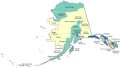
 Alaska blank borough map.svg 463 × 267; 45 KB
-
 Alaska boroughs and census areas 2008-13.svg 885 × 500; 278 KB
-
 Alaska boroughs and census areas 2013-19.svg 816 × 461; 334 KB
-
 Alaska boroughs and census areas 2019.svg 2,563 × 1,344; 1.57 MB
-
 Alaska boroughs and census areas russian version.svg 1,598 × 869; 316 KB
-
 Alaska boroughs and census areas, blank.svg 800 × 488; 1.67 MB
-
 Alaska compared to Lower 48.svg 1,085 × 748; 105 KB
-
 Alaska Denbigh Site Map.svg 1,050 × 1,050; 138 KB
-
 Alaska in its region.svg 2,681 × 1,508; 5.08 MB
-
 Alaska Köppen.svg 900 × 990; 862 KB
-
 Alaska Legislative Districts Blank.svg 989 × 627; 49 KB
-
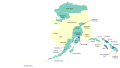
 Alaska location map.svg 512 × 382; 619 KB
-
 Alaska overlaid on US hu.svg 2,059 × 1,258; 717 KB
-
 Alaska Portal.svg 1,668 × 480; 149 KB
-
 Alaska racial and ethnic map.svg 463 × 267; 24 KB
-
 Alaska Senate district A.svg 820 × 443; 1.31 MB
-
 Alaska Senate District B.svg 820 × 443; 1.31 MB
-
 Alaska Senate District C.svg 820 × 443; 1.31 MB
-
 Alaska Senate District D.svg 820 × 443; 1.31 MB
-
 Alaska Senate District E.svg 820 × 443; 1.31 MB
-
 Alaska Senate District F.svg 820 × 443; 1.31 MB
-
 Alaska Senate District G.svg 820 × 443; 1.31 MB
-
 Alaska Senate District H.svg 820 × 443; 1.31 MB
-
 Alaska Senate District I.svg 820 × 443; 1.31 MB
-
 Alaska Senate District J.svg 820 × 443; 1.31 MB
-
 Alaska Senate District K.svg 820 × 443; 1.31 MB
-
 Alaska Senate District L.svg 820 × 443; 1.31 MB
-
 Alaska Senate District M.svg 820 × 443; 1.31 MB
-
 Alaska Senate District N.svg 820 × 443; 1.31 MB
-
 Alaska Senate District O.svg 820 × 443; 1.31 MB
-
 Alaska Senate District P.svg 820 × 443; 1.31 MB
-
 Alaska Senate District Q.svg 820 × 443; 1.31 MB
-
 Alaska Senate District R.svg 820 × 443; 1.31 MB
-
 Alaska Senate District S.svg 820 × 443; 1.31 MB
-
 Alaska Senate District T.svg 820 × 443; 1.31 MB
-
 Brooks Range.svg 637 × 369; 554 KB
-
 Flag map of Alaska.svg 4,372 × 2,304; 349 KB
-
 Gibson Islands.svg 274 × 376; 391 KB
-
 Gray alaska.svg 2,878 × 1,537; 159 KB
-
 Kodiakislandmap.svg 1,000 × 855; 850 KB
-
 LGBT flag map of Alaska.svg 3,036 × 2,187; 9 KB
-
 Map of Alaska buroughs and census areas.svg 555 × 352; 51 KB
-
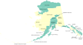
 Map of USA AK full.svg 800 × 560; 376 KB
-
 Map of USA AK.svg 286 × 186; 167 KB
-
 Map of USA highlighting OCA Diocese of Alaska.svg 959 × 593; 78 KB
-
 NRHP Alaska Map.svg 792 × 612; 249 KB
-
 Superfund sites in Alaska.svg 830 × 436; 42 KB
-
 Trans-Alaska Pipeline map.svg 303 × 1,071; 65 KB
-
 Trans-Alaska Pipeline work camps.svg 303 × 1,071; 65 KB
-
 USA Alaska location map.svg 1,553 × 1,160; 1.24 MB
-
 Voyages of Ilya Voznesensky (1840-1848) - es.svg 1,482 × 1,086; 1,011 KB
-
 Voyages of Ilya Voznesensky (1840-1848) - ru.svg 1,482 × 1,086; 913 KB


_-_es.svg)
_-_ru.svg)