Category:SVG maps of Virginia
Jump to navigation
Jump to search
States of the United States: Alabama · Alaska · Arizona · Arkansas · California · Colorado · Connecticut · Delaware · Florida · Georgia · Hawaii · Idaho · Illinois · Indiana · Iowa · Kansas · Kentucky · Louisiana · Maine · Maryland · Massachusetts · Michigan · Minnesota · Mississippi · Missouri · Montana · Nebraska · Nevada · New Hampshire · New Jersey · New Mexico · New York · North Carolina · North Dakota · Ohio · Oklahoma · Oregon · Pennsylvania · Rhode Island · South Carolina · South Dakota · Tennessee · Texas · Utah · Vermont · Virginia · Washington · West Virginia · Wisconsin · Wyoming – Washington, D.C.
American Samoa · Guam · Northern Mariana Islands · Puerto Rico – Navassa Island · Palmyra Atoll
American Samoa · Guam · Northern Mariana Islands · Puerto Rico – Navassa Island · Palmyra Atoll
A collection of maps of Virginia or portions thereof in SVG format.
Subcategories
This category has the following 3 subcategories, out of 3 total.
Media in category "SVG maps of Virginia"
The following 88 files are in this category, out of 88 total.
-
 5 digit ZCTAs in Virginia.svg 7,486 × 3,247; 753 KB
-
 Battle of Beaver Dam Creek. Lee's plan – ru.svg 1,016 × 1,151; 315 KB
-
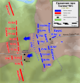 Battle of Salem Church - ru.svg 2,128 × 2,184; 413 KB
-
 Confederate & African-American Monuments of Virginia.svg 1,368 × 936; 11.54 MB
-
 COVID-19 Cases in Virginia by counties (14.03.2020).svg 764 × 341; 238 KB
-
 COVID-19 Cases in Virginia by counties.svg 512 × 228; 203 KB
-
 DC Area Road Map With FontSubset.svg 3,000 × 3,000; 944 KB
-
 DC Area Road Map.svg 3,000 × 3,000; 1.86 MB
-
 Gordon's Attack (May 6, 1864) - ru.svg 964 × 840; 264 KB
-
 Harrisonburg to Frederick.svg 532 × 462; 228 KB
-
 LGBT flag map of Virginia.svg 7,486 × 3,245; 110 KB
-
 Map of USA Commonwealths.svg 286 × 186; 169 KB
-
 Map of USA VA.svg 286 × 186; 167 KB
-
 Map of USA VA2.svg 286 × 186; 171 KB
-
 Map of Virginia Counties by Law Enforcement Type.svg 7,486 × 3,247; 548 KB
-
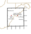
 Martinsville, Virginia micropolitan area - Location.svg 792 × 344; 362 KB
-
 Maryland Campaign (September 10—13, 1862) - ru.svg 1,332 × 943; 593 KB
-
 Massies Corner to Mount Airy.svg 698 × 601; 858 KB
-
 Mule Shoe (Battle of Spotsylvania) - ru.svg 1,422 × 1,080; 199 KB
-
 National Radio Quiet Zone.svg 679 × 753; 121 KB
-
 Northern Virginia Campaign (as of August 22, 1862) - ru.svg 1,455 × 1,318; 499 KB
-
 Orange-county-virginia-1734.svg 529 × 370; 1.75 MB
-
 Prince William area.svg 623 × 493; 635 KB
-
 Quantico MCB.svg 700 × 550; 66 KB
-
 Raid on Chambersburg - ru.svg 1,473 × 1,549; 833 KB
-
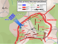
 Second Battle of Fredericksburg - ru.svg 1,952 × 1,796; 686 KB
-
 Shenandoah National Park.svg 1,000 × 1,000; 47 KB
-
 Shenandoah Valley.svg 716 × 662; 430 KB
-
 Southern.northern.virginia.svg 547 × 484; 270 KB
-
 Spotsylvania Court House May 12 - ru.svg 1,422 × 1,080; 370 KB
-
 Spotsylvania Court House May 8 - ru.svg 1,586 × 1,268; 676 KB
-
 Stuart’s raid (25-28 June) - ru.svg 1,569 × 1,303; 686 KB
-
 Tidewater region Virginia location map.svg 792 × 344; 362 KB
-
 Tri-Cities - Location.svg 792 × 344; 362 KB
-
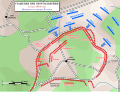
 Upton's attack (May 10, 1864) - ru.svg 1,422 × 1,080; 379 KB
-
 US federal courts in Virginia.svg 1,070 × 614; 371 KB
-
 USA Virginia relief location map.svg 1,500 × 964; 3.39 MB
-
 USA Virginia West Virginia border location map.svg 717 × 561; 209 KB
-
 VA SR 28 map.svg 1,450 × 870; 715 KB
-
 Virginia (1933–1938) county map, cb 500k.svg 810 × 358; 86 KB
-
 Virginia (1940–1941) county map, cb 500k.svg 810 × 358; 86 KB
-
 Virginia (1943–1944) county map, cb 500k.svg 810 × 358; 86 KB
-
 Virginia (1945) county map, cb 500k.svg 810 × 358; 86 KB
-
 Virginia (1946–1947) county map, cb 500k.svg 810 × 358; 86 KB
-
 Virginia (1948) county map, cb 500k.svg 810 × 358; 87 KB
-
 Virginia (1949–1950) county map, cb 500k.svg 810 × 358; 87 KB
-
 Virginia (1952) county map, cb 500k.svg 810 × 358; 88 KB
-
 Virginia (1953) county map, cb 500k.svg 810 × 358; 88 KB
-
 Virginia (1954) county map, cb 500k.svg 810 × 358; 89 KB
-
 Virginia (1955–1957) county map, cb 500k.svg 810 × 358; 89 KB
-
 Virginia (1958) county map, cb 500k.svg 810 × 358; 88 KB
-
 Virginia (1960) county map, cb 500k.svg 810 × 358; 89 KB
-
 Virginia (1961) county map, cb 500k.svg 810 × 358; 89 KB
-
 Virginia (1963–1965) county map, cb 500k.svg 810 × 358; 88 KB
-
 Virginia (1966–1967) county map, cb 500k.svg 810 × 358; 88 KB
-
 Virginia (1968–1970) county map, cb 500k.svg 810 × 358; 89 KB
-
 Virginia (1972–1973) county map, cb 500k.svg 810 × 358; 89 KB
-
 Virginia (1976–1982) county map, cb 500k.svg 810 × 358; 88 KB
-
 Virginia (1984–1986) county map, cb 500k.svg 810 × 358; 88 KB
-
 Virginia (1988–1994) county map, cb 500k.svg 810 × 358; 87 KB
-
 Virginia (1995–2001) county map, cb 500k.svg 810 × 358; 86 KB
-
 Virginia (2007–2013) county map, cb 500k.svg 810 × 358; 71 KB
-
 Virginia Ancestries by County (es).svg 511 × 384; 43 KB
-
 Virginia Ancestries by County 2020.svg 666 × 307; 90 KB
-
 Virginia Ancestries by County no text.svg 666 × 307; 145 KB
-
 Virginia Ancestries by County.svg 666 × 460; 132 KB
-
 Virginia Constitutional Convention 1829–1830 District Map.png 7,200 × 4,680; 904 KB
-
 Virginia Constitutional Convention 1829–1830 District Map.svg 512 × 366; 147 KB
-

-
 Virginia Counties by race (2020 census).svg 343 × 166; 135 KB
-
 Virginia county map, cb 500k.svg 810 × 358; 84 KB
-
 Virginia geographic map-en.svg 3,641 × 2,000; 12.5 MB
-
 Virginia House of Delegates district map (2020) blank.svg 100 × 43; 416 KB
-
 Virginia Köppen.svg 1,305 × 927; 939 KB
-
 Virginia pre split blank map.svg 331 × 213; 156 KB
-
 Virginia Presidential Election Results 2012.svg 810 × 358; 86 KB
-
 Virginia property taxes map 2019.svg 512 × 253; 110 KB
-
 Virginia racial and ethnic map.svg 343 × 166; 74 KB
-
 Virginia- Largest cities.svg 792 × 344; 432 KB
-
 Virginia-Density.svg 792 × 344; 403 KB
-
 Virginia-gsusa.svg 9,261 × 3,324; 328 KB
-
 Virginia-Median family income.svg 792 × 344; 394 KB
-
 Virginia-Median household income.svg 792 × 344; 396 KB
-
 Virginia-Per Capita income.svg 792 × 344; 391 KB
-
 Virginia-Population change from 2000-2010.svg 792 × 344; 411 KB
-
 Virginia-Population.svg 792 × 344; 394 KB
-
 Virginia-Year of established.svg 792 × 344; 389 KB
-
 ZCTA 226.svg 7,486 × 3,247; 193 KB


.svg)


_-_ru.svg)


_-_ru.svg)

_-_ru.svg)

_-_ru.svg)


_-_ru.svg)


_-_ru.svg)


_county_map,_cb_500k.svg)
_county_map,_cb_500k.svg)
_county_map,_cb_500k.svg)
_county_map,_cb_500k.svg)
_county_map,_cb_500k.svg)
_county_map,_cb_500k.svg)
_county_map,_cb_500k.svg)
_county_map,_cb_500k.svg)
_county_map,_cb_500k.svg)
_county_map,_cb_500k.svg)
_county_map,_cb_500k.svg)
_county_map,_cb_500k.svg)
_county_map,_cb_500k.svg)
_county_map,_cb_500k.svg)
_county_map,_cb_500k.svg)
_county_map,_cb_500k.svg)
_county_map,_cb_500k.svg)
_county_map,_cb_500k.svg)
_county_map,_cb_500k.svg)
_county_map,_cb_500k.svg)
_county_map,_cb_500k.svg)
_county_map,_cb_500k.svg)
_county_map,_cb_500k.svg)
.svg)


.svg)


_blank.svg)