Category:SVG maps of Washington (state)
Jump to navigation
Jump to search
States of the United States: Alabama · Alaska · Arizona · Arkansas · California · Colorado · Connecticut · Delaware · Florida · Georgia · Hawaii · Idaho · Illinois · Indiana · Iowa · Kansas · Kentucky · Louisiana · Maine · Maryland · Massachusetts · Michigan · Minnesota · Mississippi · Missouri · Montana · Nebraska · Nevada · New Hampshire · New Jersey · New Mexico · New York · North Carolina · North Dakota · Ohio · Oklahoma · Oregon · Pennsylvania · Rhode Island · South Carolina · South Dakota · Tennessee · Texas · Utah · Vermont · Virginia · Washington · West Virginia · Wisconsin · Wyoming – Washington, D.C.
American Samoa · Guam · Northern Mariana Islands · Puerto Rico – Navassa Island · Palmyra Atoll
American Samoa · Guam · Northern Mariana Islands · Puerto Rico – Navassa Island · Palmyra Atoll
A collection of maps of Washington or portions thereof in SVG format.
Subcategories
This category has the following 2 subcategories, out of 2 total.
Media in category "SVG maps of Washington (state)"
The following 66 files are in this category, out of 66 total.
-
 113th U.S. House districts in Washington.svg 369 × 242; 234 KB
-
 Blakely Island locator map.svg 1,052 × 744; 232 KB
-
 Blank Washington Map.svg 1,781 × 1,159; 231 KB
-
 Central Washington.svg 1,781 × 1,159; 227 KB
-
 US West Coast.svg 286 × 186; 137 KB
-
 Columbia gorge topographic map-fr.svg 682 × 359; 2.84 MB
-
 Condit Hydroelectric Project.svg 650 × 1,750; 65 KB
-
 Copalis NWR Map.svg 550 × 624; 283 KB
-
 Cypress Island locator map.svg 1,052 × 744; 232 KB
-
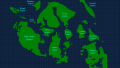
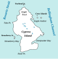 Cypress Island Map.svg 393 × 401; 22 KB
-
 Decatur Island locator map.svg 1,052 × 744; 232 KB
-
 Eastern Washington map.svg 1,781 × 1,159; 220 KB
-
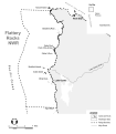 Flattery Rocks NWR Map.svg 550 × 630; 591 KB
-
 Guemes Island locator map.svg 1,052 × 744; 232 KB
-
 I-90 Seattle terminus.svg 640 × 320; 36 KB
-
 I-90 WA-1.svg 800 × 800; 94 KB
-
 Initiative 692 Results with Data.svg 1,781 × 1,159; 267 KB
-
 Initiative 692 Results.svg 1,781 × 1,159; 228 KB
-
 Inland Northwest United States.svg 280 × 280; 383 KB
-
 Inland Northwest.svg 991 × 1,056; 464 KB
-
 KSEA airport diagram.svg 484 × 743; 1,009 KB
-
 LGBT flag map of Washington.svg 5,920 × 3,856; 96 KB
-
 Lopez Island locator map.svg 1,052 × 744; 232 KB
-
 Lummi Island locator map.svg 1,052 × 744; 232 KB
-
 Map of cities in Washington (state).svg 837 × 583; 2.74 MB
-
 Map of Liberty.svg 1,781 × 1,159; 231 KB
-
 Map of Washington counties, blank.svg 1,781 × 1,159; 215 KB
-
 Mount Adams Hazard map-fr.svg 760 × 873; 3.05 MB
-
 Mount Adams Region topographic map-fr 2.svg 513 × 669; 3.03 MB
-
 Mount Adams Region topographic map-fr.svg 751 × 870; 3.02 MB
-
 Mount Rainier National Park.svg 1,000 × 1,000; 35 KB
-
 Orcas Island locator map.svg 1,052 × 744; 232 KB
-
 Quillayute Needles NWR Map.svg 575 × 625; 647 KB
-
 Referendum 71 Results.svg 1,781 × 1,159; 228 KB
-
 San Juan Island locator map.svg 1,052 × 744; 232 KB
-
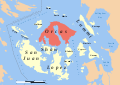
 San Juan Islands Locator Base.svg 562 × 405; 987 KB
-
 San-Juan-Islands-with-Grid.svg 512 × 288; 209 KB
-
 Seattle WA Directional Zones.svg 482 × 828; 28 KB
-
 Shaw Island locator map.svg 1,052 × 744; 232 KB
-
 South Washington Cascade Range topographic map-fr.svg 720 × 722; 6.86 MB
-
 South Washington protected areas map-fr.svg 720 × 722; 6.86 MB
-
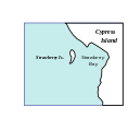 Strawberryis map.svg 393 × 401; 8 KB
-
 Sucia Island Map.svg 864 × 648; 9.18 MB
-
 Superfund sites in Washington.svg 634 × 420; 373 KB
-
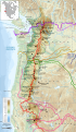
 Trails of Cascade Range map-fr.svg 403 × 693; 3.3 MB
-
 Trails of Cascade Range map-it.svg 403 × 693; 2.65 MB
-
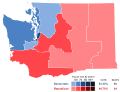 United States House of Representatives Election 2016 - Washington.svg 1,000 × 763; 114 KB
-
 Wa 502.svg 1,781 × 1,159; 267 KB
-
 Washington administrative map-fr.svg 1,031 × 675; 4.06 MB
-
 Washington areas Columbia map-fr.svg 1,031 × 675; 7.04 MB
-
 Washington areas map-fr.svg 1,031 × 675; 7.06 MB
-
 Washington county map, cb 500k.svg 810 × 535; 57 KB
-
 Washington Court of Appeals divisions.svg 1,781 × 1,159; 235 KB
-
 Washington gubernatorial election, 2012 Map.svg 1,781 × 1,159; 228 KB
-
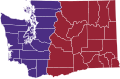
 Washington Initiative 502 Results.svg 166 × 124; 27 KB
-
 Washington Köppen.svg 1,260 × 1,242; 1.08 MB
-
 Washington municipal corporation topographic map-fr.svg 596 × 389; 7.43 MB
-
 Washington racial and ethnic map.svg 166 × 124; 17 KB
-
 Washington regions map.svg 1,781 × 1,159; 2.44 MB
-
 Washington State Köppen Climate Types (1991-2020).svg 1,344 × 1,325; 1.32 MB
-
 Washington topographic map-fr.svg 1,031 × 675; 6.52 MB
-
 Washington tribal territories map-fr.svg 1,031 × 675; 6.3 MB
-
 Washington-state-map h.svg 709 × 470; 32 KB
-
 Western Washington map.svg 1,781 × 1,159; 215 KB
-
 WIAA Districts.svg 1,781 × 1,159; 237 KB
-
 Zip's Drive-in Locations.svg 1,921 × 1,477; 87 KB


.svg)


.svg)


