Category:SVG maps of Montana
Jump to navigation
Jump to search
States of the United States: Alabama · Alaska · Arizona · Arkansas · California · Colorado · Connecticut · Delaware · Florida · Georgia · Hawaii · Idaho · Illinois · Indiana · Iowa · Kansas · Kentucky · Louisiana · Maine · Maryland · Massachusetts · Michigan · Minnesota · Mississippi · Missouri · Montana · Nebraska · Nevada · New Hampshire · New Jersey · New Mexico · New York · North Carolina · North Dakota · Ohio · Oklahoma · Oregon · Pennsylvania · Rhode Island · South Carolina · South Dakota · Tennessee · Texas · Utah · Vermont · Virginia · Washington · West Virginia · Wisconsin · Wyoming – Washington, D.C.
American Samoa · Guam · Northern Mariana Islands · Puerto Rico – Navassa Island · Palmyra Atoll
American Samoa · Guam · Northern Mariana Islands · Puerto Rico – Navassa Island · Palmyra Atoll
A collection of maps of Montana or portions thereof in SVG format.
Subcategories
This category has only the following subcategory.
Media in category "SVG maps of Montana"
The following 14 files are in this category, out of 14 total.
-
 45th parallel US-as.svg 959 × 593; 66 KB
-
 45th parallel US-bn.svg 959 × 593; 66 KB
-
 45th parallel US.svg 959 × 593; 66 KB
-
 Flag-map of Montana.svg 915 × 528; 255 KB
-
 LGBT flag map of Montana.svg 9,193 × 5,303; 44 KB
-
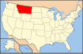 Map of U.S. - MT.svg 286 × 186; 167 KB
-
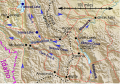 Montana - locations in River runs through it.svg 1,021 × 709; 280 KB
-
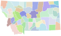
 Montana counties by race.svg 317 × 184; 33 KB
-
 Montana county map, cb 500k.svg 810 × 473; 42 KB
-
 Montana flagmap-.svg 300 × 300; 140 KB
-
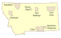 Montana Indian Reservations.svg 744 × 460; 296 KB
-
 Montana Köppen.svg 1,440 × 1,215; 1,017 KB
-
 Montana racial and ethnic map.svg 316 × 183; 24 KB
-
 USA Montana blank map.svg 1,201 × 893; 499 KB


