Category:SVG maps of Missouri
Jump to navigation
Jump to search
States of the United States: Alabama · Alaska · Arizona · Arkansas · California · Colorado · Connecticut · Delaware · Florida · Georgia · Hawaii · Idaho · Illinois · Indiana · Iowa · Kansas · Kentucky · Louisiana · Maine · Maryland · Massachusetts · Michigan · Minnesota · Mississippi · Missouri · Montana · Nebraska · Nevada · New Hampshire · New Jersey · New Mexico · New York · North Carolina · North Dakota · Ohio · Oklahoma · Oregon · Pennsylvania · Rhode Island · South Carolina · South Dakota · Tennessee · Texas · Utah · Vermont · Virginia · Washington · West Virginia · Wisconsin · Wyoming – Washington, D.C.
American Samoa · Guam · Northern Mariana Islands · Puerto Rico – Navassa Island · Palmyra Atoll
American Samoa · Guam · Northern Mariana Islands · Puerto Rico – Navassa Island · Palmyra Atoll
A collection of maps of Missouri in SVG format
Subcategories
This category has only the following subcategory.
Media in category "SVG maps of Missouri"
The following 33 files are in this category, out of 33 total.
-
 1968 MO LG.svg 810 × 717; 49 KB
-
 2013 St. Louis, Missouri mayoral election results by ward.svg 366 × 756; 323 KB
-
 38th parallel structures loc.svg 610 × 372; 530 KB
-
 Flag-map of Missouri.svg 1,525 × 1,341; 327 KB
-
 LGBT flag map of Missouri.svg 1,317 × 1,184; 15 KB
-
 Map of USA MO.svg 286 × 186; 167 KB
-
 MDC Lands 2007 central region hilite.svg 651 × 581; 632 KB
-
 MDC Lands 2007 Kansas City region hilite.svg 651 × 582; 624 KB
-
 MDC Lands 2007 northeast region hilite.svg 651 × 582; 620 KB
-
 MDC Lands 2007 northwest region hilite.svg 651 × 582; 624 KB
-
 MDC Lands 2007 Ozark region hilite.svg 651 × 582; 624 KB
-
 MDC Lands 2007 southeast region hilite.svg 651 × 582; 624 KB
-
 MDC Lands 2007 southwest region hilite.svg 651 × 582; 624 KB
-
 MDC Lands 2007 St Louis region hilite.svg 651 × 582; 623 KB
-
 MDC Lands 2007 v2.svg 651 × 582; 610 KB
-
 MDC Lands 2007.svg 851 × 761; 657 KB
-
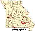
 Missouri counties and cities with domestic partnerships.svg 950 × 500; 189 KB
-
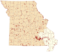
 Missouri counties by race.svg 285 × 252; 34 KB
-
 Missouri county map, cb 500k.svg 810 × 717; 40 KB
-
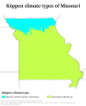 Missouri Köppen.svg 990 × 1,224; 600 KB
-
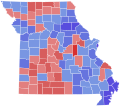
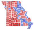
 Missouri Lieutenant Governor Election Results by County, 2004.svg 810 × 717; 49 KB
-
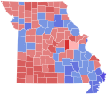
 Missouri Lieutenant Governor Election Results by County, 2008.svg 810 × 717; 49 KB
-
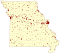 Missouri Natl Reg Historic Places v1.svg 820 × 727; 431 KB
-
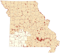
 Missouri racial and ethnic map.svg 284 × 252; 52 KB
-
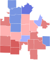 Missouri4th2010Results.svg 652 × 775; 148 KB
-
 MO 1972 LG.svg 810 × 717; 49 KB
-
 MO LG 1976.svg 810 × 717; 49 KB
-
 MormonWarMap english.svg 500 × 520; 928 KB
-
 MormonWarMap spanish.svg 500 × 520; 928 KB
-
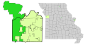
 Rock Island Trail State Park MO locator.svg 567 × 499; 406 KB
-
 St. Louis, Missouri mayoral election results by ward, 2017.svg 366 × 756; 322 KB
-
 USA Missouri location map.svg 1,401 × 1,282; 853 KB
-
 USA Missouri relief location map.svg 1,401 × 1,282; 4.03 MB


