Category:SVG maps of Kansas
Jump to navigation
Jump to search
States of the United States: Alabama · Alaska · Arizona · Arkansas · California · Colorado · Connecticut · Delaware · Florida · Georgia · Hawaii · Idaho · Illinois · Indiana · Iowa · Kansas · Kentucky · Louisiana · Maine · Maryland · Massachusetts · Michigan · Minnesota · Mississippi · Missouri · Montana · Nebraska · Nevada · New Hampshire · New Jersey · New Mexico · New York · North Carolina · North Dakota · Ohio · Oklahoma · Oregon · Pennsylvania · Rhode Island · South Carolina · South Dakota · Tennessee · Texas · Utah · Vermont · Virginia · Washington · West Virginia · Wisconsin · Wyoming – Washington, D.C.
American Samoa · Guam · Northern Mariana Islands · Puerto Rico – Navassa Island · Palmyra Atoll
American Samoa · Guam · Northern Mariana Islands · Puerto Rico – Navassa Island · Palmyra Atoll
Subcategories
This category has only the following subcategory.
Media in category "SVG maps of Kansas"
The following 28 files are in this category, out of 28 total.
-
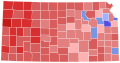 2014 Kansas gubernatorial election results map by county.svg 810 × 424; 34 KB
-

-
 37th parallel US.svg 959 × 593; 67 KB
-
 Flag-map of Kansas.svg 621 × 318; 427 KB
-
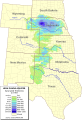
 High plains fresh groundwater usage 2000.svg 747 × 946; 1.48 MB
-
 Kansas and Oklahoma Railroad Route Map.svg 6,805 × 3,485; 182 KB
-

-
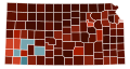 Kansas counties by race.svg 295 × 155; 20 KB
-
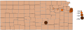
 Kansas county map, cb 500k.svg 810 × 424; 26 KB
-
 Kansas flagmap.svg 600 × 600; 102 KB
-
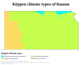 Kansas Köppen.svg 1,440 × 1,134; 537 KB
-
 Kansas racial and ethnic map.svg 295 × 155; 38 KB
-
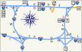
 Kansas Turnpike map.svg 704 × 501; 341 KB
-
 KC Alphabet.svg 907 × 570; 228 KB
-
 KWN59 coverage map.svg 675 × 763; 185 KB
-
 LGBT flag map of Kansas.svg 830 × 446; 3 KB
-
 Location of cities in Kansas with populations exceeding 50k.svg 1,920 × 691; 164 KB
-
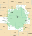
 Location of Prairie Band of Potawatomi.svg 6,607 × 3,388; 38 KB
-
 Map of districts in the Coronado Area Council BSA.svg 6,653 × 3,434; 57 KB
-

-

-
 NRHP Kansas Map.svg 990 × 765; 10.55 MB
-
 Ogallala saturated thickness 1997-sattk97-v2.svg 656 × 960; 1.36 MB
-
 USA Kansas location map.svg 1,400 × 783; 372 KB
-
 USA Kansas relief location map.svg 1,400 × 783; 2.2 MB
-
 UTC hue4map USA-KS.svg 6,607 × 3,388; 21 KB
-
 WXK92 Coverage.svg 675 × 763; 115 KB
-
 WXL71 coverage map.svg 675 × 763; 264 KB


.svg)
.svg)


