Category:Maps of the history of Switzerland
Jump to navigation
Jump to search
Countries of Europe: Albania · Andorra · Armenia‡ · Austria · Azerbaijan‡ · Belarus · Belgium · Bosnia and Herzegovina · Bulgaria · Croatia · Cyprus‡ · Czech Republic · Denmark · Estonia · Finland · France‡ · Georgia‡ · Germany · Greece · Hungary · Iceland · Republic of Ireland · Italy · Kazakhstan‡ · Latvia · Lithuania · Luxembourg · Malta · Moldova · Montenegro · Netherlands‡ · North Macedonia · Norway · Poland · Portugal‡ · Romania · Russia‡ · Serbia · Slovakia · Slovenia · Spain‡ · Sweden · Switzerland · Turkey‡ · Ukraine · United Kingdom
Limited recognition: Abkhazia‡ · Kosovo · South Ossetia‡ · Transnistria · Northern Cyprus‡
‡: partly located in Europe
Limited recognition: Abkhazia‡ · Kosovo · South Ossetia‡ · Transnistria · Northern Cyprus‡
‡: partly located in Europe
| NO WIKIDATA ID FOUND! Search for Maps of the history of Switzerland on Wikidata | |
| Upload media |
Subcategories
This category has the following 9 subcategories, out of 9 total.
B
- Maps of Basel prince-bishopric (12 F)
F
H
- Maps of the Helvetic Republic (24 F)
M
- Maps of the Old Confederacy (19 F)
T
Media in category "Maps of the history of Switzerland"
The following 200 files are in this category, out of 227 total.
(previous page) (next page)-
 Modern history; Europe (1904) (14579068250).jpg 3,072 × 1,768; 1.64 MB
-
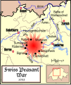 Swiss Peasant War of 1653 4.svg 840 × 1,001; 342 KB
-
 St. Blasien-Bonndorf - 1789.jpg 591 × 472; 171 KB
-
 Napoleonic Central Europe.jpg 3,937 × 2,855; 2.85 MB
-
 Napoleonic northern Italy circa 1795–1801.jpg 861 × 635; 196 KB
-
 35 of 'Histoire de la Nation suisse' (11238732276).jpg 2,144 × 1,785; 934 KB
-
 377 of 'Geschichte der schweizerischen Neutralität' (11303460445).jpg 1,502 × 1,432; 382 KB
-

-
 Aare bei Klingnau 1741.jpg 1,024 × 627; 179 KB
-
 Aargau 1798.png 640 × 600; 28 KB
-
 Aargau Eisenbahn1900.png 640 × 600; 32 KB
-
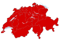 Abstimmung «Ja zu Europa» Resultat Kantonskarte.svg 1,052 × 744; 271 KB
-
 Alamannien es.svg 704 × 626; 824 KB
-
 Alamannien Hochburgund ca 1000.png 2,500 × 2,107; 1.11 MB
-
 Alamannien IT.svg 704 × 626; 129 KB
-
 Alamannien-hu.svg 397 × 350; 627 KB
-
 Alamannien.svg 397 × 350; 734 KB
-
 AltaYBajaBorgoñaSiglosIXX.svg 1,002 × 1,014; 1.17 MB
-
 Alte Konstanzerstrasse Map1.jpg 1,766 × 2,616; 1.12 MB
-
 Amt Pfarrei Gericht Muri.png 600 × 880; 28 KB
-
 Andree49-2.jpg 1,935 × 1,423; 1.23 MB
-
 Archives des sciences physiques et naturelles" (1846-1947.) (19727435576).jpg 3,490 × 2,388; 2.33 MB
-
 Atlas Suisse Jungfrau Finsteraarhorn.tiff 1,407 × 1,004; 4.44 MB
-
 AtlasTyrolensisDetailFinstermuenzColored.png 746 × 618; 630 KB
-
 Bailliage d'Aarwangen.png 472 × 370; 87 KB
-
 Bailliage de Bipp.png 306 × 246; 47 KB
-
 Bailliage de Flumenthal.png 204 × 185; 18 KB
-
 Bailliage de Schenkenberg.png 383 × 354; 76 KB
-
 Bailliage Trachselwald.png 656 × 760; 255 KB
-
 Baliaggi-transalpini rev.png 1,500 × 1,516; 572 KB
-
 BorgoñaSiglosXIIXIII.svg 1,068 × 1,081; 1.3 MB
-
 Bourgogne in XI-XII century.png 931 × 647; 294 KB
-
 Burgunderkriege.png 2,500 × 2,527; 1.13 MB
-
 Bündner Wirren Phase 2.jpg 2,500 × 2,250; 3.34 MB
-
 Bündner-Wirren Phase1.jpg 2,500 × 2,250; 3.34 MB
-
 Bündner-Wirren-Phase-3.jpg 2,500 × 2,250; 2.15 MB
-
 Carte Compesieres-1816-1851.png 237 × 235; 39 KB
-

-
 Carte guerre de Souabe.png 2,500 × 1,311; 267 KB
-
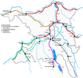
 Carte guerre paysans 1653 operations-es.svg 826 × 1,172; 367 KB
-
 Carte guerre paysans 1653 operations.svg 826 × 1,172; 226 KB
-
 Carte guerre paysans 1653.svg 1,263 × 879; 264 KB
-
 Carte-Royaume-dArles.png 1,500 × 1,529; 412 KB
-
 CH-NB-Schweiz-18671-page007.tif 1,132 × 942; 1.88 MB
-
 Churraetien.png 2,500 × 2,160; 1.06 MB
-
 Circuit de validation du traité de Fribourg.jpg 1,433 × 1,032; 165 KB
-
 Confederacion dei VIII Cantons.png 1,146 × 720; 190 KB
-
 D060- N° 434. La Suisse en 1795. - Liv3-Ch16.png 1,443 × 1,280; 259 KB
-
 Drei Bünde Karte 1768.jpg 5,184 × 3,888; 5.95 MB
-
 Droysens-255.jpg 2,623 × 1,396; 3.79 MB
-
 Droysens-25a.jpg 2,604 × 1,398; 3.62 MB
-
 Droysens-25c.jpg 2,610 × 1,403; 4.4 MB
-
 Droysens-25d.jpg 2,626 × 1,390; 3.89 MB
-
 Droysens-25e.jpg 2,611 × 1,428; 3.99 MB
-
 Droysens-25f.jpg 2,626 × 1,416; 4.02 MB
-
 Droysens-25g.jpg 5,661 × 4,307; 4.61 MB
-
 Droysens-25i.jpg 1,489 × 1,054; 1.49 MB
-
 Duchy of Swabia locator map (1004).svg 4,431 × 3,875; 4.7 MB
-
 Eingemeindung Zuerich.png 1,500 × 1,407; 179 KB
-
 Empire carolingien.png 371 × 428; 44 KB
-
 File-H1N1 Switzerland Map.svg 1,052 × 744; 360 KB
-
 FMIB 39522 Map of Glacial Movements in France and Switzerland.jpeg 1,660 × 1,369; 498 KB
-
 Freiamt 1712.png 215 × 360; 9 KB
-
 Freiburg territoriale Entwicklung.jpg 1,500 × 1,091; 830 KB
-

-
 Gerichtsherrschaft-Bubikon.svg 570 × 724; 262 KB
-
 Gerichtsherrschaften Landvogtei Thurgau.png 2,500 × 1,662; 985 KB
-
 Geschichte Graubuenden.png 3,873 × 3,624; 1.84 MB
-
 Gingins.png 884 × 661; 292 KB
-
 Gliederung Stadtstaat Basel 1798.png 1,500 × 1,266; 285 KB
-
 Grafschaft Baden.png 1,084 × 1,594; 148 KB
-
 Grafschaft Toggenburg.png 2,000 × 1,599; 328 KB
-
 H1N1 Switzerland Map.svg 1,052 × 744; 276 KB
-
 H1N1swissmap.png 800 × 566; 72 KB
-
 Helvetische Revolution.png 2,500 × 1,590; 1.33 MB
-
 Herrschaft Wädenswil.jpg 667 × 791; 239 KB
-
 Herrschaften Graubuenden.png 2,500 × 2,312; 1.05 MB
-
 Herrschaftsbereich Lenzburger eng.png 1,000 × 926; 251 KB
-
 Herrschaftsbereich Lenzburger.png 1,000 × 926; 139 KB
-
 Hist kirchl Einteilung CH.png 2,500 × 1,585; 975 KB
-
 Historische Karte CH 18 Jh English.PNG 3,000 × 1,884; 894 KB
-
 Historische Karte CH Fokus Vitudurum.png 1,165 × 485; 152 KB
-
 Historische Karte CH Helvet.png 1,808 × 1,153; 514 KB
-
 Historische Karte CH Rom 1-fr.png 2,500 × 1,594; 807 KB
-
 Historische-Karte-des-Kantons-Basel.png 1,000 × 621; 182 KB
-
 Historische-Karte-des-Kantons-Freiburg-FR.png 2,000 × 1,454; 603 KB
-
 Historische-Karte-des-Kantons-Freiburg.png 2,000 × 1,454; 603 KB
-
 Hohe Gerichte Thurgau.png 2,250 × 1,398; 321 KB
-

-

-

-
 Kanton Baden.png 1,200 × 2,264; 224 KB
-
 Kantone Linth und Saentis.png 800 × 907; 80 KB
-
 Karte 13 Alte Orte.png 2,500 × 1,652; 512 KB
-
 Karte Alter Zuerichkrieg.png 1,600 × 1,180; 284 KB
-
 Karte Besitz-der-Sax.png 1,000 × 1,660; 160 KB
-
 Karte eidgenossenschaft2.png 1,000 × 712; 172 KB
-
 Karte Ennetbirgische Vogteien.png 1,500 × 1,516; 570 KB
-
 Karte Ennetbirgische Vogteien1.png 850 × 1,147; 552 KB
-
 Karte Gemeine-Herrschaften.png 2,000 × 1,268; 245 KB
-
 Karte Hoch Niederburgund-FR.png 2,000 × 2,126; 549 KB
-
 Karte Hoch und Niederburgund EN.png 2,000 × 2,126; 538 KB
-
 Karte Hoch und Niederburgund-el.png 1,310 × 1,338; 200 KB
-
 Karte Hoch- und Niederburgund.png 2,000 × 2,126; 549 KB
-
 Karte Kanton St.Gallen Bezirke.png 885 × 1,047; 214 KB
-
 Karte Koenigreich Burgund DE.png 1,500 × 1,529; 405 KB
-
 Karte Königreich Arelat DE.png 1,500 × 1,529; 414 KB
-
 Karte Schwabenkrieg.png 1,990 × 1,052; 346 KB
-
 Karte Schweizerischer Bauernkrieg Feldzüge.svg 827 × 1,172; 225 KB
-
 Karte Schweizerischer Bauernkrieg.svg 1,263 × 879; 270 KB
-
 Karte Stadtstaat Bern vereinfacht-EN.png 2,000 × 1,655; 615 KB
-
 Karte Stadtstaat Bern vereinfacht.png 2,000 × 1,655; 604 KB
-
 Karte Stadtstaat Bern version-für-svgexport.png 4,000 × 3,401; 1.25 MB
-
 Karte Stadtstaat Bern Wachstum.png 2,500 × 2,060; 957 KB
-
 Karte Stadtstaat Bern.svg 1,160 × 997; 470 KB
-
 Karte von Deutschland, dem Königr. der Niederlande und der Schweiz.jpg 5,821 × 4,769; 7.38 MB
-
 Karte Werdenberger.png 1,500 × 2,194; 615 KB
-
 Karte Werdenberger1.jpg 1,978 × 2,200; 958 KB
-
 Karte Zugewandte Orte.png 1,200 × 761; 211 KB
-
 Karte Zweiter Villmergerkrieg 1712.png 3,000 × 1,903; 616 KB
-
 Karte-Basler-Kantonstrennung.png 1,500 × 1,014; 245 KB
-
 Karte-Departement-Léman-1798.png 2,500 × 2,101; 669 KB
-
 Karte-Entstehung-Kanton-Genf.png 2,500 × 1,928; 605 KB
-
 Karte-Entwicklung-Savoyen-bis-1789.png 2,500 × 2,542; 1.05 MB
-
 Karte-Herzogtum-Savoyen-1475.png 1,500 × 1,551; 583 KB
-
 Karte-Historische-Entwicklung-Luzern.png 2,000 × 2,444; 734 KB
-
 Karte-Historische-Gliederung-Solothurn.png 2,000 × 1,690; 345 KB
-
 Karte-Kanton-Genf-1792.png 2,500 × 1,767; 518 KB
-
 Karte-Kanton-Genf-1814-Erster-Friede-von-Paris.png 2,500 × 2,210; 621 KB
-
 Karte-Kanton-Genf-1815-Pariser-Vertrag.png 2,500 × 2,210; 594 KB
-
 Karte-Kanton-Genf-1816-Turiner-Vertrag.png 2,500 × 2,210; 694 KB
-
 Karte-Ritterorden.png 1,500 × 951; 148 KB
-
 Karte-Ritterorden.svg 2,063 × 1,308; 574 KB
-
 Karte-Territoriale-Entwicklung-Kanton-Solothurn.png 2,500 × 2,112; 764 KB
-
 Karte-Wachstum-Kanton-Züric.png 2,500 × 2,483; 1.19 MB
-
 Karte-Zweiter-Kappelerkrieg.png 2,500 × 1,522; 772 KB
-
 KarteSchaffhausen1900.png 972 × 758; 20 KB
-
 Kingdom of Arles 1000.svg 485 × 340; 1.25 MB
-
 Kingdom of Germany 1000.svg 485 × 340; 1.22 MB
-
 Kingdom of Germany 1004.svg 485 × 340; 1.23 MB
-
 La Bourgogne aux XI e XIIe siecles ru.svg 1,050 × 1,450; 304 KB
-
 La Bourgogne aux XI e XIIe siecles-uk.svg 1,050 × 1,450; 304 KB
-
 La Bourgogne aux XI et XIIe siècles-es.svg 1,050 × 1,450; 515 KB
-
 La Bourgogne aux XI et XIIe siècles.svg 1,050 × 1,450; 302 KB
-
 Landgrafschaft Burgund.png 957 × 865; 112 KB
-
 Le royaume Burgonde au Ve siècle-es.svg 339 × 440; 126 KB
-
 Le royaume Burgonde au Ve siècle.png 339 × 440; 92 KB
-
 Le royaume Burgonde au Ve siècle.svg 339 × 440; 144 KB
-
 Les districts jurassiens.png 3,077 × 2,092; 600 KB
-
 LV Grüningen.png 800 × 1,016; 113 KB
-
 LV Kyburg copy.svg 570 × 724; 204 KB
-
 Map Kingdom Arelat AR.png 1,454 × 1,485; 856 KB
-
 Map Kingdom Arelat EN.png 1,310 × 1,338; 209 KB
-
 Map Kingdom Arelat-el.png 1,310 × 1,338; 227 KB
-
 Map of the jurassic districts.png 3,077 × 2,092; 594 KB
-
 Map Sonderbund War Lucern.jpg 831 × 680; 68 KB
-
 Map Swabian War.png 2,500 × 1,311; 448 KB
-
 Map Swiss Peasant War of 1653 Operations.svg 826 × 1,172; 229 KB
-
 Map Swiss Peasant War of 1653.svg 1,263 × 879; 275 KB
-
 Mayorie Chexbres.png 319 × 344; 53 KB
-
 Old Swiss Confederation.svg 729 × 529; 162 KB
-
 Ostschweiz1798.png 1,000 × 874; 151 KB
-
 OV Neuamt.png 800 × 1,016; 104 KB
-
 Plan R.A.T.S.png 500 × 376; 94 KB
-
 Possessions Billens.png 738 × 640; 285 KB
-
 Possessions de la famille de Colombier.png 884 × 661; 299 KB
-
 Possessions des Champion.png 884 × 661; 292 KB
-
 Possessions Frobourg.png 888 × 820; 395 KB
-
 Possessions Grandson.png 2,952 × 2,954; 1.28 MB
-
 Possessions Humbert de Savoie.png 1,776 × 2,064; 1.12 MB
-
 Rattachement-chablais-faucigny-genevois-savoie-suisse.jpg 900 × 1,139; 1,014 KB
-
 Reduit Schweiz Neu.jpg 3,736 × 2,410; 4.6 MB
-
 ReduitSchweiz.gif 432 × 295; 16 KB
-
 Regeneration Schweiz 1830 33.png 2,500 × 1,574; 416 KB
-
 Reino Burgúndio no século V.svg 339 × 440; 127 KB
-
 Religion map of Switzerland in 1530 - de.png 2,500 × 1,757; 1.31 MB
-
 Religion map of Switzerland in 1530 - fr.png 2,500 × 1,757; 1.1 MB
-
 Religion map of Switzerland in 1536 - de.png 2,500 × 1,756; 1.07 MB
-
 Religion map of Switzerland in 1536 - fr.png 2,500 × 1,756; 1.07 MB
-
 Religion map of Switzerland in 1700 - de.png 3,000 × 1,882; 1.72 MB
-
 Religion map of Switzerland in 1700 - en.png 3,000 × 1,862; 800 KB
-
 Religion map of Switzerland in 1700 - fr.png 3,000 × 1,862; 1.04 MB
-
 Resultate Partnerschaftsgesetz in der Schweiz.jpg 450 × 290; 103 KB
-
 Riviera 1079.png 728 × 704; 110 KB
-
 Riviera 1200.png 728 × 704; 115 KB
-
 Riviera 1255.png 728 × 704; 114 KB
-
 Riviera 1295.png 728 × 704; 113 KB
-
 Riviera 1317.png 728 × 704; 113 KB
-
 Riviera 1338.png 728 × 704; 114 KB
-
 Riviera c.1100.png 728 × 704; 109 KB
-
 Roemische Provinzen Alpenraum ca 14 n Chr.jpg 2,000 × 1,351; 1.03 MB
-
 Royaume Burgonde en 499.png 640 × 831; 177 KB
-
 Royaumeburgonde501.png 640 × 831; 178 KB
-
 Rviera 1363.png 728 × 704; 114 KB
-
 Römische Provinzen im Alpenraum 395 n Chr.png 2,500 × 1,688; 659 KB
-
 Römische Provinzen im Alpenraum ca 14 n Chr.png 2,497 × 1,688; 739 KB
-
 Römische Provinzen im Alpenraum ca 150 n Chr.png 2,500 × 1,688; 1,001 KB
-
 SAH in der Schweiz.jpg 578 × 372; 25 KB
-
 Schweiz Frühmia Adel-es.svg 2,114 × 1,319; 1.28 MB
-
 Schweiz Frühmia Adel.svg 512 × 359; 939 KB
_(14579068250).jpg)


.jpg)
.jpg)
.jpg)


_(19727435576).jpg)


.svg)


%27_(11092987586).jpg)
.jpg)
.jpg)


