Category:Maps of the Helvetic Republic
Jump to navigation
Jump to search
Media in category "Maps of the Helvetic Republic"
The following 24 files are in this category, out of 24 total.
-
 Napoleonic northern Italy circa 1795–1801.jpg 861 × 635; 196 KB
-
 Helvetische Republik (Nord) 1802.png 744 × 609; 136 KB
-
 Helvetische Republik 1799 01 11.jpg 1,827 × 1,206; 1.48 MB
-
 Helvetische Republik.jpg 2,709 × 2,119; 1.27 MB
-
 Helvetische Revolution.png 2,500 × 1,590; 1.33 MB
-
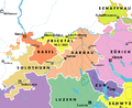
 Kanton Baden.png 1,200 × 2,264; 224 KB
-
 Kantone Linth und Saentis.png 800 × 907; 80 KB
-
 Karte Distrikte Kanton Leman-DE.png 2,000 × 1,896; 400 KB
-
 Karte Distrikte Kanton Leman.png 2,000 × 1,896; 400 KB
-
 Karte Helvetik 1-fr.svg 2,478 × 1,549; 584 KB
-
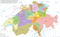 Karte Helvetik 1.png 2,500 × 1,561; 1.19 MB
-
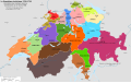
 Karte Helvetik 2.png 3,000 × 2,186; 1.21 MB
-
 Karte Helvetik 3-EN.png 2,500 × 1,570; 743 KB
-
 Karte Helvetik 3-FR.png 2,500 × 1,570; 738 KB
-
 Karte Helvetik 3-fr.svg 2,478 × 1,549; 585 KB
-
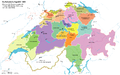
 Karte Helvetik 3.png 2,500 × 1,577; 845 KB
-
 Karte Helvetik 3b.png 2,500 × 1,623; 369 KB
-
 Karte Helvetik 4 Malmaison.png 2,500 × 1,570; 465 KB
-
 Karte Helvetik 4 Malmaison2.png 2,500 × 1,570; 459 KB
-
 Karte Helvetik 4-fr.svg 2,478 × 1,549; 575 KB
-
 Karte Helvetik 4.png 2,500 × 1,570; 448 KB
-
 Karte Zurich 1800.jpg 1,500 × 1,119; 776 KB
-
 Karte-Kanton-Schaffhausen-Helvetik.png 1,500 × 1,159; 167 KB
-
 Karte-Kanton-Zürich-Helvetik.png 2,500 × 2,483; 757 KB

_1802.png)


