Category:Maps of the history of Czechia
Jump to navigation
Jump to search
Subcategories
This category has the following 18 subcategories, out of 18 total.
A
H
M
- Maps of German-Austria (10 F)
- Maps of Samo's realm (8 F)
- Maps of the Battle of Königgrätz (28 F)
S
Media in category "Maps of the history of Czechia"
The following 120 files are in this category, out of 120 total.
-
 Kingdom of Bohemia during the Hussite Wars.jpg 1,151 × 861; 468 KB
-
 Napoleonic Central Europe.jpg 3,937 × 2,855; 2.85 MB
-
 1861 р.. Ходзько Борейко Леонард Стан на 862 р.jpg 1,600 × 1,198; 553 KB
-
 3republika.png 1,255 × 634; 63 KB
-
 Accordo di Monaco.png 2,253 × 1,961; 73 KB
-
 Bohemia 1138–1254.jpg 2,001 × 1,561; 1.59 MB
-
 Bohemia under Otakar II and Karel IV CZ.svg 520 × 471; 1.36 MB
-
 Bohemia under Otakar II PL.svg 520 × 471; 1.36 MB
-
 Bohemia-ottokar2.jpg 596 × 496; 113 KB
-
 Bohemiae Rosa.jpg 500 × 742; 120 KB
-
 Brazda 1.jpg 904 × 1,085; 387 KB
-
 Brněnský kraj 1950.png 804 × 473; 105 KB
-
 Campus Lucsco et Provincia Lucensis.png 1,600 × 1,229; 1.59 MB
-
 Carolingian Empire map 1895.jpg 5,697 × 4,050; 7.84 MB
-
 Crown of Bohemia 1648.png 1,134 × 1,084; 593 KB
-
 Duchy of Bohemia 1000.svg 485 × 340; 1.25 MB
-
 Duernkrut3.jpg 722 × 773; 193 KB
-
 Egerland.PNG 540 × 574; 28 KB
-
 Empire carolingien.png 371 × 428; 44 KB
-
 ExpulsionNeveklovskoPercent.JPG 1,329 × 1,250; 142 KB
-
 ExpulsionNeveklovskoT.gif 1,329 × 1,250; 779 KB
-
 Gottwaldovský kraj 1950.png 804 × 473; 99 KB
-
 Great Moravia Puspoki's Theory.jpg 1,068 × 848; 960 KB
-
 Greater austria.png 1,500 × 1,280; 45 KB
-
 Vereinigte Staaten von Groß-Österreich.png 1,500 × 1,280; 192 KB
-
 대 오스트리아.png 1,500 × 1,280; 64 KB
-
 Greater austriaPL.png 1,500 × 1,280; 74 KB
-
 Hradecký kraj 1950.png 804 × 473; 100 KB
-
 Image taken from page 273 of 'Kriegsgeschichtliche Studien' (15968058874).jpg 4,550 × 1,934; 904 KB
-
 Image taken from page 273 of 'Kriegsgeschichtliche Studien' (16402992038).jpg 2,431 × 2,158; 418 KB
-

-

-
-

-

-

-
 Jaegerndfmap.jpg 310 × 448; 42 KB
-
 Jihlavský kraj 1950.png 804 × 473; 101 KB
-
 Josephinische Landaufnahme Mähren.jpg 3,061 × 2,192; 812 KB
-
 Karlovarský kraj 1950.png 804 × 473; 98 KB
-
 Karte Böhmen unter Ottokar II.png 823 × 821; 187 KB
-
 Karte Böhmische Krone.png 823 × 821; 104 KB
-
 Karte Gebietsaustausch Tschechoslowakei-Polen 1958.png 1,105 × 1,200; 173 KB
-
 Kingdom of Germany 1004.svg 485 × 340; 1.23 MB
-
 Kolin Znaim aus Bahnkarte Deutschland 1899.png 460 × 670; 618 KB
-
 Kurgan kultur.png 440 × 364; 272 KB
-
 Kurganisierung.png 583 × 289; 326 KB
-
 Languages in Central Europe 1910.jpg 1,049 × 1,031; 429 KB
-
 Liberecký kraj 1950.png 804 × 473; 99 KB
-
 Location of dowry towns in the Czech Republic.JPG 914 × 536; 40 KB
-
 Nitra moravia 833 hu.svg 492 × 582; 18 KB
-
 Nitra moravia 833 sl.svg 492 × 582; 81 KB
-
 Nitra Moravia 833-es.svg 478 × 582; 184 KB
-
 Nitra moravia 833-it.svg 491 × 636; 40 KB
-
 Nitra Moravia 833-pt.svg 478 × 582; 22 KB
-
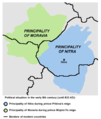 Nitra moravia 833.png 492 × 582; 27 KB
-
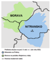 Nitra moravia 833-cs.png 492 × 582; 24 KB
-
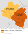
 Fürstentümer Nitra und Mähren.png 492 × 582; 18 KB
-
 NJ Nový Jičín-2010.png 1,262 × 1,427; 80 KB
-
 Olomoucký kraj 1950.png 804 × 473; 102 KB
-
 Ostravský kraj 1950.png 804 × 473; 101 KB
-
 Panství habsburské v XVI. století.jpg 952 × 823; 191 KB
-
 Pardubický kraj 1950.png 804 × 473; 99 KB
-
 Plan Hradu Krakovce.jpg 1,314 × 2,456; 859 KB
-
 Plzeňský kraj 1950.png 804 × 473; 103 KB
-
 Plán Hradu Kozí.jpg 1,770 × 1,552; 743 KB
-
 PNG Jagelon.png 1,268 × 1,054; 90 KB
-
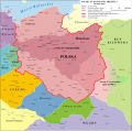
 Poland 992-1025 map PL.png 1,349 × 1,161; 510 KB
-
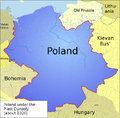
 Poland historical map AD 960 - 992.png 578 × 570; 284 KB
-
 Poland1020-c.png 700 × 691; 422 KB
-
 Poland1020-es2.svg 11,510 × 11,360; 1.03 MB
-
 Poland1020.png 700 × 691; 487 KB
-
 Poland960.png 520 × 513; 307 KB
-
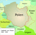
 Polen 960-992.png 2,309 × 2,279; 1.08 MB
-
 Polen1020.png 700 × 691; 483 KB
-
 Polen960.png 520 × 513; 270 KB
-
 Polska 1039 - 1058-es.svg 11,510 × 11,360; 2.54 MB
-
 Polska 1039 - 1058.png 2,309 × 2,279; 1.07 MB
-
 Polska 960 - 992-es.svg 11,510 × 11,360; 2.5 MB
-
 Polska 960 - 992.png 1,854 × 1,828; 1.45 MB
-
 Polska 960 - 992.svg 11,510 × 11,360; 2.37 MB
-
 Polska 992 - 1025-es.svg 11,510 × 11,360; 2.55 MB
-
 Polska 992 - 1025-pt.svg 12,277 × 12,117; 2.19 MB
-
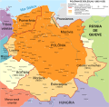
 Polska 992 - 1025.png 4,215 × 3,780; 4.17 MB
-
 Polska around 1000.png 2,309 × 2,279; 1.41 MB
-
 Polska 992 - 1025.svg 1,500 × 1,480; 2.38 MB
-
 Polska WladLokietka (1275-1300) es.svg 1,187 × 1,039; 1.55 MB
-
 Polska WladLokietka (1275-1300) hu.svg 1,187 × 1,039; 1.42 MB
-
 Polska1020-c.png 700 × 691; 429 KB
-
 Polska1020.png 700 × 691; 438 KB
-
 Polska960-992.png 520 × 513; 275 KB
-

-
 Prag-Bruenn aus Bahnkarte Deutschland 1899.png 1,000 × 750; 1.53 MB
-
 Pražský kraj 1950.png 804 × 473; 108 KB
-
 Propagační mapka v La Nation Tchèque.jpg 987 × 514; 119 KB
-
 Rise Ceska za Karla IV.jpg 3,289 × 2,516; 1.36 MB
-
 Rozsah českého státu od polovice XVIII. století do světové války.jpg 613 × 420; 49 KB
-

-
 Svidna deserted medieval settlement location CZ.png 550 × 370; 21 KB
-
 Tesetice-Kyjovice.jpg 1,000 × 708; 268 KB
-
 The Hussite wars, by the Count Lützow - map.jpg 3,203 × 2,559; 2.42 MB
-
 THEFEST1.jpg 2,000 × 1,480; 2.32 MB
-
 Unetice culture Czech Republic.jpg 1,000 × 608; 188 KB
-
 Vlachovo Brezi - Jan Hus.jpg 1,227 × 1,715; 699 KB
-
 Volby 1946 komunisté.png 1,255 × 634; 68 KB
-
 Vucedol culture map.png 815 × 1,137; 78 KB
-
 WenceslausIImap-blank.png 1,062 × 1,079; 216 KB
-
 WenceslausIImap-cs.png 1,062 × 1,079; 342 KB
-
 WenceslausIImap-en.png 1,062 × 1,079; 296 KB
-
 West slavs 9th-10th c it.png 876 × 723; 392 KB
-
 West slavs 9th-10th c..png 876 × 723; 419 KB
-
 West slavs 9th-10th c.2-es.svg 1,454 × 1,092; 897 KB
-
 Západní Slované 9.-10. st.png 876 × 723; 489 KB
-
 Ústecký kraj 1950.png 804 × 473; 98 KB
-
 Čechy a Morava.png 1,503 × 1,063; 3.58 MB
-
 Českobudějovický kraj 1950.png 804 × 473; 103 KB
-
 České kmeny.png 800 × 460; 85 KB
-
 České Slezsko po roce 1920 na mapě Česka.png 3,662 × 2,104; 346 KB
-
 Český stát v X. století za Boleslava I. a II.jpg 930 × 484; 114 KB
-
 Карта Польщі у 1020 році.png 700 × 691; 542 KB


.jpg)
.jpg)
%27_(11176072693).jpg)
%27_(11174838534).jpg)
%27_(11180857695).jpg)
.jpg)
.jpg)
.jpg)


_es.svg)
_hu.svg)


