Category:Maps of bailliages of Switzerland
Jump to navigation
Jump to search
Deutsch: Vogtei, Obervogtei, Landvogtei, Amt, Kastlanei (Berner Oberland) Karten
Français : Cartes des bailliages
Français : Carte dei baliaggio
Media in category "Maps of bailliages of Switzerland"
The following 43 files are in this category, out of 43 total.
-
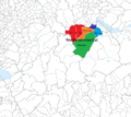
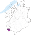 Attalens.png 2,952 × 3,302; 1.35 MB
-
 Bailliage Avenches.png 411 × 320; 86 KB
-
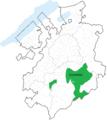 Bailliage Corbières.png 2,952 × 3,302; 1.37 MB
-
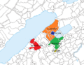
 Bailliage Ebikon.png 940 × 880; 418 KB
-
 Bailliage Knutwil.png 940 × 880; 422 KB
-
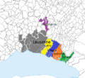 Bailliage Lausanne.png 491 × 449; 134 KB
-
 Bailliage Malters Littau.png 940 × 880; 423 KB
-
 Bailliage Ruswil.png 940 × 880; 422 KB
-
 Bailliage Vevey.png 764 × 704; 108 KB
-
 Bailliage Weggis.png 940 × 880; 418 KB
-
 Bailliage Yverdon 1536-1566.png 1,996 × 1,588; 730 KB
-
 Bailliages bernois Vaud 1536-1539.png 2,897 × 2,518; 2.05 MB
-
 Bailliages bernois Vaud 1539-1555.png 2,897 × 2,518; 2.08 MB
-
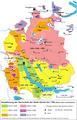
 Bailliages fribourgeois 1536.png 2,952 × 3,302; 1.38 MB
-
 Bailliages fribourgeois.png 2,952 × 3,302; 1.39 MB
-
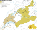
 Baliaggi-transalpini rev.png 1,500 × 1,516; 572 KB
-
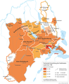
 Berner Aargau.png 2,000 × 2,111; 494 KB
-
 Berner-Vogteien-im-Kanton-Waadt fr.png 2,000 × 1,867; 454 KB
-
 Bernische-Vogteien-Kanton-Waadt.png 2,897 × 2,518; 1.63 MB
-
 Burgunderkriege.png 2,500 × 2,527; 1.13 MB
-
 Châtellenie Niedersimmental.png 940 × 840; 364 KB
-
 Châtellenie Obersimmental.png 940 × 840; 364 KB
-
 Gouvernement de Hautcrêt.png 315 × 319; 61 KB
-
 Historische Karte Zuerich.png 1,000 × 1,561; 227 KB
-
 Illens et Arconciel.png 2,952 × 3,302; 1.35 MB
-
 Karte Bernische-Vogteien-Kanton-Waadt en.png 2,000 × 1,738; 477 KB
-
 Karte Bernische-Vogteien-Kanton-Waadt fr.png 2,000 × 1,738; 505 KB
-
 Karte Stadtstaat Bern vereinfacht-EN.png 2,000 × 1,655; 615 KB
-
 Karte Stadtstaat Bern vereinfacht.png 2,000 × 1,655; 604 KB
-
 Karte Stadtstaat Bern version-für-svgexport.png 4,000 × 3,401; 1.25 MB
-
 Karte Stadtstaat Bern Wachstum.png 2,500 × 2,060; 957 KB
-
 Karte Stadtstaat Bern.svg 1,160 × 997; 470 KB
-
 Karte-Historische-Entwicklung-Luzern.png 2,000 × 2,444; 734 KB
-
 Karte-Historische-Gliederung-Solothurn.png 2,000 × 1,690; 345 KB
-
 Karte-Territoriale-Entwicklung-Kanton-Solothurn.png 2,500 × 2,112; 764 KB
-
 Karte-Verwaltung-Stadtstaat.png 2,500 × 2,263; 927 KB
-
 Karte-Wachstum-Kanton-Züric.png 2,500 × 2,483; 1.19 MB
-
 Landvogtei Freie Aemter.png 1,222 × 1,276; 103 KB
-
 LV Grüningen.png 800 × 1,016; 113 KB
-
 LV Kyburg copy.svg 570 × 724; 204 KB
-
 Oron et Corsier.png 315 × 319; 62 KB
-
 Teile St Gallen.png 900 × 961; 278 KB
-
 Verwaltung Kanton Zürich 17.png 800 × 1,168; 331 KB


