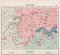
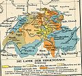
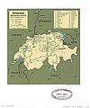
Category:Old maps of Switzerland
Jump to navigation
Jump to search
Use the appropriate category for maps showing all or a large part of Switzerland. See subcategories for smaller areas:
| If the map shows | Category to use |
|---|---|
| Switzerland on a recently created map | Category:Maps of Switzerland or its subcategories |
| Switzerland on a map created more than 70 years ago | Category:Old maps of Switzerland or its subcategories |
| the history of Switzerland on a recently created map | Category:Maps of the history of Switzerland or its subcategories |
| the history of Switzerland on a map created more than 70 years ago | Category:Old maps of the history of Switzerland or its subcategories |
Wikimedia category | |||||
| Upload media | |||||
| Instance of | |||||
|---|---|---|---|---|---|
| Category combines topics | |||||
 | |||||
Subcategories
This category has the following 36 subcategories, out of 36 total.
Media in category "Old maps of Switzerland"
The following 161 files are in this category, out of 161 total.
-
16 of 'Annals of Switzerland. (With plates.)' (11244615274).jpg 1,920 × 1,291; 685 KB
-
Meyers b14 s0746a.jpg 800 × 646; 251 KB
-
Sprachgebiete der Schweiz im 20. Jahrhundert.jpg 2,246 × 2,052; 1.38 MB
-
2014-GareCornavin-Hall1.jpg 2,592 × 1,944; 1.24 MB
-
20th Century Geography of Religions in Switzerland.jpg 2,168 × 1,934; 1.28 MB
-
Andree49-2.jpg 1,935 × 1,423; 1.23 MB
-
Appenzell stumpf.jpg 1,804 × 1,420; 1.62 MB
-
Atlas Ortelius KB PPN369376781-057av-057br.jpg 3,000 × 2,194; 4.47 MB
-
Atlas Van der Hagen-KW1049B10 097-ZVRICHGOW et Basiliensis provincia.jpeg 5,500 × 4,244; 3.69 MB
-
Atlas Van der Hagen-KW1049B10 098-DAS WIFLISPVR- GERGOW.jpeg 5,500 × 4,234; 3.98 MB
-
Atlas Van der Hagen-KW1049B10 099-ARGOW cum parte merid. ZVRICHGOW.jpeg 5,500 × 4,291; 4.38 MB
-
Helvetia (NYPL b15404146-1632187).jpg 7,230 × 5,428; 6.52 MB
-
Baubahn-Schlossweid.JPG 1,077 × 1,624; 1.27 MB
-
Belagerung Baden stumpf.jpg 1,789 × 865; 1.02 MB
-
Bonstetten Confederacy 1479.jpg 687 × 642; 166 KB
-
Bouillet - Atlas universel, Carte 68.png 3,425 × 2,674; 9.48 MB
-
Brockhaus and Efron Encyclopedic Dictionary b77 293-0.jpg 2,905 × 2,127; 2.95 MB
-
Brockhaus and Efron Encyclopedic Dictionary b77 308-0.jpg 1,221 × 2,082; 689 KB
-
Brupbacher Pfäffikon Plan.jpg 2,195 × 2,889; 2.94 MB
-
Busskirch - Allmeindplan 1649 2010-10-22 16-42-00.JPG 3,427 × 2,041; 2.09 MB
-
Canton de Genève LOC 2012593355.jpg 4,147 × 2,903; 1.97 MB
-
Canton de Genève LOC 2012593355.tif 4,147 × 2,903; 34.44 MB
-
Carte de la Suisse @ Hall @ Gare de Genève-Cornavin @ Genève (50898656222).jpg 6,240 × 4,160; 4.31 MB
-
Carte de la Suisse.jpg 9,743 × 6,951; 22.48 MB
-
Carte du département du Mont-Terrible.jpg 1,027 × 737; 695 KB
-
Carte physique, administrative et routière de la Suisse LOC 2012593357.jpg 10,744 × 8,283; 20.62 MB
-
Carte physique, administrative et routière de la Suisse LOC 2012593357.tif 10,744 × 8,283; 254.61 MB
-
Charte von Helvetien Und Wallis.jpg 7,306 × 5,625; 14.77 MB
-
Charte von Schwaben Tafel 39 Schaffhausen.jpg 2,130 × 2,615; 4.53 MB
-
Charte von Schwaben Tafel 46 Basel.jpg 2,673 × 2,152; 3.81 MB
-
Charte von Schwaben Tafel 47-48 Kaiserstuhl.jpg 2,131 × 822; 1.29 MB
-
Charte von Schwaben Tafel 49 Frauenfeld.jpg 2,134 × 2,600; 4.08 MB
-
Charte von Schwaben Tafel 50 St Gallen.jpg 2,119 × 2,571; 4.08 MB
-
Chur - 27-47.jpg 3,457 × 4,998; 3.58 MB
-
Como - 27-46.jpg 3,512 × 4,986; 3.76 MB
-
D027 - N° 318. Genève et la Percée du Rhône. - liv3-ch07.png 1,450 × 1,690; 487 KB
-
D029 - N° 319. Premier Noyau suisse. - liv3-ch07.png 1,428 × 1,698; 493 KB
-
D285- Morcellement d’un territoire montagneux, il y a 600 ans. - L1-Ch5.png 1,504 × 1,344; 45 KB
-
D312- N° 476. Voies ferrées entre Calais et Milan. - Liv4-Ch01.png 1,446 × 1,844; 295 KB
-
D329- Stations lacustres du lac de Neuchâtel. -liv3-ch2.png 1,430 × 1,262; 371 KB
-
D384- N° 380. Protestants et catholiques en Suisse. - liv3-ch12.png 1,440 × 1,236; 177 KB
-
Das Land Appenzell (Gabriel Walser).png 1,070 × 630; 1.42 MB
-
Die Schweiz - Stieler's Hand-Atlas.jpg 5,608 × 4,557; 11.5 MB
-
Diocesis Constantiensis.jpg 2,448 × 1,800; 1.38 MB
-
Droysens-25.jpg 5,781 × 8,927; 4.5 MB
-
Electric railway journal (1911) (14573038269).jpg 1,180 × 1,210; 211 KB
-
Elvetica II.jpg 652 × 339; 84 KB
-
Elvetica.jpg 1,321 × 700; 422 KB
-
Extrait Tablede Peutinger Secteur Rhône et Alpes.jpg 896 × 356; 196 KB
-
Frankreich und die Schweiz.jpg 5,550 × 4,507; 8.6 MB
-
Geognostische Karte der Schweiz.JPG 2,126 × 1,299; 171 KB
-
Grigioni leghe.png 860 × 718; 1.55 MB
-
Helvetik2.jpg 1,024 × 777; 376 KB
-
Iconographic Encyclopedia of Science, Literature and Art 187.jpg 2,520 × 2,230; 1.29 MB
-
Karte Archidiaconate und Decanate des Bischtums Constanz.jpg 4,212 × 4,377; 5.69 MB
-
Karte Hist Entwicklung der Eisenbahn Schweiz.jpg 2,805 × 1,911; 843 KB
-
Korrektion.jpg 400 × 220; 20 KB
-
Kriegstheater oder Graenzkarte Zwischen Frankreich und Italien.jpg 7,304 × 6,474; 16.3 MB
-
Le Canton de Basle, et Parties des Cantons d'Argauvie et Soleure du Frikthal et Frontieres.jpg 9,665 × 7,255; 24.48 MB
-
Legende Schlacht bei Zürich 1.jpg 632 × 1,118; 96 KB
-
Legende Schlacht bei Zürich 2.jpg 644 × 1,080; 65 KB
-
Legende Schlacht bei Zürich 3.jpg 640 × 1,100; 68 KB
-
Legende Schlacht bei Zürich 4.jpg 624 × 942; 64 KB
-
Map - Special Collections University of Amsterdam - OTM- HB-KZL 32.20.41.tif 7,643 × 6,275; 137.21 MB
-
Map of Switzerland by Abraham Ortelius.jpeg 1,584 × 1,181; 565 KB
-
Mapa d'una zona llacustre de Suïssa (AFCEC RIBASV D 4812).jpeg 838 × 768; 180 KB
-
Maxima Sequanorum.jpg 613 × 524; 402 KB
-
Michaeliskarte Wettingen.jpg 687 × 589; 193 KB
-
Nouvelle Carte Hydrographique et Routière de la Suisse.jpg 11,314 × 7,930; 14.45 MB
-
La Suisse divisee en ses treze cantons, ses alliez & ses sujets (NYPL b13967336-5206867).tiff 10,326 × 7,758, 2 pages; 229.46 MB
-
Canton Zürich sire Illustris Helvetiorum Respublica Tigurina .. (NYPL b13967336-5206868).tiff 10,326 × 7,758, 2 pages; 229.46 MB
-
Canton Bern sive illustris Helvetiorum respublica Bernensis, .. (NYPL b13967336-5206870).tiff 10,326 × 7,758, 2 pages; 229.46 MB
-
Canton Lucern sive illustris Helvetiorum Respublica Lucernensis, .. (NYPL b13967336-5206871).tiff 10,326 × 7,758, 2 pages; 229.46 MB
-
Canton Uri sive Pagus Helvetiae Uriensis .. (NYPL b13967336-5206872).tiff 10,326 × 7,758, 2 pages; 229.46 MB
-
Canton Schweiz sive Pagus Helvetiae Suitensis .. (NYPL b13967336-5206873).tiff 10,326 × 7,758, 2 pages; 229.46 MB
-
Canton Unterwalden sive Pagus Helvetiae Subsylvanus .. (NYPL b13967336-5206874).tiff 10,326 × 7,758, 2 pages; 229.46 MB
-
Canton Zug sive Pagus Helvetiae Tugiensis cum Confinibus .. (NYPL b13967336-5206875).tiff 10,326 × 7,758, 2 pages; 229.46 MB
-
Helvetia, or Swisserland (NYPL b14428893-1503424).jpg 6,299 × 5,248; 7.58 MB
-
Reilly 253.jpg 1,375 × 907; 534 KB
-
Reilly 391.jpg 3,816 × 2,536; 1.6 MB
-
Reilly 393.jpg 3,536 × 2,731; 1.47 MB
-
Reilly 395.jpg 3,675 × 2,832; 1.96 MB
-
Reilly 396.jpg 3,342 × 2,876; 1.86 MB
-
Reilly Karte von der Schweiz.jpg 8,758 × 6,900; 10.79 MB
-
Reilly Karte von der Schweiz2.jpg 740 × 580; 172 KB
-
Rise of the Swiss Republic - Map of Switzerland.jpg 3,790 × 2,795; 1.86 MB
-
Röthenbach LOC 2008621300.jpg 5,893 × 4,677; 3.35 MB
-
Röthenbach LOC 2008621300.tif 5,893 × 4,677; 78.85 MB
-
Schweiz Mediation.jpg 3,000 × 2,304; 2.71 MB
-
Schweizerkarte Tschudi.jpg 2,592 × 1,944; 2.2 MB
-
Seutter Kanton Zürich.JPG 3,529 × 2,992; 6.56 MB
-
Sierre LOC 2007632857.jpg 5,890 × 4,450; 3.7 MB
-
Sierre LOC 2007632857.tif 5,890 × 4,450; 74.99 MB
-
Sondrio - 28-46.jpg 3,500 × 5,022; 3.93 MB
-
Stumpf Froschauer Landtaflen Wallis.jpg 2,130 × 1,239; 1.51 MB
-
Suisse - Aspect physique du sol - gravé chez L. Sonnet - btv1b53147346m.jpg 4,915 × 3,631; 2.92 MB
-
Suisse - dressée par J. M. Darmet - btv1b53136080s.jpg 8,780 × 6,782; 10.99 MB
-
Suisse et Alpes Occidentales - btv1b8445117b.jpg 7,626 × 9,236; 11.17 MB
-
Suisse geographique.jpg 933 × 594; 202 KB
-
Suisse orientale - Carte du canton des Grisons - btv1b53081185z.jpg 4,917 × 3,298; 3.15 MB
-
Suisse, d'après l'état-major fédéral et les nouvelles cartes cantonales - btv1b53027850b.jpg 9,806 × 6,913; 14.17 MB
-
Suisse, d'après l'état-major fédéral et les nouvelles cartes cantonales - btv1b53028012w.jpg 9,772 × 6,768; 14.12 MB
-
Suisse. Savoie - J. B. Bourguignon d'Anville... - btv1b5973275x.jpg 3,371 × 2,596; 1.01 MB
-
Sveits - no-nb krt 00924.jpg 9,122 × 7,647; 26.81 MB
-
Svizzera.jpg 1,072 × 991; 491 KB
-
Swiss confed shepherd.jpg 2,245 × 1,259; 607 KB
-
Swiss-confederation-shepherd-atlas 1-2245x1259.jpg 2,245 × 1,259; 838 KB
-
Swisserland LOC 2009579458.jpg 11,382 × 8,419; 14.26 MB
-
Swisserland LOC 2009579458.tif 11,382 × 8,419; 274.16 MB
-
Switzerland according to the best authorities (3046076736).jpg 2,000 × 1,791; 2.73 MB
-
Switzerland, administrative divisions. LOC 00555352.jpg 2,423 × 2,906; 704 KB
-
Switzerland, administrative divisions. LOC 00555352.tif 2,423 × 2,906; 20.15 MB
-
Switzerland, administrative divisions. LOC 2011588251.jpg 3,157 × 4,159; 1.4 MB
-
Switzerland, administrative divisions. LOC 2011588251.tif 3,157 × 4,159; 37.57 MB
-
Switzerland. 6-61. LOC 73697665.jpg 11,631 × 7,083; 8.37 MB
-
Switzerland. 6-61. LOC 73697665.tif 11,631 × 7,083; 235.7 MB
-
Switzerland. LOC 00555353.jpg 2,394 × 2,898; 818 KB
-
Switzerland. LOC 00555353.tif 2,394 × 2,898; 19.85 MB
-
Switzerland. LOC 00555354.jpg 2,533 × 3,266; 922 KB
-
Switzerland. LOC 00555354.tif 2,533 × 3,266; 23.67 MB
-
Switzerland. LOC 2011588110.jpg 3,074 × 3,883; 1.78 MB
-
Switzerland. LOC 2011588110.tif 3,074 × 3,883; 34.15 MB
-
Szwajcaria1903.jpg 3,509 × 2,550; 3.66 MB
-
Südwestliches Deutschland, enth. Bayern, Würtemberg, Baden, Hohenzollern und Schweiz.jpg 5,527 × 4,549; 8.51 MB
-
Topographia farbig.jpg 2,000 × 1,568; 2.12 MB
-
Vidal-lablache 425606-1.jpg 3,976 × 3,392; 4.57 MB
-
Vidal-lablache 425606-2.jpg 3,928 × 3,408; 4.79 MB
-
Wiki n10 VDMA jpeg.jpg 2,283 × 1,684; 1.82 MB
-
Zofingen 1715.jpg 1,200 × 1,550; 294 KB
-
Zuerichgau Stumpf.jpg 1,200 × 1,734; 1.11 MB


