Category:Maps of the history of Central Europe
Jump to navigation
Jump to search
Wikimedia category | |||||
| Upload media | |||||
| Instance of | |||||
|---|---|---|---|---|---|
| |||||
Use the appropriate category for maps showing all or a large part of Central Europe. See subcategories for smaller areas:
| If the map shows | Category to use |
|---|---|
| Central Europe on a recently created map | Category:Maps of Central Europe or its subcategories |
| Central Europe on a map created more than 70 years ago | Category:Old maps of Central Europe or its subcategories |
| the history of Central Europe on a recently created map | Category:Maps of the history of Central Europe or its subcategories |
| the history of Central Europe on a map created more than 70 years ago | Category:Old maps of the history of Central Europe or its subcategories |
Subcategories
This category has the following 40 subcategories, out of 40 total.
Media in category "Maps of the history of Central Europe"
The following 79 files are in this category, out of 79 total.
-
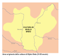
Bijelo Brdo Culture-it.svg 760 × 684; 92 KB
-
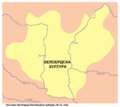
Bijelo brdo culture01.png 1,048 × 937; 47 KB
-
Bijelo brdo culture02.png 1,048 × 937; 47 KB
-
Bney hes bney khes in 15th century.svg 663 × 350; 991 KB
-
Bohemia under Otakar II and Karel IV CZ.svg 520 × 471; 1.36 MB
-
Bohemia under Otakar II PL.svg 520 × 471; 1.36 MB
-
Bohemia-ottokar2.jpg 596 × 496; 113 KB
-
Central Europe (ethnic).JPG 2,230 × 1,436; 2.81 MB
-
Central Erope 1572 es.svg 1,122 × 883; 248 KB
-
Dispersal of Slavs as of 1900 (1910 map).jpg 1,200 × 1,031; 212 KB
-
Europa Central 1938.png 772 × 549; 81 KB
-
Finno-ugrian-map-de.svg 963 × 987; 927 KB
-
Finno-ugrian-map-es.svg 963 × 987; 1.01 MB
-
Finno-ugrian-map-ukr.svg 963 × 987; 927 KB
-
Finno-ugrian-map.svg 963 × 987; 927 KB
-
Finnugroj en 1000 (eo).svg 963 × 987; 927 KB
-
Gepid kingdom 6th century - es.svg 1,102 × 1,154; 218 KB
-
Gepid kingdom 6th century - pt.svg 1,102 × 1,154; 223 KB
-
Gepid kingdom 6th century - ru.svg 1,033 × 1,082; 161 KB
-
Gepid kingdom 6th century - zh.svg 1,102 × 1,154; 82 KB
-
Gepid kingdom 6th century-hu.svg 1,102 × 1,154; 70 KB
-
Gepid kingdom 6th century-sr.png 858 × 894; 53 KB
-
Gepid kingdom 6th century.png 858 × 894; 55 KB
-
Great Moravia Puspoki's Theory.jpg 1,068 × 848; 960 KB
-
Great Moravia Svatopluk.jpg 1,214 × 878; 264 KB
-
Great Moravia.svg 600 × 439; 17 KB
-
Gutthiuda.jpg 800 × 547; 460 KB
-
Historical map of the Balkans around 582-612 AD-es.svg 512 × 360; 23 KB
-
Historical map of the Balkans around 582-612 AD-hu.svg 512 × 360; 28 KB
-
Historical map of the Balkans around 582-612 AD-pt.svg 512 × 357; 18 KB
-
Historical map of the Balkans around 582-612 AD.jpg 1,688 × 1,977; 476 KB
-
InterwarCentralEurope.png 450 × 456; 45 KB
-
Istorija Rusije.PNG 610 × 622; 115 KB
-
Jagellók országai.jpg 712 × 523; 49 KB
-
Karel-IV..jpg 912 × 685; 385 KB
-
Karte Böhmen unter Karl IV.-es.svg 396 × 394; 1.64 MB
-
Karte Böhmen unter Karl IV.png 823 × 821; 178 KB
-
Karte Böhmen unter Ottokar II.png 823 × 821; 187 KB
-
Karte Böhmische Krone.png 823 × 821; 104 KB
-
Kelet-Közép-Európa Mátyás király uralkodásának végén.png 9,491 × 8,051; 10.35 MB
-
Lenguas Rusia Antigua.jpg 610 × 622; 185 KB
-
Map Austria and the spartitions of Poland 1928-1940 - Touring Club Italiano CART-TRC-60.jpg 6,290 × 6,846; 4.53 MB
-
Map Austria in the napoleonic age 1928-1940 - Touring Club Italiano CART-TRC-61.jpg 5,056 × 6,579; 3.63 MB
-
Map for the Silesian and Seven Years Wars.jpg 1,672 × 1,238; 438 KB
-
Maps of Slavinia, Pomerania, and Pomerelia.png 650 × 1,100; 1.03 MB
-
MEZ Zone.gif 2,844 × 2,535; 2.3 MB
-
Mitteleuropa ENG Leg wielgórski.PNG 779 × 1,072; 221 KB
-
Mitteleuropa ENG wielgórski.PNG 779 × 1,072; 212 KB
-
Mitteleuropa no labels wielgórski.PNG 779 × 1,072; 183 KB
-
Mitteleuropa POL Leg wielgórski.PNG 779 × 1,072; 211 KB
-
Mitteleuropa POL wielgórski.PNG 779 × 1,072; 201 KB
-
Mitteleuropa – Völker und Sprachgebiete 1904.jpg 5,625 × 4,153; 16.82 MB
-
Muromian-map.png 610 × 622; 165 KB
-
Origins 200 AD.png 769 × 665; 297 KB
-
Origins 300BC.png 498 × 407; 321 KB
-
Origins 700.png 670 × 458; 620 KB
-
Pannonian sea vojvodina-en.png 1,399 × 927; 92 KB
-
Pannonian sea vojvodina-sr.png 1,399 × 927; 92 KB
-
Pannonian sea02-sr.png 1,399 × 927; 84 KB
-
Pannonian sea02.png 1,399 × 927; 84 KB
-
Pannoniansea currentborders.png 1,536 × 1,196; 119 KB
-
Reichsstrassen 1-10 1937-1945.png 3,348 × 2,416; 720 KB
-
Rozšíření Slovanů.png 960 × 822; 1,001 KB
-
Russia IX secolo.png 610 × 622; 144 KB
-
Slav-7-8-obrez.png 3,051 × 3,359; 339 KB
-
Slavic peoples 9c map.jpg 776 × 583; 144 KB
-
Spruner-Menke Handatlas 1880 Karte 31 Nebenkarte 2.jpg 3,316 × 4,900; 1.35 MB
-
Vatin culture-sr.png 1,088 × 632; 50 KB
-
Vatin culture.png 1,088 × 632; 56 KB
-
Vucedol culture map-sr.png 815 × 1,137; 79 KB
-
Vucedol culture map.png 815 × 1,137; 78 KB
-
West slavs 9th-10th c it.png 876 × 723; 392 KB
-
West slavs 9th-10th c..png 876 × 723; 419 KB
-
West slavs 9th-10th c.2-es.svg 1,454 × 1,092; 897 KB
-
Západní Slované 9.-10. st.png 876 × 723; 489 KB


