Category:Maps of the Austrian Empire
Jump to navigation
Jump to search
Subcategories
This category has the following 9 subcategories, out of 9 total.
*
C
E
L
M
Media in category "Maps of the Austrian Empire"
The following 10 files are in this category, out of 10 total.
-
 1812PRINCIPATE.png 3,445 × 1,937; 606 KB
-
 1815年的德意志邦联.png 1,011 × 1,024; 157 KB
-
 Autonóme Slovensko 1848.png 1,100 × 650; 23 KB
-
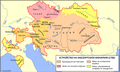 Austria in 1780 Bul Map.png 7,244 × 4,368; 1.13 MB
-
 Habsburg birodalom.jpg 782 × 559; 106 KB
-
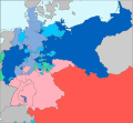 Map-AustroPrussianWar-annexed.svg 1,697 × 1,576; 755 KB
-
 Map-AustroPrussianWar.svg 1,697 × 1,576; 790 KB
-
 Pruse Autriche XVIIIème siècle.jpg 776 × 432; 158 KB
-
 Prusse Autriche XVIII.jpg 540 × 432; 107 KB
-
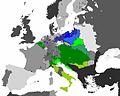
 Ukraine former empires.png 757 × 805; 94 KB


Categories:
- Austrian Empire
- Maps of the Habsburg Monarchy
- Maps of empires
- Maps of the history of Europe by former country
- Maps of the history of Central Europe
- Maps of the history of Austria
- Maps of the history of Hungary by theme
- Maps of the history of Czechia
- Maps of the history of Slovakia
- Maps of the history of Poland
- Maps of the history of Slovenia (16th-19th century)
- Maps of the history of Croatia (1526–1918)
- Maps of the Habsburg period in the history of Serbia
- Maps of the history of Vojvodina
- Maps of the history of Early Modern Romania
- Maps of the history of Transylvania
- Maps of the history of Italy