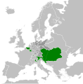
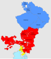
Category:Maps of the Habsburg Monarchy
Jump to navigation
Jump to search
Subcategories
This category has the following 14 subcategories, out of 14 total.
Media in category "Maps of the Habsburg Monarchy"
The following 68 files are in this category, out of 68 total.
-
Dominions House Habsburg abdication Charles V.jpg 1,654 × 1,029; 554 KB
-
Habsburg Map 1547.jpg 1,654 × 1,029; 534 KB
-
16th century Ottoman-Habsburg wars.png 1,437 × 891; 149 KB
-
1700'de Habsburglar.png 1,152 × 812; 203 KB
-
Flag Map of The Austrian Empire (1721).png 2,128 × 3,170; 428 KB
-
Flag map of the Austrian Empire (1748).png 520 × 497; 33 KB
-
Autriche antérieure.png 900 × 730; 37 KB
-
1815년 발칸 반도.png 1,000 × 1,000; 136 KB
-
Austrian Lombardy 1789.svg 450 × 456; 800 KB
-
Balkans 1815.png 1,000 × 1,000; 92 KB
-
Central europe 1572 hu.svg 922 × 880; 117 KB
-
Central europe 1572.png 922 × 880; 120 KB
-
Central Erope 1572 es.svg 1,122 × 883; 248 KB
-
Central Erope 1572 HU.svg 1,122 × 883; 243 KB
-
Habsburg Empire of Charles V.png 1,125 × 1,350; 539 KB
-
Danubian Principalities 1800 es.svg 551 × 387; 381 KB
-
Danubian Principalities 1800 no.svg 549 × 386; 89 KB
-
Danubian Principalities 1800.svg 549 × 386; 89 KB
-
Division of the House of Habsburg in 1556.jpg 1,152 × 812; 159 KB
-
Duchy of Carinthia.jpg 1,276 × 1,062; 1,011 KB
-
Dědičné habsburské země.svg 1,500 × 1,700; 43 KB
-
Eastern Adriatic 1558-es.svg 1,920 × 1,753; 3.96 MB
-
Empire Autricien au XVII. siecle OLTENIA.JPG 2,500 × 1,857; 576 KB
-
Empire of Charles V.png 1,045 × 720; 470 KB
-
Flag map of Hapsburg Austria (1795).png 742 × 578; 47 KB
-
Great serb migration-es.svg 8,584 × 7,087; 300 KB
-
Great serb migration-pt.svg 8,584 × 7,087; 143 KB
-
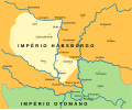
Great serb migration-sr.png 1,601 × 1,534; 123 KB
-
Great serb migration.png 1,601 × 1,534; 150 KB
-
Growth of Habsburg dominions.jpg 2,275 × 1,350; 1 MB
-
Growth of Habsburg territories.jpg 2,275 × 1,350; 1.02 MB
-
Habsbourg-1700.png 1,164 × 771; 309 KB
-
Habsburg dominions 1700.png 1,152 × 812; 226 KB
-
Habsburg Empire at its peak.png 398 × 413; 82 KB
-
Habsburg Empire of holy roman emperor Charles V.jpg 602 × 720; 271 KB
-
Habsburg Hereditary Lands (1789).svg 450 × 456; 792 KB
-
Habsburg hereditary lands-es.svg 1,500 × 1,700; 41 KB
-
Habsburg Monarchy 1714.svg 450 × 456; 915 KB
-
Habsburg Monarchy 1789.svg 450 × 456; 857 KB
-
Habsburg Monarchy.gif 864 × 518; 464 KB
-
Habsburgse Erflanden.svg 1,500 × 1,700; 41 KB
-
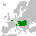
Hapsburg Monarchy 1797.svg 450 × 456; 1.02 MB
-
Hasburg Empire of Charles V, Holy Roman Emperor.png 368 × 277; 137 KB
-
Historische Karte CH 1315 IT.png 2,000 × 1,943; 655 KB
-
Historische Karte CH 1315.png 2,000 × 1,943; 411 KB
-
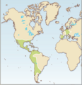
Inheritances of Charles V in 1519 (png).png 742 × 720; 179 KB
-
Josephinische Landaufnahme, 1763-87.png 1,673 × 1,277; 3.17 MB
-
Kebel 2MS.jpg 748 × 514; 149 KB
-
Map of the Holy League in 1595.svg 1,140 × 990; 525 KB
-
Partition of Hungary-ar.png 389 × 328; 42 KB
-
Partition of Hungary.png 389 × 328; 31 KB
-
Passarowitz 1718.JPG 1,200 × 1,681; 977 KB
-
Ridicarea topografica iozefina(1763-1787).png 1,673 × 1,277; 3.17 MB
-
Rom1793-1812 fr2.png 588 × 413; 100 KB
-
Rom1793-1812.png 587 × 413; 78 KB
-
Schweiz Frühmia Adel-es.svg 2,114 × 1,319; 1.28 MB
-
Schweiz Frühmia Adel.svg 512 × 359; 939 KB
-
Schweiz um 1200.png 2,500 × 1,754; 1.11 MB
-
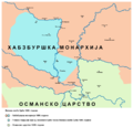
Serbia1718 1739-sr.png 851 × 737; 73 KB
-
Serbia1718 1739.png 851 × 737; 71 KB
-
Slavonia01.png 797 × 674; 80 KB
-
Terre ereditarie degli Asburgo.svg 1,500 × 1,700; 43 KB
-
Vojvodina18 19 cen-sr.png 2,000 × 1,563; 194 KB
-
Vojvodina18 19 cen.png 2,000 × 1,563; 220 KB
-
Waldstädte (Vorderösterreich).png 456 × 260; 30 KB
-
Waldstädte.png 456 × 260; 21 KB
-
Österreich BV042513086.jpg 774 × 1,180; 103 KB
-
ВЛАДЕНИЯ АВСТРИЙСКИХ ГАБСБУРГОВ С СЕРЕДИНЫ XVII в. по Третью ЧЕТВЕРТЬ XVIII в.jpg 1,149 × 1,280; 423 KB
Categories:
- Habsburg Monarchy
- Maps of empires
- Maps of the history of Europe by former country
- Maps of the history of the modern Balkans
- Maps of the history of Central Europe
- Maps of the history of Austria
- Maps of the history of Hungary by theme
- Maps of the history of Czechia
- Maps of the history of Slovakia
- Maps of the history of Poland
- Maps of the history of Slovenia (16th-19th century)
- Maps of the history of Croatia (1526–1918)
- Maps of the history of Bosnia and Herzegovina under Ottoman Empire
- Maps of the Habsburg period in the history of Serbia
- Maps of the history of Vojvodina
- Maps of the history of Early Modern Romania
- Maps of the history of modern Romania
- Maps of the history of Transylvania
- Maps of the history of Italy


