Category:Maps of Emmet County, Michigan
Jump to navigation
Jump to search
Counties of Michigan: Alcona · Alger · Allegan · Alpena · Antrim · Arenac · Baraga · Barry · Bay · Benzie · Berrien · Branch · Calhoun · Cass · Charlevoix · Cheboygan · Chippewa · Clare · Clinton · Crawford · Delta · Dickinson · Eaton · Emmet · Genesee · Gladwin · Gogebic · Grand Traverse · Gratiot · Hillsdale · Houghton · Huron · Ingham · Ionia · Iosco · Iron · Isabella · Jackson · Kalamazoo · Kalkaska · Kent · Keweenaw · Lake · Lapeer · Leelanau · Lenawee · Livingston · Luce · Mackinac · Macomb · Manistee · Marquette · Mason · Mecosta · Menominee · Midland · Missaukee · Monroe · Montcalm · Montmorency · Muskegon · Newaygo · Oakland · Oceana · Ogemaw · Ontonagon · Osceola · Oscoda · Otsego · Ottawa · Presque Isle · Roscommon · Saginaw · Sanilac · Schoolcraft · Shiawassee · St. Clair · St. Joseph · Tuscola · Van Buren · Washtenaw · Wayne · Wexford
Wikimedia category | |||||
| Upload media | |||||
| Instance of | |||||
|---|---|---|---|---|---|
| Category combines topics | |||||
| Emmet County | |||||
county in Michigan, United States   | |||||
| Instance of | |||||
| Named after | |||||
| Location | Michigan | ||||
| Capital | |||||
| Inception |
| ||||
| Population |
| ||||
| Area |
| ||||
| Different from | |||||
| official website | |||||
 | |||||
Subcategories
This category has the following 2 subcategories, out of 2 total.
M
O
Media in category "Maps of Emmet County, Michigan"
The following 28 files are in this category, out of 28 total.
-
 1842 Tonedagana Cheboygan Kishkawkee Wyandot PresqueIsle counties Michigan.jpg 1,225 × 512; 766 KB
-
 Carp Lake, MI location.png 1,900 × 1,300; 201 KB
-
 Conway, MI location.png 1,900 × 1,300; 201 KB
-
 Cross Village, MI location.png 1,900 × 1,300; 201 KB
-

-

-

-

-

-

-
 Emmet County, MI census map.png 1,000 × 1,200; 198 KB
-
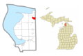
 Harbor Springs, MI location.png 928 × 1,320; 80 KB
-
 Levering, MI location.png 1,900 × 1,300; 201 KB
-
 Little Traverse Bay Bands of Odawa Indians (Emmet County, MI).png 1,900 × 1,300; 201 KB
-
 Littlefield Township, MI location3.png 1,900 × 1,300; 201 KB
-
 Mackinaw City (CHeboygan and Emmet County), MI location.png 1,677 × 1,341; 154 KB
-
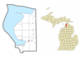
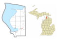
 Map of Michigan highlighting Emmet County.svg 962 × 1,127; 138 KB
-
 Michigan Senate District 37 (2010).png 3,200 × 3,450; 698 KB
-
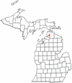 MIMap-doton-Alanson.PNG 261 × 300; 13 KB
-
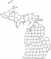
 MIMap-doton-BayShore.PNG 261 × 300; 13 KB
-
 MIMap-doton-BayView.PNG 261 × 300; 13 KB
-
 MIMap-doton-HarborSprings.PNG 261 × 300; 13 KB
-
 MIMap-doton-MackinawCity.PNG 261 × 300; 12 KB
-
 Oden, MI location.png 1,900 × 1,300; 201 KB
-
 Petoskey, Michigan location.png 928 × 1,320; 81 KB
-
 Ponshewaing, MI location.png 1,900 × 1,300; 201 KB
-
 Waugoshance Island, Michigan.png 575 × 408; 28 KB
-
 Waugoshance.png 575 × 408; 57 KB


.png)

,_MI_location.png)
.png)


