Category:Borough of Charnwood
Jump to navigation
Jump to search
non-metropolitan district in Leicestershire, United Kingdom   | |||||
| Upload media | |||||
| Instance of | |||||
|---|---|---|---|---|---|
| Location | Leicestershire, East Midlands, England | ||||
| Capital | |||||
| Legislative body |
| ||||
| Inception |
| ||||
| Population |
| ||||
| Area |
| ||||
| official website | |||||
 | |||||
Subcategories
This category has the following 40 subcategories, out of 40 total.
Media in category "Borough of Charnwood"
The following 200 files are in this category, out of 1,062 total.
(previous page) (next page)-
 'Myrtle Villa', ^126 Knightthorpe Road - geograph.org.uk - 4857829.jpg 672 × 1,024; 157 KB
-
 'Pedalpower', ^47 Ashby Road - geograph.org.uk - 4870830.jpg 1,024 × 636; 179 KB
-
 12 Degrees West - Baxter Gate - geograph.org.uk - 2939043.jpg 640 × 415; 51 KB
-
 37 and 38 Churchgate, Loughborough (geograph 7393012).jpg 1,024 × 768; 125 KB
-
 3M Healthcare, Loughborough - geograph.org.uk - 4883055.jpg 640 × 480; 139 KB
-

-

-

-
 A boater's view of Synergy Logistics, Loughborough - geograph.org.uk - 6178417.jpg 1,600 × 1,200; 402 KB
-
 A path through the Outwoods - geograph.org.uk - 1899119.jpg 2,240 × 2,774; 2.48 MB
-
 A path through the Outwoods - geograph.org.uk - 1899158.jpg 3,042 × 2,001; 2.58 MB
-
 A path through the Outwoods - geograph.org.uk - 1899172.jpg 3,253 × 2,110; 2.87 MB
-
 A512 Ashby Road - geograph.org.uk - 6221906.jpg 1,024 × 683; 229 KB
-
 A512 at Snells Brook - geograph.org.uk - 3195969.jpg 1,024 × 768; 523 KB
-
 A6 Bridge - geograph.org.uk - 2158767.jpg 800 × 531; 82 KB
-
 A6 towards Loughborough - geograph.org.uk - 3037243.jpg 640 × 480; 71 KB
-
 A60 Nottingham Road in Loughborough - geograph.org.uk - 4656168.jpg 800 × 625; 103 KB
-
 A6004 crossing the Grand Union Canal - geograph.org.uk - 4656140.jpg 800 × 566; 91 KB
-
 A6004 in Shelthorpe - geograph.org.uk - 2081677.jpg 2,227 × 1,548; 1.41 MB
-
 A6004 in Shelthorpe - geograph.org.uk - 2081678.jpg 2,385 × 2,029; 1.91 MB
-

-
-
 Acrive Aims gym on The Rushes, Loughborough - geograph.org.uk - 7203091.jpg 1,912 × 1,268; 628 KB
-
 Adcocks Close - Meadow Lane - geograph.org.uk - 2938920.jpg 640 × 480; 62 KB
-
 Advance sign for Woodbridge Roundabout on A6004 - geograph.org.uk - 7240315.jpg 3,200 × 2,400; 2.62 MB
-
 Alan Moss Road - geograph.org.uk - 2362964.jpg 1,280 × 959; 281 KB
-
 Alan Moss Road - geograph.org.uk - 2366435.jpg 1,280 × 959; 259 KB
-
 Alan Moss Road postbox ref, LE11 139 - geograph.org.uk - 2362971.jpg 959 × 1,280; 422 KB
-
 Alan Turing Drive - geograph.org.uk - 6621918.jpg 768 × 1,024; 177 KB
-
 Albert Street - Bedford Street - geograph.org.uk - 2940098.jpg 640 × 480; 58 KB
-

-
 All Saints Church Hall, Thorpe Acre - geograph.org.uk - 2364449.jpg 1,280 × 959; 237 KB
-

-
 Allsopp's Lane heading north - geograph.org.uk - 3037269.jpg 640 × 480; 139 KB
-
 Alyssum hedge - geograph.org.uk - 2362974.jpg 1,280 × 959; 448 KB
-

-
 Anytime Fitness on Bridge Street, Loughborough - geograph.org.uk - 7195395.jpg 1,858 × 1,180; 835 KB
-
 Apartment block - geograph.org.uk - 6386461.jpg 3,648 × 2,432; 3.23 MB
-

-

-

-
-

-
 Ark Business Centre on Meadow Lane, Loughborough - geograph.org.uk - 7203096.jpg 1,906 × 1,260; 660 KB
-
 Art Deco building - geograph.org.uk - 4230185.jpg 640 × 383; 151 KB
-
 Arthur Street - Frederick Street - geograph.org.uk - 2939934.jpg 640 × 480; 82 KB
-
 Arthur Street in Loughborough - geograph.org.uk - 6174709.jpg 677 × 800; 160 KB
-
 Ashby Road - geograph.org.uk - 2366782.jpg 1,280 × 959; 303 KB
-

-
 Ashby Road at Snell's Nook - geograph.org.uk - 2366775.jpg 1,280 × 959; 249 KB
-
 Ashby Square, Loughborough, Leics - geograph.org.uk - 4242155.jpg 3,776 × 2,342; 2.24 MB
-
 Ashby Square, Loughborough, Leics - geograph.org.uk - 4242381.jpg 4,032 × 2,821; 2.49 MB
-
 Atherstone Road, Loughborough - geograph.org.uk - 6901019.jpg 1,024 × 768; 112 KB
-
 ATS on Bridge Street - geograph.org.uk - 4231435.jpg 640 × 362; 106 KB
-
 Aumberry Gap - Pinfold Gate - geograph.org.uk - 2938221.jpg 640 × 480; 75 KB
-
 Back Lane, Garendon Park - geograph.org.uk - 2364507.jpg 1,280 × 959; 594 KB
-
 Bainbridge Road, Woodthorpe - geograph.org.uk - 6480140.jpg 768 × 1,024; 162 KB
-
 Bales in the Soar Valley - geograph.org.uk - 4772233.jpg 640 × 426; 45 KB
-
 Bandstand - Queen's Park - geograph.org.uk - 2938148.jpg 640 × 423; 78 KB
-
 BAPS Shri Swaminarayan Mandir - geograph.org.uk - 7178653.jpg 3,497 × 2,291; 2.77 MB
-
 Barkby Road passing beneath the Midland Main Line, Leicester - geograph.org.uk - 7178342.jpg 3,776 × 2,520; 3.95 MB
-
 Barkby Road, Northfields - geograph.org.uk - 5310483.jpg 1,024 × 768; 115 KB
-
 Baxter Gate - geograph.org.uk - 4228238.jpg 640 × 480; 134 KB
-
 Baxter Gate Baptist Church - geograph.org.uk - 5189760.jpg 879 × 1,024; 209 KB
-
 Baxter Gate, Loughborough - geograph.org.uk - 7173967.jpg 2,000 × 3,000; 5.15 MB
-
 Baxtergate, Loughborough, Leics - geograph.org.uk - 4242469.jpg 2,405 × 2,341; 1.28 MB
-
 Beacon Road - Park Road - geograph.org.uk - 2940071.jpg 640 × 476; 68 KB
-
 Beacon Road, Loughborough - geograph.org.uk - 3036953.jpg 640 × 480; 60 KB
-
 Beacon Road, Loughborough - geograph.org.uk - 3036958.jpg 640 × 480; 82 KB
-
 Beacon Road, Loughborough - geograph.org.uk - 3036963.jpg 640 × 480; 73 KB
-
 Beacon Road, Loughborough - geograph.org.uk - 5900364.jpg 1,024 × 768; 164 KB
-
 Beau of Barrow upon Soar - geograph.org.uk - 6386473.jpg 4,032 × 3,024; 4.61 MB
-
 Beck - Queen's Park - geograph.org.uk - 2938141.jpg 480 × 640; 124 KB
-
 Beck - Queen's Park - geograph.org.uk - 2938142.jpg 480 × 640; 133 KB
-
 Beck Crescent, Loughborough (1) - geograph.org.uk - 6901035.jpg 1,024 × 768; 132 KB
-
 Beck Crescent, Loughborough (2) - geograph.org.uk - 6901036.jpg 1,024 × 768; 156 KB
-

-

-
 Bell mould in Queens Park - geograph.org.uk - 4228472.jpg 640 × 480; 182 KB
-
 Bell Mould, Queen's Park - geograph.org.uk - 7186712.jpg 3,872 × 2,592; 3.91 MB
-
 Belton Road Bridge 40 - geograph.org.uk - 2354738.jpg 640 × 375; 56 KB
-
 Belton Road eastwards - geograph.org.uk - 6764729.jpg 1,600 × 1,161; 177 KB
-
 Belton Road West Bridge 40A - geograph.org.uk - 2354748.jpg 640 × 389; 48 KB
-

-

-

-
 Bishop's Meadow - geograph.org.uk - 4755230.jpg 640 × 426; 37 KB
-
 Bishop's Meadow Junction - geograph.org.uk - 4964701.jpg 1,920 × 730; 351 KB
-
 Bishop's Meadow Nature Reserve in May - geograph.org.uk - 4964667.jpg 1,280 × 960; 529 KB
-
 Black Brook from the White Bridge - geograph.org.uk - 3156397.jpg 640 × 480; 143 KB
-
 Black communications mast, Woodbrook Road, Loughborough - geograph.org.uk - 6019198.jpg 1,600 × 1,200; 719 KB
-
 Blacksmiths Arms - Ward's End - geograph.org.uk - 2937721.jpg 640 × 480; 76 KB
-
 Bluebells at Rhododendron Hill - geograph.org.uk - 1904531.jpg 2,279 × 2,135; 2.01 MB
-
 Bluebells in Booth Wood - geograph.org.uk - 2366477.jpg 1,280 × 959; 704 KB
-
 Bluebells in Booth Wood - geograph.org.uk - 2366481.jpg 1,280 × 959; 619 KB
-
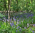
 Bluebells in Burleigh Wood (1) - geograph.org.uk - 7238559.jpg 2,400 × 3,200; 3.25 MB
-
 Bluebells in Burleigh Wood (2) - geograph.org.uk - 7238561.jpg 2,400 × 3,200; 3.25 MB
-
 Bluebells in Burleigh Wood (3) - geograph.org.uk - 7238562.jpg 2,400 × 3,200; 3.4 MB
-
 Bluebells in Burleigh Wood (4) - geograph.org.uk - 7238563.jpg 2,400 × 3,200; 3.37 MB
-
 Bluebells in the Out Woods - geograph.org.uk - 1888789.jpg 2,316 × 2,962; 3.01 MB
-

-
 Boat Inn, Loughborough - geograph.org.uk - 6555532.jpg 4,032 × 3,024; 4.64 MB
-

-
 Bowling Green - Queen's Park - geograph.org.uk - 2938144.jpg 640 × 406; 63 KB
-
 Brick Bridge - geograph.org.uk - 2158772.jpg 800 × 531; 97 KB
-

-
 Bridge on the GCR - geograph.org.uk - 2158760.jpg 800 × 531; 96 KB
-
 Bridge over Hermitage Brook, Little Moor Lane - geograph.org.uk - 5235218.jpg 1,024 × 683; 272 KB
-
 Bridge over the footpath - geograph.org.uk - 2366753.jpg 1,280 × 959; 491 KB
-

-

-

-
 Bridge Street - geograph.org.uk - 4231436.jpg 640 × 480; 141 KB
-
 Bridge Street - geograph.org.uk - 4231438.jpg 640 × 480; 119 KB
-
 Bridge Street - geograph.org.uk - 4231444.jpg 640 × 444; 111 KB
-
 Bridge Street - Swan Street - geograph.org.uk - 2938314.jpg 640 × 480; 62 KB
-
 Bridge taking Allsopp's Lane over railway - geograph.org.uk - 5235316.jpg 1,024 × 683; 194 KB
-
 Bridging the Loughborough Gap - geograph.org.uk - 7126586.jpg 3,000 × 2,000; 5.78 MB
-
 Bridleway into the Outwoods - geograph.org.uk - 2093790.jpg 2,402 × 2,698; 2.75 MB
-
 Bridleway to Loughborough - geograph.org.uk - 2093741.jpg 2,145 × 2,247; 2.14 MB
-
 Bridleway to Loughborough - geograph.org.uk - 2093774.jpg 2,965 × 1,869; 2.33 MB
-
 Bridleway to Loughborough - geograph.org.uk - 2093781.jpg 1,686 × 1,495; 987 KB
-
 Bridleway to Pocket Gate Farm - geograph.org.uk - 2093753.jpg 2,451 × 1,631; 1.69 MB
-
 Bridleway to Pocket Gate Farm - geograph.org.uk - 2093765.jpg 2,625 × 1,859; 1.85 MB
-
 Bromhead Street - Nottingham Road - geograph.org.uk - 2939123.jpg 640 × 480; 62 KB
-
 Brookfield Avenue, Loughborough - geograph.org.uk - 6019205.jpg 1,600 × 1,200; 1.01 MB
-
 Browns Lane - Frederick Street - geograph.org.uk - 2939978.jpg 640 × 480; 65 KB
-
 Browns Lane underpass - geograph.org.uk - 4229510.jpg 640 × 480; 185 KB
-
 Browns Lane underpass - geograph.org.uk - 4229513.jpg 480 × 640; 160 KB
-
 Browns Lane underpass - geograph.org.uk - 4229517.jpg 640 × 481; 141 KB
-
 Browns Lane underpass - geograph.org.uk - 4229521.jpg 640 × 480; 170 KB
-
 Browns Lane underpass - geograph.org.uk - 4229524.jpg 640 × 480; 127 KB
-
 Browns Lane underpass - geograph.org.uk - 4229527.jpg 480 × 640; 162 KB
-
 Browns Lane underpass - geograph.org.uk - 4229529.jpg 640 × 480; 148 KB
-
 Browns Lane underpass - geograph.org.uk - 4229532.jpg 640 × 480; 149 KB
-
 Browns Lane underpass - geograph.org.uk - 4229534.jpg 480 × 640; 132 KB
-
 Browns Lane underpass - geograph.org.uk - 4229540.jpg 640 × 480; 174 KB
-
 Browns Lane underpass - geograph.org.uk - 4229544.jpg 480 × 640; 172 KB
-
 Browns Lane underpass - geograph.org.uk - 4229548.jpg 640 × 480; 173 KB
-
 Brush Social Club - Fennel Street - geograph.org.uk - 2938975.jpg 640 × 480; 59 KB
-
 Brush Sports and Social Club - geograph.org.uk - 4231420.jpg 640 × 398; 106 KB
-
 Brush Works - geograph.org.uk - 7126835.jpg 3,000 × 2,000; 5.92 MB
-
 Brush Works - geograph.org.uk - 7143144.jpg 1,200 × 800; 1.1 MB
-

-

-
 Burder Street - Nottingham Road - geograph.org.uk - 2939645.jpg 640 × 480; 76 KB
-
 Burleigh Community College - geograph.org.uk - 2366520.jpg 1,280 × 959; 291 KB
-
 Burns Road - geograph.org.uk - 2362993.jpg 1,280 × 959; 212 KB
-
 Burton Street - Park Road - geograph.org.uk - 2940082.jpg 640 × 480; 67 KB
-
 Bus in Fennel Street - geograph.org.uk - 4170755.jpg 640 × 480; 59 KB
-
 Bus shelter in Nanpantan - geograph.org.uk - 3195974.jpg 1,024 × 768; 538 KB
-
 Buses passing Church Gate - geograph.org.uk - 4170663.jpg 640 × 480; 62 KB
-
 B^Q on Belton Road, Loughborough - geograph.org.uk - 7203094.jpg 1,920 × 1,280; 1 MB
-
 Caldwell Street - Frederick Street - geograph.org.uk - 2939922.jpg 640 × 480; 63 KB
-
 Caldwell Street - geograph.org.uk - 4230064.jpg 640 × 480; 118 KB
-
 Canal - Bridge Street - geograph.org.uk - 2938316.jpg 480 × 640; 86 KB
-
 Canal Bank - Bridge Street - geograph.org.uk - 2938318.jpg 480 × 640; 55 KB
-
 Canal Bridge No 38 - Nottingham Road - geograph.org.uk - 2939641.jpg 640 × 480; 73 KB
-
 Canalside apartments - geograph.org.uk - 4233036.jpg 640 × 480; 172 KB
-
 Canopy Restoration - geograph.org.uk - 2150922.jpg 800 × 531; 134 KB
-
 Car park and outdoor play area, McDonald's - geograph.org.uk - 6221890.jpg 1,024 × 683; 200 KB
-
 Carington Street - geograph.org.uk - 2362969.jpg 1,280 × 959; 300 KB
-
 Carphone Warehouse on Derby Road, Loughborough - geograph.org.uk - 7203086.jpg 1,920 × 1,280; 650 KB
-

-
 Cayley Rutherford Dining Room, Margaret Keay Way - geograph.org.uk - 4903798.jpg 1,024 × 643; 234 KB
-
 Cedar Road, Loughborough - geograph.org.uk - 7198286.jpg 1,920 × 1,280; 917 KB
-
 Cedar Road, Loughborough - geograph.org.uk - 7198288.jpg 1,920 × 1,280; 656 KB
-
 Cemetery chapel, Shelthorpe - geograph.org.uk - 3037248.jpg 640 × 480; 48 KB
-
 Central ride, Booth Wood - geograph.org.uk - 2366742.jpg 1,280 × 959; 650 KB
-
 Charcoal Kiln - geograph.org.uk - 3993486.jpg 640 × 480; 116 KB
-
 Charles Lowe ^ Sons, Churchgate - geograph.org.uk - 4170651.jpg 640 × 480; 61 KB
-

-
 Charnwood Council Offices.jpg 3,900 × 2,925; 3.57 MB
-
 Charnwood Hall along Woodhouse Lane - geograph.org.uk - 1899230.jpg 2,086 × 1,433; 849 KB
-
 Charnwood Museum - geograph.org.uk - 4228455.jpg 640 × 480; 192 KB
-
 Charnwood Museum - geograph.org.uk - 4228457.jpg 640 × 480; 166 KB
-
 Charnwood Museum - geograph.org.uk - 4229769.jpg 640 × 480; 195 KB
-
 Charnwood Museum - geograph.org.uk - 4229790.jpg 640 × 358; 107 KB
-

-
 Charnwood Museum, Loughborough - geograph.org.uk - 7271120.jpg 640 × 427; 99 KB
-
 Christmas at Loughborough Central - geograph.org.uk - 6141164.jpg 5,472 × 3,648; 7.58 MB
-

-

-

-

-
 Church Hall, Thorpe Acre Road - geograph.org.uk - 4902641.jpg 1,024 × 683; 161 KB
-
 Church of All Saints, Belgrave, Leicester - geograph.org.uk - 7178697.jpg 3,538 × 2,362; 1.13 MB
-
 Church of the Good Shepherd, Park Road - geograph.org.uk - 4705482.jpg 1,024 × 683; 124 KB
-
 Churchgate - geograph.org.uk - 4228068.jpg 640 × 401; 110 KB
-
 Churchgate - geograph.org.uk - 4228070.jpg 640 × 444; 132 KB
-
 Churchgate, Loughborough, Leics - geograph.org.uk - 4242070.jpg 3,928 × 2,663; 2.12 MB
-
 Churchgate, Loughborough, Leics - geograph.org.uk - 4242094.jpg 2,954 × 2,635; 1.66 MB
-
 Clarence Street - Nottingham Road - geograph.org.uk - 2939135.jpg 640 × 480; 66 KB
-

-

-
 Clay Pipe Jitty - Swan Street - geograph.org.uk - 2938246.jpg 480 × 640; 82 KB
-

-
 Clubs in Fennel Street - geograph.org.uk - 4170750.jpg 640 × 480; 55 KB
-

-
 Coe Avenue, Thorpe Acre - geograph.org.uk - 6901883.jpg 1,024 × 768; 179 KB


.jpg)


_-_geograph.org.uk_-_4170611.jpg)


_-_geograph.org.uk_-_6901035.jpg)
_-_geograph.org.uk_-_6901036.jpg)


_-_geograph.org.uk_-_7238559.jpg)
_-_geograph.org.uk_-_7238561.jpg)
_-_geograph.org.uk_-_7238562.jpg)
_-_geograph.org.uk_-_7238563.jpg)


