Category:Cossington, Leicestershire
Jump to navigation
Jump to search
English: Cossington is a village in the Soar Valley in Leicestershire. It lies between Sileby, Rothley, Ratcliffe-on-the-Wreake and Syston.

village and civil parish in Leicestershire, United Kingdom  | |||||
| Upload media | |||||
| Instance of | |||||
|---|---|---|---|---|---|
| Location | Charnwood, Leicestershire, East Midlands, England | ||||
| Population |
| ||||
 | |||||
Subcategories
This category has the following 3 subcategories, out of 3 total.
A
R
Media in category "Cossington, Leicestershire"
The following 200 files are in this category, out of 272 total.
(previous page) (next page)-
 170 507 Cossington 290224.jpg 4,063 × 2,077; 2.36 MB
-
 170511 EMR DMU at Cossington 290224.jpg 3,901 × 1,855; 1.53 MB
-
 222015 EMR Meridian DEMU at Cossington 290224.jpg 3,073 × 2,041; 1.82 MB
-
 66511 passes Cossington 7th September 2016.jpg 4,608 × 3,456; 4.98 MB
-
 68 Main Street, Cossington (geograph 7425514).jpg 1,024 × 768; 179 KB
-
 74 Main Street Cossington - geograph.org.uk - 3657601.jpg 1,280 × 960; 219 KB
-
 74 Main Street, Cossington (geograph 7425507).jpg 1,024 × 768; 183 KB
-
 A46 crossing the railway - geograph.org.uk - 4580080.jpg 2,256 × 1,496; 898 KB
-
 A46 east of Seagrave, aerial 2018 - geograph.org.uk - 5846102.jpg 533 × 800; 90 KB
-
 A46 heading north towards Newark - geograph.org.uk - 3038714.jpg 640 × 480; 43 KB
-
 A46 northbound - geograph.org.uk - 3651308.jpg 640 × 460; 39 KB
-
 A46 northbound - geograph.org.uk - 3651341.jpg 640 × 480; 66 KB
-
 A46 northbound - geograph.org.uk - 3651820.jpg 640 × 446; 44 KB
-
 A46 northbound - geograph.org.uk - 3651825.jpg 640 × 449; 50 KB
-
 A46 northwards - geograph.org.uk - 6771949.jpg 1,600 × 986; 88 KB
-
 A46 southwards - geograph.org.uk - 6771950.jpg 1,600 × 1,005; 102 KB
-
 A46, Park Hill - geograph.org.uk - 2393340.jpg 640 × 480; 44 KB
-
 A46, Park Hill - geograph.org.uk - 2393348.jpg 640 × 430; 47 KB
-
 Afternoon sun at Cossington Lakes - geograph.org.uk - 2832485.jpg 3,264 × 2,448; 3.07 MB
-

-
 Arable crops nr Cossington - geograph.org.uk - 918725.jpg 640 × 427; 97 KB
-
 Bench mark, Cossington Church - geograph.org.uk - 3657553.jpg 1,280 × 960; 427 KB
-
 Blackberry Lane - geograph.org.uk - 5360719.jpg 640 × 450; 99 KB
-
 Blocked field entrance - geograph.org.uk - 3038710.jpg 640 × 480; 83 KB
-
 Brick arch beneath the railway - geograph.org.uk - 4208076.jpg 1,600 × 1,493; 997 KB
-
 Bridge SPC5-44 on Back Lane - geograph.org.uk - 5360720.jpg 640 × 490; 91 KB
-
 Canada Geese along the River Wreake - geograph.org.uk - 3779492.jpg 1,600 × 1,251; 728 KB
-
 Canada Geese at the Cossington Lakes - geograph.org.uk - 6371558.jpg 800 × 770; 69 KB
-
 Canada Geese at the Cossington Lakes - geograph.org.uk - 6371559.jpg 800 × 589; 54 KB
-

-
 Canal bridge north-west of Syston in Leicestershire - geograph.org.uk - 5976626.jpg 1,440 × 960; 1.49 MB
-

-
 Chestnut Farm driveway - geograph.org.uk - 5360721.jpg 640 × 430; 53 KB
-

-

-
 Constructing a new footpath - geograph.org.uk - 2832524.jpg 3,264 × 2,448; 2.97 MB
-

-
 Cossington Coronation Oak, Elizabeth II - geograph.org.uk - 3657577.jpg 960 × 1,280; 315 KB
-

-
 Cossington Coronation Oak, George VI - geograph.org.uk - 3657592.jpg 1,280 × 960; 258 KB
-
 Cossington Hall - geograph.org.uk - 3657586.jpg 1,280 × 960; 299 KB
-
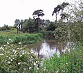
 Cossington Lakes - geograph.org.uk - 2832498.jpg 2,761 × 1,806; 1.74 MB
-
 Cossington Lakes - geograph.org.uk - 6371545.jpg 800 × 600; 117 KB
-
 Cossington Lakes - geograph.org.uk - 6371640.jpg 800 × 521; 94 KB
-
 Cossington Lakes near Rothley - geograph.org.uk - 853284.jpg 640 × 465; 67 KB
-
 Cossington Lane crossing the River Soar - geograph.org.uk - 5143932.jpg 800 × 457; 110 KB
-
 Cossington Meadows - geograph.org.uk - 132171.jpg 640 × 427; 127 KB
-
 Cossington Mill near the River Soar - geograph.org.uk - 4212975.jpg 1,600 × 1,192; 627 KB
-
 Cossington Old Mill - geograph.org.uk - 132183.jpg 640 × 427; 141 KB
-
 Cossington Road towards Cossington - geograph.org.uk - 861620.jpg 640 × 480; 72 KB
-
 Cossington Royal Oak - geograph.org.uk - 2877455.jpg 640 × 480; 159 KB
-
 Cossington war memorial - geograph.org.uk - 3584683.jpg 1,024 × 768; 180 KB
-
 Cossington War Memorial - geograph.org.uk - 3657565.jpg 1,280 × 960; 303 KB
-
 Cossington weir - geograph.org.uk - 647155.jpg 640 × 480; 120 KB
-
 Cossington Weir sluices - geograph.org.uk - 3657526.jpg 1,280 × 960; 421 KB
-
 Cows in the River Wreake - geograph.org.uk - 4102993.jpg 1,600 × 1,382; 511 KB
-
 Cruck House, Cossington - geograph.org.uk - 1045475.jpg 640 × 426; 85 KB
-

-
 Depth gauge along the River Wreake - geograph.org.uk - 3970048.jpg 1,600 × 1,274; 644 KB
-
 Dismantled bridge section - geograph.org.uk - 3779563.jpg 1,600 × 1,191; 476 KB
-
 Dismantled bridge sections - geograph.org.uk - 3779556.jpg 1,024 × 765; 196 KB
-
 Entrance to field east of the A46 - geograph.org.uk - 6771947.jpg 1,600 × 1,200; 219 KB
-
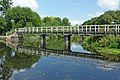
 Farm bridge over the River Wreake - geograph.org.uk - 4471641.jpg 1,743 × 1,193; 320 KB
-
 Farm track, Cossington Grange - geograph.org.uk - 3040306.jpg 640 × 480; 124 KB
-

-
 Farmland next to the A46 - geograph.org.uk - 4199206.jpg 1,600 × 1,271; 558 KB
-
 Farmland off Ratcliffe Road - geograph.org.uk - 3039474.jpg 640 × 480; 60 KB
-
 Farmland, Cossington - geograph.org.uk - 2965087.jpg 800 × 531; 83 KB
-
 Farmland, Cossington - geograph.org.uk - 4772212.jpg 640 × 353; 32 KB
-
 Field entrance off Syston Road - geograph.org.uk - 3040317.jpg 640 × 480; 113 KB
-
 Field of roses near Cossington - geograph.org.uk - 5447218.jpg 800 × 600; 176 KB
-
 Field of roses near Cossington - geograph.org.uk - 5447225.jpg 800 × 576; 236 KB
-
 Field to east of the A46 - geograph.org.uk - 6771948.jpg 1,600 × 1,233; 147 KB
-
 Fields near to All Saints Cossington - geograph.org.uk - 2970685.jpg 640 × 421; 60 KB
-
 Fishing lake near Cossington Grange - geograph.org.uk - 4199283.jpg 1,600 × 1,200; 503 KB
-
 Fishing lake near the River Wreake - geograph.org.uk - 3963053.jpg 1,600 × 1,321; 635 KB
-
 Flooded quarry working - geograph.org.uk - 3040327.jpg 640 × 480; 122 KB
-

-
 Footpath alongside the A46 - geograph.org.uk - 3970105.jpg 1,600 × 1,153; 481 KB
-
 Footpath and cycleway near Cossington - geograph.org.uk - 3657539.jpg 1,280 × 960; 404 KB
-
 Footpath and gate along the River Wreake - geograph.org.uk - 3786099.jpg 1,600 × 1,230; 593 KB
-
 Footpath and gate along the River Wreake - geograph.org.uk - 3970694.jpg 1,600 × 1,200; 872 KB
-
 Footpath and stile along the River Wreake - geograph.org.uk - 3779534.jpg 1,600 × 1,268; 644 KB
-
 Footpath from Ratcliffe College to Park Hill Lane - geograph.org.uk - 5422525.jpg 4,000 × 3,000; 2.9 MB
-
 Footpath marker and farmland next to the A46 - geograph.org.uk - 3970087.jpg 1,600 × 1,198; 689 KB
-

-
 Footpath to Cossington - geograph.org.uk - 6012461.jpg 640 × 493; 117 KB
-
 Footpath to Sileby - geograph.org.uk - 5421631.jpg 4,000 × 3,000; 1.71 MB
-
 Force field - geograph.org.uk - 1242261.jpg 640 × 480; 83 KB
-
 Former gravel pit near Cossington - geograph.org.uk - 3657528.jpg 1,280 × 960; 254 KB
-
 Gate and path along the River Wreake - geograph.org.uk - 3963009.jpg 1,600 × 1,200; 673 KB
-
 Gates to The Old Rectory, Cossington (geograph 7425532).jpg 1,024 × 768; 263 KB
-
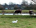 Goose and Longhorn cattle - geograph.org.uk - 3786150.jpg 1,600 × 1,256; 623 KB
-
 Grand Union Canal south of Cossington - geograph.org.uk - 853280.jpg 640 × 558; 135 KB
-

-

-

-

-
 Gravel pit near Cossington - geograph.org.uk - 3657542.jpg 1,280 × 960; 270 KB
-
 Heading north along the A46 - geograph.org.uk - 3913315.jpg 1,600 × 1,128; 351 KB
-
 Heron next to the River Wreake - geograph.org.uk - 4212964.jpg 1,600 × 1,307; 395 KB
-
 Horse in a field next to the River Wreake - geograph.org.uk - 3970631.jpg 1,600 × 1,516; 943 KB
-
 Horses near Cossington - geograph.org.uk - 2832556.jpg 1,746 × 1,305; 1.05 MB
-

-
 Isolated stretch of the River Wreake - geograph.org.uk - 3970676.jpg 1,600 × 1,350; 498 KB
-
 Junction Lock - Detail of Top Gates - geograph.org.uk - 2351081.jpg 640 × 424; 70 KB
-
 Junction Lock - geograph.org.uk - 4471647.jpg 1,748 × 1,181; 273 KB
-
 Junction Lock from below - geograph.org.uk - 2351080.jpg 640 × 424; 56 KB
-
 Junction Lock on the Grand Union Canal - geograph.org.uk - 4199266.jpg 1,600 × 1,202; 325 KB
-
 Junction Lock River Soar Navigation - geograph.org.uk - 3168781.jpg 2,081 × 1,420; 1.05 MB
-
 Junction Lock south of Cossington in Leicestershire - geograph.org.uk - 5977264.jpg 1,440 × 960; 1.88 MB
-
 Junction Lock south of Cossington in Leicestershire - geograph.org.uk - 5977275.jpg 1,280 × 960; 1.54 MB
-
 K6 telephone kiosk and postbox, Cossington - geograph.org.uk - 3657589.jpg 960 × 1,280; 345 KB
-
 K6 Telephone Kiosk, Cossington (geograph 7425518).jpg 1,024 × 768; 228 KB
-
 Lake near Cossington Mill - geograph.org.uk - 4212942.jpg 1,600 × 1,200; 543 KB
-
 Lime Tree Cottage, Cossington (geograph 7425511).jpg 1,024 × 768; 264 KB
-
 Longhorn cattle along the River Wreake - geograph.org.uk - 3963003.jpg 1,600 × 1,234; 866 KB
-
 Longhorn cattle next to the River Wreake - geograph.org.uk - 5549094.jpg 800 × 503; 123 KB
-
 Looking east along the A607 - geograph.org.uk - 3034261.jpg 3,264 × 2,448; 3.01 MB
-
 Looking up the River Soar - geograph.org.uk - 3657522.jpg 1,280 × 960; 328 KB
-

-
 Main Street, Cossington - geograph.org.uk - 2360924.jpg 1,280 × 856; 221 KB
-
 Main Street, Cossington - geograph.org.uk - 3040297.jpg 640 × 480; 74 KB
-
 Marshdale Farm near Cossington - geograph.org.uk - 5447202.jpg 800 × 600; 215 KB
-
 Midland Main Line crosses the River Wreake - geograph.org.uk - 4631717.jpg 1,165 × 791; 157 KB
-
 Midland Main Line railway - geograph.org.uk - 5251839.jpg 2,000 × 1,500; 283 KB
-
 Midland Main Line railway - geograph.org.uk - 5251840.jpg 2,000 × 1,500; 316 KB
-
 Millstream Cottage, Cossington (geograph 7421903).jpg 1,024 × 768; 165 KB
-
 Millstream Cottage, Cossington - geograph.org.uk - 3657563.jpg 1,280 × 960; 257 KB
-
 Minor road approaching the A46 - geograph.org.uk - 3038712.jpg 640 × 480; 48 KB
-

-
 Moored narrowboats at the Boat House - geograph.org.uk - 6371523.jpg 800 × 678; 140 KB
-
 Moorings along the Grand Union Canal - geograph.org.uk - 3786262.jpg 1,600 × 1,007; 540 KB
-

-
 New exit road from Ratcliffe College - geograph.org.uk - 3578484.jpg 640 × 462; 42 KB
-
 New footpath at Cossington Lakes - geograph.org.uk - 2832405.jpg 3,264 × 2,448; 3.62 MB
-
 New footpath at Cossington Lakes - geograph.org.uk - 2832414.jpg 3,264 × 2,448; 3.96 MB
-
 New footpath at Cossington Lakes - geograph.org.uk - 2832470.jpg 3,264 × 2,448; 3.28 MB
-
 New footpath at Cossington Lakes - geograph.org.uk - 2832496.jpg 3,264 × 2,448; 3.85 MB
-
 New footpath at Cossington Lakes - geograph.org.uk - 2832506.jpg 2,420 × 2,692; 2.59 MB
-
 New footpath at Cossington Lakes - geograph.org.uk - 3034269.jpg 2,470 × 1,828; 1.92 MB
-
 New gate on Rosminian Way - geograph.org.uk - 3578488.jpg 640 × 513; 45 KB
-
 New gate on Rosminian Way - geograph.org.uk - 3578489.jpg 640 × 481; 46 KB
-
 New wind turbine at the Wanlip sewage treatment works - geograph.org.uk - 3779524.jpg 1,600 × 1,147; 282 KB
-
 Off Bennet's Lane, Cossington - geograph.org.uk - 6566835.jpg 768 × 1,024; 166 KB
-
 Park Hill Road at the A46 - geograph.org.uk - 6601817.jpg 1,600 × 1,098; 475 KB
-
 Passing trains nr Cossington - geograph.org.uk - 918741.jpg 640 × 468; 101 KB
-

-

-

-

-

-
 Path along the River Wreake - geograph.org.uk - 3963060.jpg 1,600 × 1,248; 513 KB
-
 Path at Cossington Lakes - geograph.org.uk - 4199280.jpg 1,600 × 1,200; 542 KB
-
 Path at the Cossington Lakes - geograph.org.uk - 6371612.jpg 800 × 615; 220 KB
-
 Path through woodland along the River Wreake - geograph.org.uk - 3970673.jpg 1,600 × 1,200; 870 KB
-
 Platt Lane in Cossington - geograph.org.uk - 2832662.jpg 2,168 × 1,625; 1.51 MB
-
 Platts Lane in Cossington - geograph.org.uk - 4576215.jpg 1,024 × 771; 355 KB
-
 Public footpath along the River Wreake - geograph.org.uk - 3970496.jpg 1,600 × 1,200; 738 KB
-
 Public footpath near Marshdale Farm - geograph.org.uk - 5447197.jpg 800 × 600; 175 KB
-
 Quarry track - geograph.org.uk - 3040325.jpg 640 × 480; 110 KB
-
 Railway bridge across the River Wreake - geograph.org.uk - 3970545.jpg 1,600 × 1,095; 701 KB
-
 Railway bridge crossing the River Wreake - geograph.org.uk - 3970583.jpg 1,600 × 1,200; 799 KB
-
 Railway bridge crossing the River Wreake - geograph.org.uk - 3970664.jpg 1,600 × 1,106; 478 KB
-
 Railway line north of Syston - geograph.org.uk - 3970654.jpg 1,600 × 1,174; 568 KB
-
 Railway line towards Sileby - geograph.org.uk - 3034266.jpg 2,293 × 1,994; 2.29 MB
-
 Railway towards Loughborough - geograph.org.uk - 3040333.jpg 640 × 480; 95 KB
-
 Ratcliffe Road towards Sileby - geograph.org.uk - 3039477.jpg 640 × 480; 59 KB
-
 River Soar - geograph.org.uk - 647164.jpg 640 × 480; 111 KB
-
 River Soar at Cossington Meadows - geograph.org.uk - 132172.jpg 640 × 427; 117 KB
-
 River Soar Cossington Mill Weir - geograph.org.uk - 2351092.jpg 640 × 424; 88 KB
-
 River Soar near Mountsorrel in Leicestershire - geograph.org.uk - 5980871.jpg 1,280 × 960; 1.55 MB
-
 River Soar near Mountsorrel in Leicestershire - geograph.org.uk - 5981113.jpg 1,440 × 1,080; 1.83 MB
-
 River Soar near Mountsorrel in Leicestershire - geograph.org.uk - 5981116.jpg 1,440 × 960; 1.53 MB
-
 River Soar near Mountsorrel in Leicestershire - geograph.org.uk - 5981329.jpg 960 × 1,280; 1.51 MB
-
 River Soar near Mountsorrel in Leicestershire - geograph.org.uk - 5981332.jpg 960 × 1,280; 1.65 MB
-
 River Soar north-east of Rothley in Leicestershire (geograph 5978086).jpg 1,440 × 960; 1.36 MB
-
 River Soar north-east of Rothley in Leicestershire - geograph.org.uk - 5978831.jpg 1,440 × 960; 1.52 MB
-
 River Soar north-east of Rothley in Leicestershire - geograph.org.uk - 5978898.jpg 1,600 × 900; 1.62 MB
-
 River Wreake and path under the railway bridge - geograph.org.uk - 3970642.jpg 1,600 × 1,200; 573 KB
-
 River Wreake and wind turbine - geograph.org.uk - 3786168.jpg 1,600 × 1,254; 313 KB
-
 River Wreake east of Rothley in Leicestershire - geograph.org.uk - 5977670.jpg 1,440 × 960; 1.47 MB
-
 River Wreake near Syston Mills - geograph.org.uk - 3970007.jpg 1,600 × 1,272; 895 KB
-
 River Wreake viewed from The Three Way Bridge - geograph.org.uk - 3786319.jpg 1,600 × 1,265; 775 KB
-
 Riverside pasture east of Rothley in Leicestershire - geograph.org.uk - 5977676.jpg 1,440 × 1,080; 1.74 MB
-

-

-
 Rocky river bank along the Wreake - geograph.org.uk - 3970574.jpg 1,600 × 1,200; 739 KB
-
 Rosminian Way - geograph.org.uk - 3578480.jpg 640 × 463; 34 KB
-
 Rosminian Way passes The Elms Farm - geograph.org.uk - 3578487.jpg 640 × 467; 37 KB
-
 Rosminian Way passes The Elms Farm - geograph.org.uk - 3578491.jpg 640 × 488; 35 KB
-

-
 Route 1 notice board - geograph.org.uk - 3657536.jpg 1,280 × 950; 319 KB
-
 Sign along the River Wreake - geograph.org.uk - 3786109.jpg 1,600 × 1,312; 521 KB
-

-

-

-

-

-


.jpg)

.jpg)


.jpg)


.jpg)

.jpg)


.jpg)


.jpg)


