Category:Hathern
Jump to navigation
Jump to search
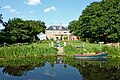
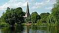
English: Hathern is a large village and civil parish in the Charnwood district of Leicestershire, England. It is in the north of the district, and is just north of Loughborough, and is on the A6. The parish has a population of about 1,800. Nearby places are Dishley, Long Whatton, and Zouch, over the border in Nottinghamshire. The village has, recent years, campaigned to prevent the green "wedge" separating Loughborough, Shepshed and Hathern from being built on.
village and civil parish in Leicestershire, UK | |||||
| Upload media | |||||
| Instance of | |||||
|---|---|---|---|---|---|
| Location | Charnwood, Leicestershire, East Midlands, England | ||||
| Population |
| ||||
| Said to be the same as | Hathern (Wikimedia duplicated page, civil parish) | ||||
 | |||||
Subcategories
This category has the following 5 subcategories, out of 5 total.
H
- Hathern railway station (1 F)
- Hathern Terra Cotta (3 F)
P
- Hathern Primary School (4 F)
S
V
- The Village Cross, Hathern (5 F)
Media in category "Hathern"
The following 192 files are in this category, out of 192 total.
-
 'Albert' on the River Soar at Zouch - geograph.org.uk - 6497414.jpg 640 × 360; 63 KB
-
 'College Garth', Hathern Turn - geograph.org.uk - 5189776.jpg 1,024 × 683; 272 KB
-
 'Sign Shop' premises at Dishley Grange - geograph.org.uk - 4902045.jpg 1,024 × 683; 286 KB
-
 41 Wide Lane, Hathern - geograph.org.uk - 4956540.jpg 1,280 × 888; 342 KB
-
 48 Wide Lane, Hathern - geograph.org.uk - 4956538.jpg 1,280 × 806; 271 KB
-
 53, Wide Lane, Hathern - geograph.org.uk - 4956535.jpg 1,280 × 853; 474 KB
-
 58 ^ 60 Narrow Lane, Hathern - geograph.org.uk - 4956510.jpg 1,280 × 853; 503 KB
-
 64 Main Street, Normanton on Soar - geograph.org.uk - 6550615.jpg 3,648 × 2,432; 4.68 MB
-
 A small riverside house, outside Zouch - geograph.org.uk - 6619857.jpg 1,600 × 1,067; 510 KB
-
 A solitary fisherman - geograph.org.uk - 6550280.jpg 2,417 × 1,611; 1.11 MB
-
 A weir at Zouch - geograph.org.uk - 6619855.jpg 1,600 × 1,067; 576 KB
-
 A6 looking south near South Lodge - geograph.org.uk - 3604111.jpg 640 × 480; 63 KB
-
 Agricultural Showground - geograph.org.uk - 5301.jpg 640 × 270; 31 KB
-
 Allotments at Hathern - geograph.org.uk - 17692.jpg 640 × 538; 208 KB
-
 Benchmark on 'College Garth' - geograph.org.uk - 5189774.jpg 683 × 1,024; 248 KB
-
 Benchmark on Dishley Cottages - geograph.org.uk - 4901655.jpg 666 × 1,024; 198 KB
-
 Benchmark on Dishley Grange outbuilding - geograph.org.uk - 4902016.jpg 683 × 1,024; 324 KB
-
 Benchmark on Loughborough Road wall pier - geograph.org.uk - 4901512.jpg 683 × 1,024; 263 KB
-
 Benchmark on St Peter and St Paul's Church - geograph.org.uk - 5190095.jpg 969 × 1,024; 261 KB
-
 Bridge 42A on the Soar Navigation - geograph.org.uk - 4964652.jpg 1,280 × 960; 653 KB
-
 Bridge 42A, west bank of the navigable River Soar - geograph.org.uk - 6181856.jpg 1,439 × 1,079; 517 KB
-
 Bungalow at One Ash - geograph.org.uk - 6550626.jpg 3,648 × 2,432; 4.77 MB
-
 Canal boats at Zouch - geograph.org.uk - 2004378.jpg 640 × 480; 93 KB
-
 Canoeists at Soar Boating Club - geograph.org.uk - 6180405.jpg 1,215 × 912; 232 KB
-
 Chain Ferry - geograph.org.uk - 3303826.jpg 1,200 × 1,600; 740 KB
-
 Charnwood Country Club - geograph.org.uk - 5302.jpg 640 × 319; 42 KB
-
 Church Cottage, Church Street, Hathern - geograph.org.uk - 4956519.jpg 853 × 1,280; 258 KB
-
-

-
 Church of St Peter and St Paul, Hathern - geograph.org.uk - 4956521.jpg 956 × 1,280; 361 KB
-
 Church of St Peter and St Paul, Hathern - geograph.org.uk - 4956524.jpg 1,280 × 872; 262 KB
-
 Church of St Peter and St Paul, Hathern - geograph.org.uk - 4956525.jpg 1,010 × 1,280; 267 KB
-
 Church of St Peter and St Paul, Hathern - geograph.org.uk - 4956529.jpg 853 × 1,280; 183 KB
-
 Church of St Peter and St Paul, Hathern - geograph.org.uk - 4956531.jpg 853 × 1,280; 459 KB
-
 Church of St Peter and St Paul, Hathern - geograph.org.uk - 4956534.jpg 1,280 × 853; 515 KB
-
 Church of St Peter and St Paul, Hathern - geograph.org.uk - 4956536.jpg 999 × 1,280; 392 KB
-
 Concrete footway by Shepshed Road - geograph.org.uk - 4808162.jpg 1,280 × 960; 591 KB
-
 Danger^ Chain ferry at Normanton on Soar - geograph.org.uk - 6180401.jpg 1,734 × 1,300; 374 KB
-
 Dishley Cottages, Derby Road - geograph.org.uk - 4901691.jpg 1,024 × 704; 223 KB
-

-
 Emergency flood mooring dolphin, northern end - geograph.org.uk - 6181841.jpg 1,600 × 1,200; 208 KB
-
 Emergency flood mooring dolphin, northern end - geograph.org.uk - 6181844.jpg 1,821 × 1,366; 457 KB
-
 Emergency Moorings - geograph.org.uk - 2354792.jpg 640 × 489; 48 KB
-

-
 Entrance to College Garth Kennels, Hathern - geograph.org.uk - 6221888.jpg 1,024 × 683; 260 KB
-
 Entrance to Shepshed Road Allotments - geograph.org.uk - 6622414.jpg 640 × 478; 84 KB
-
 Exit to Shepshed Road Allotments - geograph.org.uk - 6622647.jpg 640 × 501; 94 KB
-

-
 Finishing the Soar Head - geograph.org.uk - 5603505.jpg 1,280 × 960; 589 KB
-
 Flow from the weir - geograph.org.uk - 6550301.jpg 3,648 × 2,432; 5.56 MB
-

-

-
 Footpath to Hathern - geograph.org.uk - 4801281.jpg 1,280 × 960; 380 KB
-
 Footpath to Hathern - geograph.org.uk - 4808152.jpg 1,280 × 960; 531 KB
-
 Gateway to a muck heap - geograph.org.uk - 6622409.jpg 640 × 461; 81 KB
-
 Hathern Anchor Inn - geograph.org.uk - 2978707.jpg 640 × 480; 145 KB
-
 Hathern Baptist Church - geograph.org.uk - 2633591.jpg 1,496 × 1,122; 668 KB
-

-
 Hathern church - geograph.org.uk - 4792881.jpg 800 × 600; 107 KB
-
 Hathern Dew Drop - geograph.org.uk - 2881807.jpg 640 × 480; 113 KB
-
 Hathern Kings Arms - geograph.org.uk - 2881810.jpg 640 × 480; 137 KB
-
 Hathern Library - geograph.org.uk - 4956544.jpg 1,280 × 853; 489 KB
-
 Hathern Parish Church - geograph.org.uk - 5190159.jpg 1,024 × 680; 172 KB
-
 Hathern Parish Church from Church Street - geograph.org.uk - 5190201.jpg 683 × 1,024; 163 KB
-

-
 Hathern Road towards Long Whatton - geograph.org.uk - 6595930.jpg 1,600 × 1,128; 581 KB
-
 House on the River Soar - geograph.org.uk - 6550306.jpg 3,648 × 2,432; 3.49 MB
-

-
 Junction of walls beside the Anchor Inn carpark - geograph.org.uk - 4901544.jpg 1,024 × 683; 222 KB
-
-

-
-

-

-
 Leicestershire farmland, west of Zouch - geograph.org.uk - 6180411.jpg 1,600 × 1,200; 320 KB
-
 Long Whatton Brook - geograph.org.uk - 4789018.jpg 1,280 × 960; 702 KB
-

-
 Loughborough Road allotments - geograph.org.uk - 4801289.jpg 1,280 × 960; 367 KB
-
 Loughborough Road, Hathern - geograph.org.uk - 3280139.jpg 1,280 × 854; 233 KB
-
 Loughborough Road, Hathern - geograph.org.uk - 3280140.jpg 1,280 × 854; 221 KB
-

-
 Marina on the river Soar at Zouch - geograph.org.uk - 2004380.jpg 640 × 480; 108 KB
-
 Mound by quarry - geograph.org.uk - 323832.jpg 640 × 480; 80 KB
-
 Navigation warning - geograph.org.uk - 6550308.jpg 3,648 × 2,432; 3.89 MB
-
 Nellie's View - geograph.org.uk - 960147.jpg 640 × 480; 82 KB
-
 Normanton on Soar Chain Ferry - geograph.org.uk - 6550621.jpg 3,648 × 2,432; 5.83 MB
-
 Normanton-on-Soar from the South-West - geograph.org.uk - 6619862.jpg 1,600 × 1,067; 532 KB
-
 Oakley Grange Farm Shop - geograph.org.uk - 5852428.jpg 640 × 480; 312 KB
-
 Old road - geograph.org.uk - 4789034.jpg 1,280 × 960; 435 KB
-

-
 Play area at Oakley Grange Farm Shop - geograph.org.uk - 5852429.jpg 640 × 480; 330 KB
-
 Play area at Oakley Grange Farm Shop - geograph.org.uk - 5852431.jpg 640 × 480; 378 KB
-
 Rectory and Church, Normanton on Soar - geograph.org.uk - 6550619.jpg 3,648 × 2,432; 4 MB
-
 Residential street in Hathern. - geograph.org.uk - 6309227.jpg 1,600 × 900; 582 KB
-

-
-
 River Soar - geograph.org.uk - 3302517.jpg 800 × 600; 105 KB
-
 River Soar - geograph.org.uk - 6550609.jpg 3,648 × 2,432; 4.06 MB
-
 River Soar - geograph.org.uk - 6550632.jpg 3,648 × 2,432; 3.95 MB
-
 River Soar - geograph.org.uk - 6550634.jpg 3,648 × 2,432; 5.6 MB
-

-
-
 River Soar approaching Normanton in Nottinghamshire - geograph.org.uk - 5993532.jpg 1,440 × 960; 1.04 MB
-
 River Soar approaching Normanton in Nottinghamshire - geograph.org.uk - 5993769.jpg 960 × 1,280; 1.31 MB
-
 River Soar at Normanton in Nottinghamshire - geograph.org.uk - 5993506.jpg 1,600 × 900; 1.59 MB
-
 River Soar at Normanton in Nottinghamshire - geograph.org.uk - 5993517.jpg 1,440 × 960; 1.26 MB
-
 River Soar at Zouch - geograph.org.uk - 920625.jpg 640 × 482; 102 KB
-
 River Soar west of Zouch in Nottinghamshire - geograph.org.uk - 5995523.jpg 1,600 × 900; 1.84 MB
-
 River Soar west of Zouch in Nottinghamshire - geograph.org.uk - 5995524.jpg 1,440 × 990; 1.65 MB
-
 River Soar, Normanton on Soar - geograph.org.uk - 3787416.jpg 1,280 × 851; 360 KB
-
 River south of Normanton on Soar, Nottinghamshire - geograph.org.uk - 5992766.jpg 1,280 × 960; 1.26 MB
-
 River, woodland and pylon near Normanton on Soar - geograph.org.uk - 5992634.jpg 960 × 1,280; 1.41 MB
-
 Riverside house - geograph.org.uk - 6550303.jpg 3,648 × 2,432; 3.63 MB
-

-
 Rivet bench mark, Zouch Bridge - geograph.org.uk - 5848398.jpg 1,280 × 1,280; 687 KB
-

-
 Shepshed Road Allotments east side - geograph.org.uk - 6622417.jpg 640 × 430; 63 KB
-
 Shepshed Road Allotments plot 2 - geograph.org.uk - 6622418.jpg 640 × 513; 81 KB
-
 Shepshed Road Allotments sign - geograph.org.uk - 6622419.jpg 640 × 458; 61 KB
-
 Shepshed Road Allotments sign - geograph.org.uk - 6622649.jpg 640 × 487; 84 KB
-
 Shepshed Road Allotments west side - geograph.org.uk - 6622420.jpg 640 × 432; 61 KB
-
 Shepshed Road away from Hathern - geograph.org.uk - 6622421.jpg 640 × 457; 53 KB
-
 Shepshed Road into Hathern - geograph.org.uk - 6622422.jpg 640 × 409; 62 KB
-
 Shepshed Road towards Hathern - geograph.org.uk - 6622410.jpg 640 × 472; 60 KB
-

-
 Soar Boating Club - geograph.org.uk - 6550311.jpg 3,648 × 2,432; 3.89 MB
-
 Soar Boating Club, Normanton-on-Soar - geograph.org.uk - 6619859.jpg 1,600 × 1,067; 521 KB
-
 The Anchor Inn - geograph.org.uk - 4793819.jpg 800 × 600; 69 KB
-
 The Black Brook reaches the Soar - geograph.org.uk - 4964678.jpg 1,280 × 960; 593 KB
-
 The Manor, Main Street, Normanton on Soar - geograph.org.uk - 6550614.jpg 3,648 × 2,432; 5.48 MB
-
 The navigable River Soar at Zouch - geograph.org.uk - 6181698.jpg 1,703 × 1,277; 720 KB
-
 The Rectory, Normanton on Soar - geograph.org.uk - 6550618.jpg 3,648 × 2,432; 5.44 MB
-
 The River Soar - geograph.org.uk - 6550629.jpg 3,648 × 2,432; 4.96 MB
-
-

-
 The River Soar at Normanton, Nottinghamshire - geograph.org.uk - 3635296.jpg 1,440 × 947; 1.63 MB
-
 The River Soar at Zouch - geograph.org.uk - 3456769.jpg 2,048 × 1,536; 578 KB
-
 The River Soar at Zouch - geograph.org.uk - 6497411.jpg 640 × 480; 65 KB
-
 The River Soar at Zouch - geograph.org.uk - 919641.jpg 480 × 640; 75 KB
-
 The River Soar seen from Zouch Road Bridge - geograph.org.uk - 3053708.jpg 4,320 × 3,240; 4.41 MB
-

-
 The road out of Long Whatton - geograph.org.uk - 5848391.jpg 1,280 × 960; 411 KB
-
 The southern of the two weirs at Zouch - geograph.org.uk - 6181697.jpg 1,703 × 1,277; 1.04 MB
-
 The unnavigable River Soar at Zouch - geograph.org.uk - 6181700.jpg 1,600 × 1,200; 392 KB
-
 Two ways on the River Soar, below Zouch Lock - geograph.org.uk - 6180410.jpg 1,925 × 1,444; 553 KB
-
 UK Hathern.jpg 874 × 1,541; 224 KB
-
 Village sign, Hathern - geograph.org.uk - 960164.jpg 480 × 640; 67 KB
-
 Village Sign, Shepshed Road, Hathern - geograph.org.uk - 17691.jpg 640 × 353; 99 KB
-
 Water gate on the River Soar - geograph.org.uk - 6550302.jpg 3,648 × 2,432; 3.3 MB
-
 Weir on the River Soar at Zouch - geograph.org.uk - 6497426.jpg 640 × 480; 100 KB
-
 Whatton Road towards Long Whatton - geograph.org.uk - 6595924.jpg 1,600 × 1,032; 471 KB
-
 Wide Lane, Hathern - geograph.org.uk - 4956543.jpg 1,280 × 853; 308 KB
-
 Wide Street, Hathern - geograph.org.uk - 960179.jpg 640 × 480; 71 KB
-
 Woodland on the west bank of the River Soar - geograph.org.uk - 5995632.jpg 1,280 × 960; 1.71 MB
-
 Anchor and Rocks - geograph.org.uk - 559967.jpg 640 × 524; 144 KB
-

-
 Blues at Burleigh - geograph.org.uk - 195454.jpg 640 × 250; 45 KB
-
 Dew Drop Inn, Hathern - geograph.org.uk - 17695.jpg 640 × 593; 168 KB
-
 Farmland near Nanpantan - geograph.org.uk - 378328.jpg 640 × 427; 81 KB
-
 Footpath at Loncliffe Golf Club - geograph.org.uk - 378259.jpg 640 × 427; 157 KB
-
 Footpath near Loncliffe Golf Club - geograph.org.uk - 378353.jpg 640 × 427; 170 KB
-
 Golfers at Loncliffe Golf Club - geograph.org.uk - 378292.jpg 640 × 427; 160 KB
-
 Gorse Covert Shopping Centre, Loughborough - geograph.org.uk - 17698.jpg 640 × 410; 130 KB
-
 Hailey Avenue, Loughborough - geograph.org.uk - 17700.jpg 640 × 395; 98 KB
-

-
 Houses on Mortimer Way, Loughborough - geograph.org.uk - 17704.jpg 640 × 369; 98 KB
-
 Houses on Wide Lane, Hathern - geograph.org.uk - 17684.jpg 640 × 476; 144 KB
-
 Loncliffe Golf Club, Nanpantan - geograph.org.uk - 378243.jpg 640 × 427; 75 KB
-
 Loncliffe Golf Club, Nanpantan - geograph.org.uk - 378277.jpg 640 × 427; 108 KB
-
 Loughborough University - geograph.org.uk - 378393.jpg 640 × 427; 91 KB
-
 Narrow boats at Zouch Bridge - geograph.org.uk - 559969.jpg 640 × 514; 124 KB
-
 On-site house - geograph.org.uk - 195453.jpg 640 × 559; 113 KB
-
 Zouch Bridge - geograph.org.uk - 5813707.jpg 1,280 × 960; 354 KB
-
 Zouch Bridge - geograph.org.uk - 5848401.jpg 1,280 × 985; 483 KB
-
 Zouch Marina - geograph.org.uk - 5813709.jpg 1,280 × 960; 334 KB
-
 Zouch Radial Flood Gate - geograph.org.uk - 5814113.jpg 1,280 × 960; 586 KB
-
 Zouch Radial Flood Gate - geograph.org.uk - 5814146.jpg 1,280 × 960; 373 KB
-
 Zouch Radial Flood Gate - geograph.org.uk - 5814161.jpg 1,280 × 960; 479 KB
-
 Zouch Radial Flood Gate - geograph.org.uk - 5814164.jpg 1,280 × 960; 369 KB
-
 Zouch Radial Flood Gate - geograph.org.uk - 5814172.jpg 1,280 × 960; 455 KB
-
 Zouch Radial Flood Gate - geograph.org.uk - 5814174.jpg 960 × 1,280; 390 KB
-

-
 Zouch weir - geograph.org.uk - 5814100.jpg 1,280 × 960; 483 KB
-
 Zouch weir - geograph.org.uk - 5814110.jpg 1,280 × 960; 419 KB
-
 Public footpath to Loncliffe Golf Club - geograph.org.uk - 378320.jpg 640 × 427; 147 KB
-
 River Soar at Normanton on Soar - geograph.org.uk - 552273.jpg 640 × 501; 165 KB
-
 Shepshed Road, Hathern - geograph.org.uk - 17688.jpg 640 × 435; 112 KB
-
 Stonebow Primary School, Loughborough - geograph.org.uk - 17707.jpg 640 × 370; 105 KB
-
 The A6 Derby Road, Hathern - geograph.org.uk - 559966.jpg 640 × 444; 99 KB
-
 Thorpe Hill - geograph.org.uk - 195451.jpg 640 × 516; 72 KB
-
 Timber Framed House at Hathern - geograph.org.uk - 17685.jpg 640 × 537; 179 KB
-
 ^47 Shepshed Road - geograph.org.uk - 5233848.jpg 1,024 × 693; 178 KB


