Category:South Croxton
Jump to navigation
Jump to search
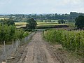
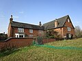
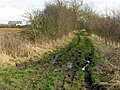
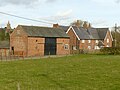
English: South Croxton is a village and civil parish in the Charnwood district of Leicestershire, England. It is on the Queniborough Brook. It has a population of around 250. Nearby places are Beeby, Barsby and Twyford.
village and civil parish in Leicestershire, UK  | |||||
| Upload media | |||||
| Instance of | |||||
|---|---|---|---|---|---|
| Location | Charnwood, Leicestershire, East Midlands, England | ||||
| Population |
| ||||
 | |||||
Subcategories
This category has only the following subcategory.
S
Media in category "South Croxton"
The following 160 files are in this category, out of 160 total.
-
 Another boggy gateway - geograph.org.uk - 6710536.jpg 2,656 × 1,768; 1.38 MB
-
 Baggrave Road - geograph.org.uk - 2991497.jpg 2,335 × 1,780; 1.85 MB
-
 Baggrave Road towards Baggrave Hall - geograph.org.uk - 5412661.jpg 640 × 462; 79 KB
-
 Baggrave Road towards Baggrave Hall - geograph.org.uk - 5412666.jpg 640 × 473; 119 KB
-
 Baggrave Road towards Twyford Road - geograph.org.uk - 5412663.jpg 640 × 471; 124 KB
-
 Baggrave Road-Twyford Road junction - geograph.org.uk - 5412667.jpg 640 × 476; 110 KB
-
 Barley - geograph.org.uk - 5119681.jpg 640 × 480; 185 KB
-
 Barn ruins south of South Croxton Road - geograph.org.uk - 6210180.jpg 3,776 × 2,520; 3.44 MB
-

-
 Blue reflections - geograph.org.uk - 5730568.jpg 1,280 × 774; 320 KB
-
 Boundary treatment - geograph.org.uk - 5720184.jpg 1,280 × 960; 482 KB
-
 Bridleway off Ridgemere Lane - geograph.org.uk - 5730579.jpg 1,280 × 960; 389 KB
-

-
 Bridleway towards Waterloo Lodge Farm - geograph.org.uk - 5720075.jpg 1,280 × 960; 350 KB
-
 Carved head - geograph.org.uk - 1139923.jpg 480 × 640; 225 KB
-
 Church rebuilding memorial - geograph.org.uk - 5675582.jpg 2,616 × 3,488; 1.41 MB
-
 Cross-paths waymarks - geograph.org.uk - 5720081.jpg 960 × 1,280; 533 KB
-
 Crossroads on Twyford Road - geograph.org.uk - 2990534.jpg 2,392 × 1,605; 1.76 MB
-
 Crossroads south of Barsby - geograph.org.uk - 5166097.jpg 3,776 × 2,520; 4 MB
-
 Croxton Road - geograph.org.uk - 3350056.jpg 640 × 484; 49 KB
-
 Croxton Road - geograph.org.uk - 5720073.jpg 1,280 × 960; 354 KB
-
 Croxton Road descending towards South Croxton - geograph.org.uk - 4304744.jpg 1,600 × 1,017; 358 KB
-
 Croxton Road towards Beeby - geograph.org.uk - 2963079.jpg 640 × 480; 62 KB
-
 Croxton Road towards Beeby - geograph.org.uk - 5119674.jpg 640 × 465; 81 KB
-
 Croxton Road towards South Croxton - geograph.org.uk - 5119675.jpg 640 × 510; 85 KB
-
 Croxton Road, looking north towards South Croxton - geograph.org.uk - 5167962.jpg 3,776 × 2,520; 4.08 MB
-
 Descending along Twyford Road - geograph.org.uk - 2990570.jpg 1,024 × 773; 277 KB
-
 Down the dip - geograph.org.uk - 5720186.jpg 1,280 × 960; 479 KB
-

-
 Entering South Croxton - geograph.org.uk - 6827812.jpg 768 × 1,024; 210 KB
-

-
 Farm building, Brook Farm - geograph.org.uk - 2963076.jpg 640 × 480; 80 KB
-
 Farm gate along Croxton Road - geograph.org.uk - 4304772.jpg 1,600 × 1,200; 596 KB
-
 Farm on South Croxton Road - geograph.org.uk - 6603159.jpg 1,600 × 1,063; 463 KB
-

-
 Farmland near South Croxton - geograph.org.uk - 144873.jpg 640 × 427; 102 KB
-
 Farmland near South Croxton - geograph.org.uk - 2991444.jpg 2,171 × 1,525; 1.57 MB
-
 Farmland near South Croxton - geograph.org.uk - 497978.jpg 640 × 539; 59 KB
-
 Farmland of Syston Road - geograph.org.uk - 2963064.jpg 640 × 480; 126 KB
-
 Farmland off South Croxton Road - geograph.org.uk - 497801.jpg 640 × 480; 107 KB
-
 Farmland, Grange Farm - geograph.org.uk - 2963072.jpg 640 × 480; 77 KB
-

-
 Field north of South Croxton Road - geograph.org.uk - 5518886.jpg 640 × 469; 78 KB
-
 Field of barley - geograph.org.uk - 5119683.jpg 640 × 473; 103 KB
-

-
 Fields by Croxton Road - geograph.org.uk - 3350057.jpg 640 × 467; 51 KB
-
 Fingerpost, footpath and flowering may - geograph.org.uk - 5790410.jpg 1,280 × 960; 654 KB
-
 Footbridge crossing Queniborough Brook - geograph.org.uk - 6712601.jpg 2,656 × 1,768; 3.06 MB
-
 Footpath over fields - geograph.org.uk - 1139915.jpg 640 × 480; 186 KB
-
 Footpath to South Croxton - geograph.org.uk - 2904199.jpg 640 × 480; 135 KB
-
 Footpath to South Croxton - geograph.org.uk - 999960.jpg 640 × 489; 143 KB
-
 Footpath to Three Turns Lane - geograph.org.uk - 1246372.jpg 640 × 413; 70 KB
-
 Footpath towards Beeby - geograph.org.uk - 3350053.jpg 640 × 473; 67 KB
-

-
 Footpath towards Three Turns Lane - geograph.org.uk - 4930444.jpg 640 × 458; 86 KB
-

-
 Gate on Footpath towards Baggrave Park - geograph.org.uk - 999961.jpg 421 × 640; 139 KB
-

-
 Grange Farm - geograph.org.uk - 2963069.jpg 640 × 480; 62 KB
-
 Heading down Twfyord Road - geograph.org.uk - 2990548.jpg 800 × 600; 217 KB
-
 Hill Top Farmhouse, South Croxton - geograph.org.uk - 5729457.jpg 1,280 × 960; 360 KB
-
 Hoof-prints in the mud - geograph.org.uk - 5730574.jpg 960 × 1,280; 788 KB
-
 Implement shed - geograph.org.uk - 1139907.jpg 640 × 480; 201 KB
-
 Junction with South Croxton Road - geograph.org.uk - 6621910.jpg 768 × 1,024; 179 KB
-
 Lane to Baggrave - geograph.org.uk - 1139910.jpg 640 × 480; 208 KB
-
 Lane to Baggrave and Hungarton - geograph.org.uk - 1139916.jpg 640 × 480; 247 KB
-
 Leaving South Croxton - geograph.org.uk - 497810.jpg 640 × 581; 102 KB
-
 Leicestershire landscape - geograph.org.uk - 5730564.jpg 1,280 × 960; 351 KB
-
 Looking down Main Street - geograph.org.uk - 497807.jpg 513 × 640; 94 KB
-
 Main Street, South Croxton - geograph.org.uk - 2963090.jpg 640 × 480; 83 KB
-
 Main Street, South Croxton - geograph.org.uk - 4376514.jpg 800 × 600; 106 KB
-
 Main Street, South Croxton - geograph.org.uk - 497811.jpg 640 × 528; 101 KB
-

-
 Muddy field corner - geograph.org.uk - 3404602.jpg 640 × 470; 42 KB
-
 New Covert - geograph.org.uk - 497800.jpg 640 × 473; 108 KB
-
 North Manor Farmhouse - geograph.org.uk - 5720160.jpg 1,280 × 960; 231 KB
-
 North Manor Farmhouse, South Croxton (geograph 7407772).jpg 1,024 × 768; 218 KB
-

-

-

-
 On the footpath from Queniborough to South Croxton - geograph.org.uk - 6710513.jpg 2,656 × 1,768; 1.04 MB
-
 Pasture between Beeby and South Croxton - geograph.org.uk - 35627.jpg 640 × 480; 116 KB
-
 Pasture between Beeby and South Croxton - geograph.org.uk - 35632.jpg 640 × 480; 125 KB
-

-
 Public access route near Waterloo Lodge Farm - geograph.org.uk - 5720087.jpg 1,280 × 960; 610 KB
-
 Public footpath to Barsby - geograph.org.uk - 2991510.jpg 2,448 × 3,264; 3.89 MB
-
 Public footpath to South Croxton - geograph.org.uk - 765355.jpg 640 × 388; 66 KB
-
 Ridgemere Lane - geograph.org.uk - 5646498.jpg 4,000 × 3,000; 2.52 MB
-
 Ridgemere Lane - geograph.org.uk - 5720009.jpg 1,280 × 960; 551 KB
-
 Ridgemere Lane, leading to Barkby Holt - geograph.org.uk - 5730578.jpg 1,280 × 960; 755 KB
-
 Ridgemere Lane, near South Croxton - geograph.org.uk - 5730572.jpg 1,280 × 960; 381 KB
-
 Right of way crossroads - geograph.org.uk - 5720079.jpg 1,280 × 960; 457 KB
-
 Right of way crossroads - geograph.org.uk - 5720082.jpg 925 × 1,280; 625 KB
-
 Road leaving Baggrave Park - geograph.org.uk - 6221186.jpg 3,776 × 2,520; 3.01 MB
-
 Rural scene near to South Croxton - geograph.org.uk - 451902.jpg 640 × 480; 87 KB
-
 Sign along South Croxton Road - geograph.org.uk - 4304738.jpg 1,600 × 1,066; 348 KB
-

-
 South Croxton Farm - geograph.org.uk - 497806.jpg 640 × 478; 90 KB
-
 South Croxton Road - geograph.org.uk - 1139911.jpg 640 × 480; 210 KB
-
 South Croxton Road - geograph.org.uk - 6210178.jpg 3,776 × 2,520; 3.21 MB
-
 South Croxton Road eastwards - geograph.org.uk - 5518888.jpg 640 × 458; 87 KB
-
 South Croxton Road westwards - geograph.org.uk - 2904191.jpg 640 × 439; 64 KB
-
 South Croxton Road westwards - geograph.org.uk - 5518884.jpg 640 × 482; 103 KB
-
 South Croxton Road westwards - geograph.org.uk - 5518889.jpg 640 × 479; 66 KB
-
 South Croxton Road westwards - geograph.org.uk - 5518892.jpg 640 × 458; 73 KB
-
 South Croxton Road, Leicestershire - geograph.org.uk - 497802.jpg 640 × 511; 123 KB
-

-
 South Croxton switching station - geograph.org.uk - 5790412.jpg 960 × 1,280; 479 KB
-
 South Croxton Triangulation Pillar - geograph.org.uk - 4930446.jpg 640 × 469; 184 KB
-
 South Croxton Triangulation Pillar - geograph.org.uk - 4930447.jpg 640 × 534; 179 KB
-
 South Croxton Triangulation Pillar - geograph.org.uk - 4942282.jpg 640 × 455; 99 KB
-
 South Croxton Triangulation Pillar - geograph.org.uk - 4942283.jpg 640 × 483; 186 KB
-
 South Croxton Triangulation Pillar - geograph.org.uk - 4942284.jpg 640 × 498; 149 KB
-
 South Croxton Triangulation Pillar - geograph.org.uk - 4942285.jpg 640 × 476; 136 KB
-
 South Croxton War Memorial - geograph.org.uk - 5720095.jpg 960 × 1,280; 521 KB
-
 South Croxton, Main Street - geograph.org.uk - 497961.jpg 640 × 532; 115 KB
-
 South Croxton.jpg 403 × 290; 108 KB
-
 South Manor Farm - geograph.org.uk - 5720093.jpg 1,280 × 960; 326 KB
-
 South Manor Farm, Syston Road, South Croxton - geograph.org.uk - 5167956.jpg 3,776 × 2,520; 4.32 MB
-
 St. John The Baptist Church in South Croxton - geograph.org.uk - 2990543.jpg 2,831 × 2,254; 2.8 MB
-
 Station Road at South Croxton Road - geograph.org.uk - 6603169.jpg 1,600 × 1,065; 635 KB
-

-

-
 Syston Road, near South Croxton - geograph.org.uk - 498122.jpg 441 × 640; 80 KB
-
 Syston Road, near South Croxton - geograph.org.uk - 498128.jpg 640 × 630; 91 KB
-
 Syston Road, South Croxton - geograph.org.uk - 5730566.jpg 1,280 × 864; 368 KB
-
 The Golden Fleece Public House - geograph.org.uk - 497967.jpg 640 × 446; 95 KB
-
 The Golden Fleece, South Croxton - geograph.org.uk - 2963083.jpg 640 × 488; 53 KB
-
 The Willows Natural Burial Ground - geograph.org.uk - 4300915.jpg 1,600 × 1,200; 427 KB
-
 The Willows Natural Burial Ground - geograph.org.uk - 5166123.jpg 3,776 × 2,520; 4.24 MB
-
 Three Turns Lane sign on east side - geograph.org.uk - 5518893.jpg 640 × 486; 161 KB
-
 Three Turns Lane sign on west side - geograph.org.uk - 5518894.jpg 640 × 459; 175 KB
-

-

-
 Towards Beeby - geograph.org.uk - 3350054.jpg 640 × 465; 62 KB
-
 Towards Beeby - geograph.org.uk - 3350058.jpg 640 × 462; 64 KB
-
 Towards New Covert - geograph.org.uk - 5119687.jpg 640 × 462; 91 KB
-
 Towards South Croxton - geograph.org.uk - 3350055.jpg 640 × 465; 52 KB
-
 Towards South Croxton - geograph.org.uk - 3350059.jpg 640 × 464; 41 KB
-
 Towards South Croxton - geograph.org.uk - 3404603.jpg 640 × 483; 43 KB
-
 Towards South Croxton - geograph.org.uk - 3404606.jpg 640 × 468; 33 KB
-
 Towards South Croxton - geograph.org.uk - 3404608.jpg 640 × 485; 56 KB
-
 Towards South Croxton - geograph.org.uk - 5119680.jpg 640 × 477; 118 KB
-

-
 Towards Syston - geograph.org.uk - 3404604.jpg 640 × 463; 44 KB
-
 Towards Syston - geograph.org.uk - 3404607.jpg 640 × 471; 40 KB
-
 Towards Syston - geograph.org.uk - 3404609.jpg 640 × 485; 49 KB
-

-
 Track to Barkby Holt - geograph.org.uk - 3404605.jpg 640 × 480; 60 KB
-
 Twyford Road - geograph.org.uk - 2904205.jpg 640 × 414; 62 KB
-
 Twyford Road and Baggrave Road junction - geograph.org.uk - 2991493.jpg 2,171 × 2,395; 2.51 MB
-
 Twyford Road at the junction with Baggrave Road - geograph.org.uk - 6210181.jpg 3,776 × 2,520; 3.17 MB
-
 View to South Croxton - geograph.org.uk - 559835.jpg 640 × 480; 53 KB
-
 View towards Charnwood - geograph.org.uk - 5720182.jpg 1,280 × 960; 266 KB
-
 View towards South Croxton - geograph.org.uk - 2990573.jpg 3,257 × 2,311; 2.92 MB
-
 View towards the church - geograph.org.uk - 4930450.jpg 640 × 454; 53 KB
-
 View towards Waterloo Lodge Farm - geograph.org.uk - 5720084.jpg 1,280 × 928; 460 KB
-
 Welcome to South Croxton - geograph.org.uk - 497805.jpg 640 × 504; 102 KB
-
 Welcome to South Croxton - geograph.org.uk - 497975.jpg 640 × 486; 104 KB
-
 Wellington boots would have been useful - geograph.org.uk - 6710529.jpg 2,656 × 1,768; 1.95 MB


.jpg)


