Category:Barkby
Jump to navigation
Jump to search
Main Wikipedia article: Barkby.
village and civil parish in Leicestershire, United Kingdom  | |||||
| Upload media | |||||
| Instance of | |||||
|---|---|---|---|---|---|
| Location | Charnwood, Leicestershire, East Midlands, England | ||||
 | |||||
Subcategories
This category has the following 3 subcategories, out of 3 total.
Media in category "Barkby"
The following 192 files are in this category, out of 192 total.
-
 10 Main Street, Barkby - geograph.org.uk - 5718202.jpg 1,280 × 960; 267 KB
-
 12 Main Street, Barkby - geograph.org.uk - 5718237.jpg 1,280 × 1,156; 327 KB
-
 12-16 School Lane - geograph.org.uk - 5718305.jpg 1,280 × 993; 347 KB
-
 16 Main Street, Barkby - geograph.org.uk - 5717548.jpg 1,280 × 992; 340 KB
-
 24 Main Street, Barkby (Merton Farmhouse) - geograph.org.uk - 5718242.jpg 1,280 × 1,007; 295 KB
-
 25 Brookside, Barkby - geograph.org.uk - 5718287.jpg 1,280 × 960; 381 KB
-
 26-30 School Lane, Barkby - geograph.org.uk - 5718299.jpg 1,280 × 1,008; 353 KB
-
 27 Brookside, Barkby - geograph.org.uk - 5718294.jpg 1,280 × 1,280; 385 KB
-
 32 Main Street, Barkby - geograph.org.uk - 5718246.jpg 1,280 × 948; 295 KB
-
 8-14 Vicarage Lane, Barkby - geograph.org.uk - 5718265.jpg 1,280 × 954; 363 KB
-

-
 A gate to the fields - geograph.org.uk - 4931278.jpg 640 × 487; 110 KB
-
 Along the hedge - geograph.org.uk - 4931296.jpg 640 × 480; 106 KB
-
 Barkby Brook - geograph.org.uk - 1760102.jpg 480 × 640; 151 KB
-
 Barkby Brook - geograph.org.uk - 5718173.jpg 1,280 × 960; 645 KB
-
 Barkby Brook in Barkby village - geograph.org.uk - 4664812.jpg 800 × 600; 219 KB
-
 Barkby Forge - geograph.org.uk - 5718179.jpg 1,280 × 992; 292 KB
-
 Barkby Grange Farm - geograph.org.uk - 5718331.jpg 1,280 × 881; 361 KB
-
 Barkby Grange Farm buildings - geograph.org.uk - 5718329.jpg 1,280 × 932; 402 KB
-
 Barkby Grange Farmhouse - geograph.org.uk - 5718326.jpg 1,280 × 989; 321 KB
-
 Barkby Hall - geograph.org.uk - 5099278.jpg 640 × 433; 72 KB
-
 Barkby Hall Farm - geograph.org.uk - 3578533.jpg 640 × 469; 36 KB
-
 Barkby Holt Lane - geograph.org.uk - 3578534.jpg 640 × 476; 41 KB
-
 Barkby Holt Lane - geograph.org.uk - 5246184.jpg 2,000 × 1,500; 411 KB
-
 Barkby Holt Lane - geograph.org.uk - 5621206.jpg 4,000 × 3,000; 3.03 MB
-
 Barkby Holt Lane - geograph.org.uk - 5718318.jpg 1,280 × 960; 424 KB
-
 Barkby Holt Lane - geograph.org.uk - 5718320.jpg 960 × 1,280; 462 KB
-
 Barkby Holt Lane eastwards - geograph.org.uk - 3578518.jpg 640 × 479; 36 KB
-
 Barkby Holt Lane eastwards - geograph.org.uk - 3578526.jpg 640 × 482; 44 KB
-
 Barkby Holt Lane eastwards - geograph.org.uk - 3578535.jpg 640 × 475; 39 KB
-
 Barkby Holt Lane heading east - geograph.org.uk - 2962983.jpg 640 × 480; 126 KB
-
 Barkby Holt Lane passes a small wood - geograph.org.uk - 3578527.jpg 640 × 480; 45 KB
-
 Barkby Holt Lane westwards - geograph.org.uk - 3578519.jpg 640 × 468; 36 KB
-
 Barkby Holt Lane westwards - geograph.org.uk - 3578528.jpg 640 × 498; 61 KB
-
 Barkby Holt Lane westwards - geograph.org.uk - 3578536.jpg 640 × 484; 50 KB
-
 Barkby Lane - geograph.org.uk - 2605739.jpg 640 × 474; 75 KB
-
 Barkby Lodge - geograph.org.uk - 4437904.jpg 640 × 426; 51 KB
-
 Barkby Lodge near Barkby - geograph.org.uk - 4426751.jpg 1,600 × 1,280; 338 KB
-
 Barkby Post Office - geograph.org.uk - 497053.jpg 640 × 588; 122 KB
-

-

-
 Barkby Thorpe Spinney - geograph.org.uk - 5340711.jpg 4,000 × 3,000; 3.66 MB
-
 Barkby village sign - geograph.org.uk - 3815555.jpg 1,600 × 1,060; 366 KB
-
 Barn at The Old Vicarage, Barkby - geograph.org.uk - 5718279.jpg 1,280 × 946; 489 KB
-
 Beeby Road heading towards Barkby - geograph.org.uk - 3238318.jpg 4,000 × 3,000; 3.55 MB
-
 Beeby Road in Barkby - geograph.org.uk - 3238347.jpg 3,072 × 2,691; 2.06 MB
-
 Beeby Road in Barkby - geograph.org.uk - 3238354.jpg 2,743 × 2,604; 2.08 MB
-
 Beeby Road on the edge of Barkby village - geograph.org.uk - 3815552.jpg 1,600 × 1,056; 564 KB
-
 Bench mark, St Mary's Church, Barkby - geograph.org.uk - 5718226.jpg 918 × 1,280; 472 KB
-
 Bridleway off Ridgemere Lane - geograph.org.uk - 5730579.jpg 1,280 × 960; 389 KB
-
 Bridleway towards South Croxton - geograph.org.uk - 3578537.jpg 640 × 483; 48 KB
-
 Brooklands Farmhouse, Barkby - geograph.org.uk - 5718249.jpg 1,280 × 914; 395 KB
-
 Brookside, Barkby, south side - geograph.org.uk - 5718282.jpg 1,280 × 960; 542 KB
-
 Building at Syston Grange - geograph.org.uk - 4931568.jpg 640 × 546; 127 KB
-
 Church of St Mary, Barkby (geograph 6748022).jpg 2,656 × 1,768; 2.88 MB
-
 Church of St Mary, Barkby - geograph.org.uk - 5718213.jpg 937 × 1,280; 351 KB
-
 Church of St Mary, Barkby - geograph.org.uk - 5718225.jpg 1,280 × 922; 401 KB
-
 Church of St Mary, Barkby - geograph.org.uk - 5718231.jpg 1,280 × 944; 415 KB
-
 Church of St Mary, Barkby - geograph.org.uk - 5718232.jpg 1,280 × 1,280; 329 KB
-
 Church of St Mary, Barkby - geograph.org.uk - 5718235.jpg 1,280 × 1,280; 274 KB
-
 Churchyard gateway, Barkby (detail) - geograph.org.uk - 5718206.jpg 900 × 1,280; 446 KB
-
 Churchyard gateway, Barkby - geograph.org.uk - 5718208.jpg 1,280 × 960; 456 KB
-
 Corner of a field - geograph.org.uk - 4931297.jpg 640 × 480; 100 KB
-
 Cottages and barn, Main Street, Barkby - geograph.org.uk - 5718198.jpg 1,280 × 909; 271 KB
-
 Cottages on Main Street - geograph.org.uk - 5718196.jpg 1,280 × 960; 291 KB
-
 Cottages on School Lane, Barkby - geograph.org.uk - 5718301.jpg 1,280 × 955; 318 KB
-
 Cricket ground, Barkby - geograph.org.uk - 2962974.jpg 640 × 480; 64 KB
-
 Dairy Farm, Barkby - geograph.org.uk - 5718264.jpg 1,280 × 960; 340 KB
-
 Double gateway - geograph.org.uk - 4931279.jpg 640 × 522; 104 KB
-
 Driveway to Barkby Hall Farm - geograph.org.uk - 3578538.jpg 640 × 483; 38 KB
-
 Driveway to Redlands Farm - geograph.org.uk - 4931572.jpg 640 × 460; 81 KB
-
 End of Barkby Hall Farm driveway - geograph.org.uk - 3578539.jpg 640 × 484; 43 KB
-
 Entrance to Syston Grange farm yard - geograph.org.uk - 4931569.jpg 640 × 480; 76 KB
-
 Farm track near Barkby Grange Farm - geograph.org.uk - 3238340.jpg 4,000 × 3,000; 3.44 MB
-
 Farm track off Barkby Holt Lane - geograph.org.uk - 5718315.jpg 1,280 × 960; 432 KB
-
 Farmland near Barkby - geograph.org.uk - 2962981.jpg 640 × 480; 99 KB
-

-
 Farmland near Barkby village - geograph.org.uk - 4114001.jpg 1,600 × 1,184; 450 KB
-
 Farmland near Syston - geograph.org.uk - 2963017.jpg 640 × 480; 90 KB
-
 Farmland off Ridgemere Lane - geograph.org.uk - 2963045.jpg 640 × 480; 114 KB
-
 Farmland on the edge of Syston - geograph.org.uk - 4427941.jpg 1,600 × 1,159; 410 KB
-
 Farmyard - geograph.org.uk - 4931280.jpg 640 × 450; 87 KB
-

-
 Fields near to Syston Grange - geograph.org.uk - 4931281.jpg 640 × 459; 81 KB
-
 Fieldside track - geograph.org.uk - 3404599.jpg 640 × 445; 48 KB
-
 Fieldside track towards Syston - geograph.org.uk - 4931282.jpg 640 × 486; 97 KB
-
 Footbridge near Syston Grange - geograph.org.uk - 1205065.jpg 561 × 640; 106 KB
-
 Footpath between wheat and trees - geograph.org.uk - 4931298.jpg 640 × 480; 127 KB
-
 Footpath from Barkby Holt Lane to Ridgemere Lane - geograph.org.uk - 5246194.jpg 2,000 × 1,500; 418 KB
-
 Footpath from Barkby Holt Lane to Syston Grange - geograph.org.uk - 5621207.jpg 4,000 × 3,000; 3.06 MB
-
 Footpath from Barkby Holt Lane to Syston Grange - geograph.org.uk - 5621208.jpg 4,000 × 3,000; 2.34 MB
-
 Footpath from Syston to the Queniborough Road - geograph.org.uk - 5245590.jpg 2,000 × 1,500; 532 KB
-
 Footpath marker - geograph.org.uk - 4931299.jpg 616 × 640; 159 KB
-
-
 Footpath through Barkby Holt - geograph.org.uk - 5645784.jpg 480 × 640; 98 KB
-
 Footpath through the wheat - geograph.org.uk - 4931300.jpg 640 × 480; 103 KB
-
 Footpath to Beeby Road - geograph.org.uk - 4114168.jpg 1,600 × 1,200; 540 KB
-
 Footpath to Queniborough - geograph.org.uk - 4931283.jpg 640 × 467; 118 KB
-
 Footpath towards Syston - geograph.org.uk - 3578541.jpg 640 × 470; 39 KB
-
 Former village shop and Post Office - geograph.org.uk - 5718187.jpg 1,280 × 1,013; 337 KB
-
 Gate across the track - geograph.org.uk - 4931284.jpg 640 × 491; 118 KB
-
 Gate into field - geograph.org.uk - 4931574.jpg 640 × 510; 171 KB
-
 Gateway to Barkby Hall (detail) - geograph.org.uk - 5718230.jpg 1,280 × 960; 390 KB
-
 Gateway to Barkby Hall - geograph.org.uk - 5718229.jpg 960 × 1,280; 431 KB
-
 Gateway to Redland Farm - geograph.org.uk - 4931575.jpg 640 × 506; 99 KB
-
 Grange Cottage - geograph.org.uk - 4931576.jpg 640 × 492; 104 KB
-
 Grange Cottage - geograph.org.uk - 4931577.jpg 640 × 505; 100 KB
-
 Grange Cottage sign - geograph.org.uk - 4931578.jpg 640 × 457; 104 KB
-
 Grazing land, New York Farm - geograph.org.uk - 2963052.jpg 640 × 480; 74 KB
-
 Grazing, Barkby - geograph.org.uk - 2962978.jpg 640 × 480; 130 KB
-
 Historical Map of Barkby.PNG 653 × 367; 508 KB
-

-
 K6 telephone kiosk - geograph.org.uk - 5718192.jpg 960 × 1,280; 363 KB
-
 Livestock pen - geograph.org.uk - 4931285.jpg 640 × 419; 79 KB
-
 Main Street - geograph.org.uk - 5246175.jpg 2,000 × 1,500; 565 KB
-
 Main Street, Barkby - geograph.org.uk - 4159724.jpg 1,280 × 851; 336 KB
-
 Muck heap and farm buildings - geograph.org.uk - 4931286.jpg 640 × 471; 75 KB
-
 Muddy field corner - geograph.org.uk - 3404602.jpg 640 × 470; 42 KB
-
 New ditching alongside Barkby Holt Lane - geograph.org.uk - 5718324.jpg 1,280 × 960; 479 KB
-
 New housing, Syston - geograph.org.uk - 3038588.jpg 640 × 390; 38 KB
-
 Notices on the gate across the track - geograph.org.uk - 4931287.jpg 640 × 365; 106 KB
-
 Oak Apple Day mosaic - geograph.org.uk - 5718182.jpg 1,280 × 960; 484 KB
-
 Oil seed rape crop at Barkby - geograph.org.uk - 4664867.jpg 800 × 582; 181 KB
-

-
 Pavilion at Barkby cricket ground - geograph.org.uk - 4113971.jpg 1,600 × 1,113; 387 KB
-
 Pavilion at Barkby cricket ground - geograph.org.uk - 4664276.jpg 800 × 510; 158 KB
-
 Ploughed field near Barkby - geograph.org.uk - 1204998.jpg 640 × 438; 92 KB
-
 Postbox along Barkby Main Street - geograph.org.uk - 3815563.jpg 1,600 × 1,119; 422 KB
-
 Queniborough Road heading north - geograph.org.uk - 2963020.jpg 640 × 480; 93 KB
-
 Queniborough Road towards Barkby - geograph.org.uk - 3578493.jpg 640 × 468; 70 KB
-
 Redlands Farm and buildings - geograph.org.uk - 4931579.jpg 640 × 470; 103 KB
-
 Redlands Farm near to Syston Grange - geograph.org.uk - 4931288.jpg 640 × 401; 75 KB
-
 Ridgemere Lane - geograph.org.uk - 5646498.jpg 4,000 × 3,000; 2.52 MB
-

-

-

-
 Ridgemere Lane towards South Croxton - geograph.org.uk - 2963055.jpg 640 × 480; 91 KB
-
 Ridgemere Lane towards South Croxton - geograph.org.uk - 3404601.jpg 640 × 479; 44 KB
-
 Roadworks at Barkby - geograph.org.uk - 2904165.jpg 640 × 439; 107 KB
-
 School Lane, Barkby - geograph.org.uk - 5718308.jpg 1,280 × 962; 327 KB
-
 Single gateway - geograph.org.uk - 4931290.jpg 640 × 521; 134 KB
-
 Slow along Beeby Road - geograph.org.uk - 3238336.jpg 3,403 × 2,552; 2.64 MB
-
 Stile and footpath along Beeby Road - geograph.org.uk - 4113995.jpg 1,600 × 1,212; 484 KB
-
 Stile in the corner of a field - geograph.org.uk - 4931301.jpg 640 × 441; 122 KB
-

-
 The Brookside Inn, Barkby - geograph.org.uk - 5718289.jpg 1,280 × 960; 488 KB
-
 The Dower House, Barkby - geograph.org.uk - 5718271.jpg 1,280 × 960; 549 KB
-
 The Main Street in Barkby - geograph.org.uk - 4664805.jpg 800 × 600; 105 KB
-
 The Malt Shovel - geograph.org.uk - 497059.jpg 640 × 481; 92 KB
-
 The Malt Shovel, Barkby - geograph.org.uk - 4159763.jpg 1,280 × 851; 253 KB
-
 The Old Post Office - geograph.org.uk - 2262908.jpg 640 × 427; 77 KB
-
 The Old Vicarage, Barkby - geograph.org.uk - 5718274.jpg 1,280 × 960; 508 KB
-
 The other line - geograph.org.uk - 4437901.jpg 640 × 426; 117 KB
-
 The Pochin School, Barkby - geograph.org.uk - 5718312.jpg 1,280 × 912; 255 KB
-
 The Retreat in Barkby - geograph.org.uk - 4427936.jpg 1,600 × 1,154; 450 KB
-
 The White House Farm. Barkby (geograph 7141433).jpg 1,024 × 768; 135 KB
-
 The White House Farmhouse, main Street, Barkby - geograph.org.uk - 5718240.jpg 1,280 × 1,280; 338 KB
-
 Thorpe Lane in Barkby - geograph.org.uk - 3238413.jpg 3,516 × 2,685; 3.17 MB
-
 Thorpe Lane into Barkby - geograph.org.uk - 2962975.jpg 640 × 480; 122 KB
-
 Towards Barkby Holt - geograph.org.uk - 3578542.jpg 640 × 488; 40 KB
-
 Towards Barkby Holt Lane - geograph.org.uk - 4931302.jpg 640 × 480; 100 KB
-
 Towards Queniborough - geograph.org.uk - 3578494.jpg 640 × 480; 63 KB
-
 Towards Syston - geograph.org.uk - 3578495.jpg 640 × 488; 48 KB
-
 Towards Syston - geograph.org.uk - 4931303.jpg 640 × 443; 108 KB
-
 Track between fields - geograph.org.uk - 2607501.jpg 640 × 480; 71 KB
-

-

-

-

-
 Track past Syston Grange towards Syston - geograph.org.uk - 4931293.jpg 640 × 541; 107 KB
-
 Track to Barkby Holt - geograph.org.uk - 3404605.jpg 640 × 480; 60 KB
-
 Track to New York Farm - geograph.org.uk - 2963051.jpg 640 × 480; 76 KB
-
 Track to the fields - geograph.org.uk - 4931294.jpg 640 × 510; 131 KB
-

-
 Tractor crop-spraying - geograph.org.uk - 4931580.jpg 640 × 489; 116 KB
-
 Tractor crop-spraying - geograph.org.uk - 4931581.jpg 640 × 477; 112 KB
-
 Tractor tracks in the wheat - geograph.org.uk - 4931304.jpg 640 × 480; 106 KB
-
 Tractor with crop sprayer on track - geograph.org.uk - 4931583.jpg 640 × 477; 100 KB
-
 Tree at the cricket ground in Barkby - geograph.org.uk - 3238406.jpg 3,823 × 2,847; 3.56 MB
-
 Trees next to Thorpe Lane - geograph.org.uk - 3238437.jpg 3,848 × 2,416; 2.76 MB
-
 Waste ground by the railway line - geograph.org.uk - 4437903.jpg 640 × 426; 102 KB
-
 Welcome to Barkby - geograph.org.uk - 497027.jpg 640 × 501; 105 KB
-
 Another view of Main Street, Barkby - geograph.org.uk - 497056.jpg 640 × 452; 91 KB
-
 Barkby Brook - geograph.org.uk - 497033.jpg 640 × 480; 145 KB
-
 Barkby Lane near Barkby Village - geograph.org.uk - 497063.jpg 640 × 545; 109 KB
-
 Barkby Lodge - geograph.org.uk - 497076.jpg 618 × 640; 146 KB
-
 Barkby Thorpe Lane - geograph.org.uk - 497103.jpg 640 × 493; 88 KB
-
 Dairy Farm in Barkby village - geograph.org.uk - 497035.jpg 640 × 441; 81 KB
-
 Main Street, Barkby - geograph.org.uk - 497049.jpg 590 × 640; 137 KB
-
 Main Street, Barkby - geograph.org.uk - 497061.jpg 640 × 511; 95 KB
-
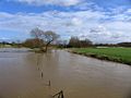 River Wreake in spate - geograph.org.uk - 355493.jpg 640 × 480; 57 KB
-
 Yellow path towards Barkby - geograph.org.uk - 159540.jpg 480 × 640; 70 KB


_-_geograph.org.uk_-_5718242.jpg)


.jpg)


_-_geograph.org.uk_-_5718206.jpg)


_-_geograph.org.uk_-_5718230.jpg)


.jpg)


