Category:1920s maps of Europe
Jump to navigation
Jump to search
Temperate regions: North America · South America · Africa · Europe · Asia · Oceania – Polar regions: – Other regions:
Subcategories
This category has the following 54 subcategories, out of 54 total.
.
1
- 1920s maps of Armenia (4 F)
- 1920s maps of Georgia (8 F)
A
- 1920s maps of Albania (2 F)
B
- 1920s maps of Belgium (13 F)
- 1920s maps of Bosnia and Herzegovina (empty)
- 1920s maps of Bulgaria (4 F)
C
- 1920s maps of the Caucasus (21 F)
D
E
- 1920s maps of Eastern Europe (6 F)
F
G
H
- 1920s maps of Hungary (7 F)
I
- 1920s maps of Iceland (4 F)
- 1920s maps of Ireland (4 F)
L
- 1920s maps of Luxembourg (4 F)
N
P
R
- 1920s maps of Romania (1 F)
S
- 1920 maps of Slovenia (empty)
- 1920s maps of Slovenia (1 F)
T
U
Media in category "1920s maps of Europe"
The following 13 files are in this category, out of 13 total.
-
 Europe in 1923.jpg 7,097 × 5,456; 6.97 MB
-
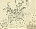
 Europe politique... - dressée par J. Forest... - btv1b53065086s.jpg 15,680 × 12,120; 33.5 MB
-
 Bell telephone magazine (1922) (14756405675).jpg 1,172 × 3,150; 617 KB
-
 Bell telephone magazine (1922) (14776336403).jpg 2,336 × 1,898; 952 KB
-
 Canadian school geography (1922) (14762349974).jpg 1,458 × 2,170; 404 KB
-
 Canadian school geography (1922) (14764715355).jpg 1,490 × 2,192; 478 KB
-
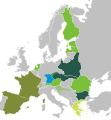 International Agrarian Bureau.svg 2,670 × 2,880; 445 KB
-
 International Entente of Radical and Similar Democratic Parties.svg 2,670 × 2,880; 393 KB
-
 Lange diercke sachsen europa bodenbenutzung.jpg 1,248 × 1,589; 883 KB
-
 Map Geological Map of Europe 1928-1940 - Touring Club Italiano CART-TRC-23.jpg 7,613 × 6,403; 32.32 MB
-
 Map Linguistic map of Europe 1928-1940 - Touring Club Italiano CART-TRC-29.jpg 7,491 × 6,356; 27.8 MB
-
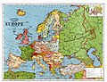
 The 1920s-1922 Larousse Europe map.jpg 1,992 × 1,263; 1.34 MB
-
 Wilsonian Armenia National Geographic 1921.jpg 625 × 563; 123 KB


_(14776336403).jpg)
_(14762349974).jpg)
_(14764715355).jpg)


_(14756405675).jpg)