Category:1920s maps of the Iberian Peninsula
Jump to navigation
Jump to search
| 20th-century maps of the Iberian Peninsula: ← 1900s 1910s 1920s 1930s 1940s 1950s 1960s 1970s 1980s 1990s → |
Subcategories
This category has the following 2 subcategories, out of 2 total.
P
S
Media in category "1920s maps of the Iberian Peninsula"
The following 5 files are in this category, out of 5 total.
-
 Botánica descriptiva BHL11322102.jpg 2,482 × 1,718; 522 KB
-
 Cambridge Medieval History V 3 (1922) (14765298242).jpg 6,584 × 5,014; 7.05 MB
-
 España y Portugal - E. López, editor - btv1b8458571q.jpg 7,796 × 6,262; 6.92 MB
-
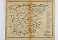
 Map of the portuguese and spanish railways.jpg 2,313 × 1,821; 753 KB
-


_(14765298242).jpg)


