Category:1950s maps of Europe
Jump to navigation
Jump to search
Temperate regions: North America · South America · Africa · Europe · Asia · Oceania – Polar regions: – Other regions:
Subcategories
This category has the following 42 subcategories, out of 42 total.
1
A
B
- 1950s maps of Bulgaria (14 F)
D
E
F
G
- 1950s maps of Greece (8 F)
H
I
- 1950s maps of Iceland (5 F)
L
N
P
R
S
T
U
Media in category "1950s maps of Europe"
The following 2 files are in this category, out of 2 total.
-
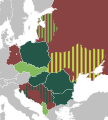
 Balkan Pact (1953) + NATO member states.png 1,173 × 984; 53 KB
-
 International Peasant Union.svg 840 × 930; 419 KB
_%2B_NATO_member_states.png)
