Category:1920s maps of Greece
Jump to navigation
Jump to search
Subcategories
This category has the following 2 subcategories, out of 2 total.
- 1920 maps of Greece (2 F)
- 1924 maps of Greece (1 F)
Media in category "1920s maps of Greece"
The following 7 files are in this category, out of 7 total.
-
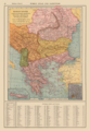 Balkan States and Greater Greece Map 1921 by Francis J Reynolds.png 3,314 × 4,795; 24.2 MB
-
 Démosthène par Georges Clemenceau Carte2.jpg 1,435 × 2,001; 802 KB
-
 Greater Greece and Aegean Topographic Map by Bartholomew 1920.jpg 9,597 × 7,470; 32.37 MB
-
 Greater Greece Map Detail by John Bartholomew 1920.jpg 2,742 × 2,743; 2.68 MB
-
 La Grece en 1920 (Greater Greece in 1920) Excelsior Map.jpg 2,000 × 2,000; 765 KB
-
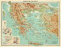
 Map of Great Greece (Megali Hellas) Venizelos c1920.jpg 3,528 × 2,455; 3.4 MB
-


_Excelsior_Map.jpg)
_Venizelos_c1920.jpg)
_Southeast_Europe_and_Asia_Minor_1922.jpg)