
Category:1960s maps of Europe
Temperate regions: North America · South America · Africa · Europe · Asia · Oceania – Polar regions: – Other regions:
Subcategories
This category has the following 44 subcategories, out of 44 total.
1
A
B
- 1960s maps of Belgium (8 F)
- 1960s maps of Bulgaria (6 F)
C
- 1960s maps of Cyprus (6 F)
D
E
F
G
H
- 1960s maps of Hungary (6 F)
I
- 1960s maps of Iceland (5 F)
N
P
- 1960s maps of Poland (9 F)
- 1960s maps of Portugal (2 F)
R
- 1960s maps of Romania (7 F)
S
- 1960s maps of Spain (11 F)
T
- 1960s maps of Turkey (10 F)
U
Media in category "1960s maps of Europe"
This category contains only the following file.
-
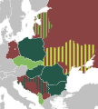 International Peasant Union.svg 840 × 930; 419 KB
