Category:1920s maps of Sweden
Jump to navigation
Jump to search
Subcategories
This category has the following 2 subcategories, out of 2 total.
- 1926 maps of Sweden (1 F)
Media in category "1920s maps of Sweden"
The following 10 files are in this category, out of 10 total.
-
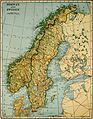 Collier's 1921 Norway - Map of Norway and Sweden.jpg 1,798 × 2,308; 1.3 MB
-
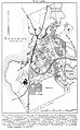
 Karta över Västerås vid 1900-talets början.png 771 × 720; 79 KB
-
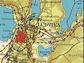
 Ludvika 1925.jpg 778 × 1,252; 344 KB
-
 Karta över Uppsala, 1920, Nordisk familjebok.jpg 2,509 × 2,695; 1.08 MB
-
 Karta över Varberg (ur Nordisk familjebok).jpg 781 × 656; 158 KB
-
 Karta över Viborg under tidigt 1900-tal.png 782 × 1,150; 129 KB
-
 Katrineholm (1924).png 3,158 × 2,605; 214 KB
-

-
 Ludvika 1929.jpg 606 × 455; 189 KB
-
 PostruterDanmark2.jpg 758 × 832; 143 KB


.jpg)

.png)
_(14782209882).jpg)

