Category:1900s maps of Egypt
Jump to navigation
Jump to search
Countries of Asia: Afghanistan · Armenia‡ · Azerbaijan‡ · People's Republic of China · Cyprus‡ · Egypt‡ · Georgia‡ · India · Indonesia‡ · Iran · Iraq · Japan · Jordan · Lebanon · Pakistan · Philippines · Russia‡ · Syria · Thailand · Turkey‡ · Uzbekistan
Limited recognition: Abkhazia‡ · Taiwan · State of Palestine
‡: partly located in Asia
Limited recognition: Abkhazia‡ · Taiwan · State of Palestine
‡: partly located in Asia
Countries of Africa: Algeria · Djibouti · Egypt‡ · Eritrea · Ethiopia · Libya · Madagascar · Morocco · Somalia · South Africa · Sudan · Tunisia · Zambia · Zimbabwe
Limited recognition: Somaliland
‡: partly located in Africa
Limited recognition: Somaliland
‡: partly located in Africa
Subcategories
This category has the following 3 subcategories, out of 3 total.
- 1903 maps of Egypt (3 F)
- 1905 maps of Egypt (1 F)
- 1907 maps of Egypt (empty)
Media in category "1900s maps of Egypt"
The following 29 files are in this category, out of 29 total.
-
 088 agypten-dar-fur-und-abessinien (1905).png 1,695 × 2,205; 2.24 MB
-
 D068- N° 436. Egypte et Syrie de Bonaparte. - Liv3-Ch16.png 1,444 × 1,798; 336 KB
-

-

-
 The Harmsworth atlas and Gazetter 1908 (135850580).jpg 9,572 × 12,531; 123.22 MB
-
 Africa 1909 07.png 1,264 × 951; 1.86 MB
-
 Atlas of ancient and classical geography (1909) (14780040424).jpg 3,412 × 2,260; 2.02 MB
-
 D137-Vallée du Nil, au-dessus de Memphis.-L2-Ch6.png 928 × 2,090; 263 KB
-
 D139-Nomes de la Haute Egypte.-L2-Ch6.png 930 × 1,936; 235 KB
-
 D141-Nomes de la Basse Egypte.-L2-Ch6.png 1,518 × 1,548; 151 KB
-
 D147-Désert oriental.-L2-Ch6.png 1,328 × 1,736; 391 KB
-
 D161-Delta du Nil.-L2-Ch6.png 1,518 × 1,352; 284 KB
-
 D163-Edfu et le Défilé de la Chaîne.-L2-Ch6.png 902 × 2,152; 220 KB
-
 D165-L’Atbâra et la Mer Rouge.-L2-Ch6.png 1,512 × 1,816; 372 KB
-
 D171-Le Fayum et le Uadi-Rayan.-L2-Ch6.png 1,492 × 1,660; 373 KB
-
 D183-Première Cataracte.-L2-Ch6.png 910 × 1,854; 328 KB
-
 D199-Territoire des Pyramides.-L2-Ch6.png 1,420 × 1,904; 369 KB
-
 D210-Thèbes et ses Faubourgs.-L2-Ch6.png 1,326 × 1,541; 285 KB
-
 D215-Plan de Nekab (Elkab, Eileithyiaspolis).-L2-Ch6.png 1,438 × 1,802; 364 KB
-
 D219-Capitales et Routes.-L2-Ch6.png 1,298 × 1,740; 158 KB
-
 D225-Du Temple d’Ombos à celui de Soleb.-L2-Ch6.png 1,446 × 1,424; 274 KB
-
 D231-Communications intermaritimes.-L2-Ch6.png 1,439 × 1,860; 354 KB
-
 D349-Alexandrie d’Egypte et le Nil.-L2-Ch8.png 1,454 × 1,946; 241 KB
-
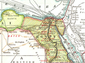
 Lake Moeris.jpg 1,620 × 1,122; 949 KB
-
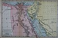
 Map of Egypt and the Soudan.png 2,706 × 3,705; 4.49 MB
-
 Table of Nations.jpg 1,328 × 1,749; 648 KB
-
 Yuzhakov Big Encyclopedia Map of Egypt.jpg 3,828 × 4,620; 3.7 MB
-
 Histoire ancienne des peuples de l'Orient 1904 (139104714).jpg 4,846 × 4,857; 23.74 MB
-
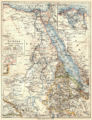
 Ägypten und Nubien - btv1b10104312r.jpg 7,020 × 9,930; 7.95 MB
.png)

.jpg)

.jpg)

_(14780040424).jpg)


.-L2-Ch6.png)


.jpg)
