Category:1900s maps of Morocco
Jump to navigation
Jump to search
Countries of Africa: Algeria · Djibouti · Egypt‡ · Eritrea · Ethiopia · Libya · Madagascar · Morocco · Somalia · South Africa · Sudan · Tunisia · Zambia · Zimbabwe
Limited recognition: Somaliland
‡: partly located in Africa
Limited recognition: Somaliland
‡: partly located in Africa
Media in category "1900s maps of Morocco"
The following 11 files are in this category, out of 11 total.
-

-

-
 Thymiaterium and Other Ancient Northwest African Settlements.png 816 × 618; 1.13 MB
-
 Africaseptentrionalis-sb.jpg 3,043 × 2,035; 2.03 MB
-
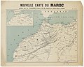 Nouvelle carte du Maroc - btv1b84443347 (1 of 2).jpg 9,004 × 7,208; 6.71 MB
-
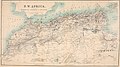 Cook's practical guide to Algeria and Tunisia (1908) (14586642948).jpg 3,138 × 1,764; 724 KB
-
-
 D090- N° 439. Le détroit de Gibraltar. - Liv3-Ch17.png 1,451 × 1,719; 490 KB
-
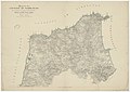
 D280- N° 467. Le Maroc du Sultan et le Bled es Siba. - Liv3-Ch20.png 1,442 × 1,648; 63 KB
-
 D349- N° 374. Espagne et Maurétanie. - liv3-ch11.png 1,436 × 1,594; 327 KB
-
 Zur Marokkokonferenz ! Karte von Marokko... - von K. Langenbucher... - btv1b8444187p.jpg 9,740 × 8,276; 9.73 MB

.jpg)


.jpg)
_(14586642948).jpg)


