Category:1930s maps of Egypt
Jump to navigation
Jump to search
Countries of Africa: Algeria · Angola · Democratic Republic of the Congo · Djibouti · Egypt‡ · Ethiopia · Libya · Madagascar · Morocco · Mozambique · Sierra Leone · South Africa · Sudan · Tunisia
‡: partly located in Africa
‡: partly located in Africa
Subcategories
This category has only the following subcategory.
Media in category "1930s maps of Egypt"
The following 9 files are in this category, out of 9 total.
-
 Asian places in Brockhaus 1937.jpg 1,600 × 2,601; 2.4 MB
-
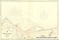 Admiralty Chart No 2573 Damietta to El Arish, Published 1930.jpg 16,197 × 11,087; 42.03 MB
-

-
 ETH-BIB-Aegypten im Altertum-Dia 247-11172.tif 3,044 × 3,291; 9.64 MB
-
 GJ34-503-Seite3.gif 600 × 900; 28 KB
-
 Lange diercke sachsen afrika nildelta.jpg 1,078 × 702; 381 KB
-

-

-
 Wagons-Lits-Egypt-brochure-1930.jpg 2,048 × 2,144; 537 KB


.jpg)
.jpg)
