Category:1900s maps of Algeria
Jump to navigation
Jump to search
Countries of Africa: Algeria · Djibouti · Egypt‡ · Eritrea · Ethiopia · Libya · Madagascar · Morocco · Somalia · South Africa · Sudan · Tunisia · Zambia · Zimbabwe
Limited recognition: Somaliland
‡: partly located in Africa
Limited recognition: Somaliland
‡: partly located in Africa
Media in category "1900s maps of Algeria"
The following 18 files are in this category, out of 18 total.
-

-

-

-

-
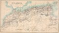
 Africaseptentrionalis-sb.jpg 3,043 × 2,035; 2.03 MB
-

-
 Cook's practical guide to Algeria and Tunisia (1908) (14586633989).jpg 3,290 × 2,620; 716 KB
-
 Cook's practical guide to Algeria and Tunisia (1908) (14586642948).jpg 3,138 × 1,764; 724 KB
-
 Cook's practical guide to Algeria and Tunisia (1908) (14586812047).jpg 2,618 × 1,414; 412 KB
-

-
 Bulletin. 1901-13 (20235835010).jpg 2,150 × 3,646; 1.5 MB
-
 Chemins de fer de l'Ouenza - btv1b53121117c.jpg 7,294 × 7,912; 4.03 MB
-
 D122- N° 444. Le Sahel d’Alger et la Mitidja - Liv3-Ch17.png 1,445 × 1,571; 307 KB
-
 D431- N° 500. Algérie, Tunisie, Sahara. - Liv4-Ch03.png 1,446 × 1,518; 268 KB
-
 D465- N° 285. Maurétanie et Sahara. -liv3-ch4.png 1,454 × 1,736; 355 KB
-
 Hess - La Vérité sur l’Algérie, 1905, page 65.jpg 1,572 × 2,184; 975 KB
-
 L. Moreau and H. Soulie, Essai sur la repartition... Wellcome L0026241.jpg 2,072 × 1,012; 1.01 MB
-
 Map of date palm oases in Tunisia and Algeria 1906.jpg 750 × 716; 155 KB
.jpg)
.jpg)
.jpg)
.jpg)

.jpg)
_(14586633989).jpg)
_(14586642948).jpg)
_(14586812047).jpg)

.jpg)


