Category:1900s maps of Somalia
Jump to navigation
Jump to search
Countries of Africa: Algeria · Djibouti · Egypt‡ · Eritrea · Ethiopia · Libya · Madagascar · Morocco · Somalia · South Africa · Sudan · Tunisia · Zambia · Zimbabwe
Limited recognition: Somaliland
‡: partly located in Africa
Limited recognition: Somaliland
‡: partly located in Africa
Subcategories
This category has the following 2 subcategories, out of 2 total.
- 1909 maps of Somalia (empty)
1
Media in category "1900s maps of Somalia"
The following 5 files are in this category, out of 5 total.
-
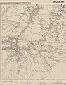
 1906 Map of a portion of Somaliland by the Ordnance Survey Office.jpg 16,986 × 17,654; 42.48 MB
-
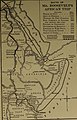
 Africa 1909, Edward Hertslet (Horn of Africa, detail).jpg 640 × 480; 72 KB
-
-
 Map of a portion of Somaliland.png 8,035 × 8,351; 124.1 MB
-
 Map of the French Coast of the Somalis showing Harar.jpg 668 × 852; 256 KB

.jpg)
.jpg)

