Category:1900s maps of Armenia
Jump to navigation
Jump to search
Media in category "1900s maps of Armenia"
The following 9 files are in this category, out of 9 total.
-
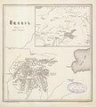
 Stanford, Edward. Asia Minor, Caucasus, Black Sea. 1901 (I).jpg 518 × 554; 135 KB
-
 Lynch Armenia Bingöl mountains map left.png 1,391 × 2,092; 6.55 MB
-
 Lynch Armenia Bingöl mountains map right.png 1,052 × 2,092; 4.98 MB
-
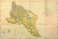 Ethnographic map of the Erivan Governorate-1902.png 4,956 × 3,376; 13.86 MB
-
 Russian map Armenia 1903.png 2,232 × 1,696; 10.2 MB
-
 Map of Sasun by Alexander Kalantar.pdf 804 × 893; 1.75 MB
-
 Provinces of the North-West Frontiers with Jazirah and Azerbaijan.png 984 × 658; 1.06 MB
-
 Kazakh uyezd.png 611 × 542; 896 KB
-
 Карта Кавказского края с показателем густоты армянского населения.png 4,954 × 4,440; 16.28 MB
.jpg)


