Category:1900s maps of Madagascar
Jump to navigation
Jump to search
Countries of Africa: Algeria · Djibouti · Egypt‡ · Eritrea · Ethiopia · Libya · Madagascar · Morocco · Somalia · South Africa · Sudan · Tunisia · Zambia · Zimbabwe
Limited recognition: Somaliland
‡: partly located in Africa
Limited recognition: Somaliland
‡: partly located in Africa
Media in category "1900s maps of Madagascar"
The following 13 files are in this category, out of 13 total.
-

-

-

-
 PL O. Jan Beyzym T. J. i Trędowaci na Madagaskarze 113.jpeg 699 × 1,007; 170 KB
-
 Bulletin de la Société géologique de France (1906) (20249012690).jpg 2,139 × 3,110; 2.65 MB
-
 Bulletin de la Société géologique de France (1906) (20428425582).jpg 3,234 × 2,492; 3 MB
-
 Cultru - Un empereur de Madagascar au XVIIIe siècle - Benyowszky, figure page7.png 1,480 × 2,533; 317 KB
-
 The Harmsworth atlas and Gazetter 1908 - Madagascar detail map.jpg 3,331 × 4,929; 20.28 MB
-

-

-

-
 D251- Madagascar et les Mascareignes -liv2-ch13.png 1,444 × 1,786; 303 KB
-
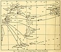 Percy Sladen Trust expedition 1905 magnetic variation transactionsofli214linn 0024.jpg 2,316 × 1,968; 491 KB
.jpg)
.jpg)


_(20249012690).jpg)
_(20428425582).jpg)


.jpg)
.jpg)
.jpg)
