Category:1848 maps
Jump to navigation
Jump to search
| ← · 1840 · 1841 · 1842 · 1843 · 1844 · 1845 · 1846 · 1847 · 1848 · 1849 · → |
Deutsch: Karten mit Bezug zum Jahr 1848
English: Maps related to the year 1848
Español: Mapas relativos al año 1848
Français : Cartes concernant l’an 1848
Русский: Карты 1848 года
Subcategories
This category has the following 11 subcategories, out of 11 total.
Media in category "1848 maps"
The following 60 files are in this category, out of 60 total.
-
Wien im October 1848 p048 Plan von Wien.jpg 1,499 × 1,916; 2.26 MB
-
Abhandlungen der Königlichen Akademie der Wissenschaften in Berlin (1848) (16143948444).jpg 3,250 × 3,086; 1.63 MB
-
Abhandlungen der Königlichen Akademie der Wissenschaften in Berlin (1848) (16558990727).jpg 3,184 × 3,082; 1.71 MB
-
Bad Homburg, Coghlans Stadtplan von 1848.JPG 2,076 × 1,620; 1.21 MB
-
Batalla de Elviña (Battle of Corunna) - 16-01-1809 - mapa (map).jpg 1,199 × 917; 923 KB
-
Benjamin Zeeb Wolf Ben Nathan Nata Lichtenstaedter, מפת ארצות הקדם (FL17237344 2480888).jpg 6,398 × 4,310; 43.37 MB
-
C. F. Wigand, Plan von Pressburg (FL39696785 3699922).jpg 10,775 × 8,139; 116.45 MB
-
Carte du département de la Loire - 1848.jpg 7,554 × 10,488; 11.45 MB
-
Chart. LOC 2003627051.jpg 10,234 × 5,533; 5.44 MB
-
Chart. LOC 2003627051.tif 10,234 × 5,533; 162 MB
-
Connecticut for schools, families, and general use LOC gm70001741.jpg 12,368 × 9,249; 15.38 MB
-
Detailed map of Yamato Province, enlarged and revised in Kaei period (14775312839).jpg 1,557 × 2,000; 1.56 MB
-
Douro river map Forrester.jpg 6,913 × 1,687; 3.05 MB
-
Formigas 1849 map.png 1,007 × 1,622; 4.68 MB
-
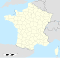
France location map-Departements 1848.svg 2,000 × 1,922; 587 KB
-
Gaea excursoria Germanica (Taf. 23) BHL27432415.jpg 2,041 × 3,568; 975 KB
-
Gaea excursoria Germanica (Taf. 24) BHL27432416.jpg 2,041 × 3,568; 816 KB
-
Gamla Stan och Riddarholmen 1848.jpg 2,296 × 2,892; 3.53 MB
-
Globe terrestre, Malby & Co, 1848 (37499591734).jpg 5,184 × 3,456; 7.25 MB
-
Helgeandsholmen 1848.jpg 1,066 × 782; 243 KB
-
Izmaylovo map 1848.jpg 1,000 × 678; 408 KB
-
Kaart van Zuid Holland 1848.jpg 13,583 × 9,961; 28.8 MB
-
Madrid-1848-Rafo y Ribera.jpg 2,792 × 1,920; 470 KB
-
Map & profiles of the Vt. Central and Vt. and Canada Railroads LOC 79693228.jpg 19,397 × 8,055; 12.93 MB
-
Map & profiles of the Vt. Central and Vt. and Canada Railroads LOC 79693228.tif 19,397 × 8,055; 447.01 MB
-
Map and profiles of the Vt. Central and Vt. and Canada Railroads (13410961605).jpg 2,000 × 925; 1.35 MB
-
Map of Delaware County, Pennsylvania - from original surveys, with the farm limits LOC 2012592172.jpg 17,900 × 12,813; 28.04 MB
-
Map of Delaware County, Pennsylvania - from original surveys, with the farm limits LOC 2012592172.tif 17,900 × 12,813; 656.18 MB
-
Map of the Carlisle Barracks, Carlisle, Pennsylvania. LOC 86692309.jpg 4,472 × 2,936; 1.2 MB
-
Map of the Carlisle Barracks, Carlisle, Pennsylvania. LOC 86692309.tif 4,472 × 2,936; 37.56 MB
-
Map of the Troy and Greenfield Rail Road and its connections (11838754365).jpg 2,000 × 1,393; 2.32 MB
-
Nikolskoe Plan Nikolskoer Weg Gustav Meyer 1848.jpg 1,506 × 965; 246 KB
-
Persia afghanistan 1848.jpg 491 × 402; 116 KB
-
Plan of Peaceful Edo (14958881361).jpg 2,258 × 2,000; 2.53 MB
-
Plano de Madrid, 1848, de Francisco Coello.jpg 5,000 × 2,948; 4.53 MB
-
Rogozhskoe 1848.jpg 1,000 × 619; 250 KB
-
The Environs Of London.jpg 8,295 × 5,524; 16.12 MB
-
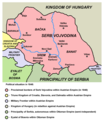
Vojvodina-1848-1.png 638 × 737; 69 KB
-
W. & A. K. Johnston, Battle of Mount Thabor.16th April 1799 (FL37129674 3911851).jpg 2,423 × 1,980; 3.81 MB
-
W. & A. K. Johnston, Map of lower Egypt and part of Syria (FL37129699 3911997).jpg 3,153 × 2,372; 3.07 MB
-
Westindische Inseln (3120220493).jpg 2,000 × 1,640; 2.9 MB


