Category:1840s maps
Jump to navigation
Jump to search
| 19th-century maps: ← 1800s 1810s 1820s 1830s 1840s 1850s 1860s 1870s 1880s 1890s → |
Not to be confused with maps depicting the 1840s.
Subcategories
This category has the following 20 subcategories, out of 20 total.
*
1
A
E
O
Media in category "1840s maps"
The following 21 files are in this category, out of 21 total.
-
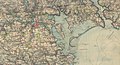
 1840s Map of Kirribilli Point compared to modern map.jpg 760 × 604; 297 KB
-
 1840s Map of Kirribilli Point.jpg 760 × 604; 106 KB
-
 1840s map of Kirribilli Thomas Jeffrey.jpg 798 × 798; 88 KB
-
 Asian - Altas der neusten Erdkunde.jpg 2,703 × 2,258; 2.09 MB
-
 Carte ancienne Île-Tudy.JPG 2,227 × 1,201; 1.13 MB
-
 Die Britischen Inseln, Spanien, Portugal, u. Frankreich 02.jpg 2,224 × 2,694; 1.81 MB
-
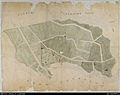
 Département de l'Isère - 1840s.jpg 8,192 × 7,092; 7.99 MB
-
 Europa - Atlas der neuen Erdkunde.jpg 2,696 × 2,226; 1.89 MB
-
 KokugunYochi1849.jpg 4,418 × 2,212; 7.16 MB
-
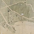 Map of Kirribilli circa 1840.jpg 1,200 × 1,200; 147 KB
-
 Florida (NYPL b13692629-1401774).tiff 4,936 × 5,475; 77.34 MB
-
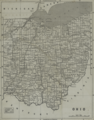 Ohio. NYPL1401778.tiff 3,362 × 4,281; 35.6 MB
-
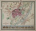 Plan von München 1844 (farbig).jpg 800 × 684; 115 KB
-
 Stadtplan von München 1843.jpg 1,356 × 1,089; 344 KB
-
 Stadtplan von München 1844.jpg 8,417 × 7,095; 69.97 MB
-
 Stadtplan von München 1849.jpg 2,186 × 2,917; 4.1 MB
-
 Stadtplan von München um 1840.jpg 1,602 × 1,146; 345 KB
-
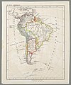 Süd-Amerika.jpg 2,227 × 2,668; 1.4 MB
-
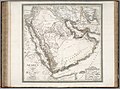 Weimarer Hand-Atlas - Arabien, 1841 (DRMC 9074050).jpg 6,275 × 4,659; 6.96 MB
-
 Weimarer Hand-Atlas - Arabien, 1848 (DRMC 2077045).jpg 8,685 × 11,660; 17.46 MB
-
 William Purser, Toka (FL165745477 2369966).jpg 4,089 × 2,951; 12.54 MB


.jpg)


.jpg)
.jpg)
.jpg)