Category:1848 maps of Africa
Jump to navigation
Jump to search
Temperate regions: North America · South America · Africa · Europe · Asia · Oceania – Polar regions: – Other regions:
| ← 1840 1841 1842 1843 1844 1845 1846 1847 1848 1849 → |
Media in category "1848 maps of Africa"
The following 7 files are in this category, out of 7 total.
-
-
 Afrique - par A.-H. Dufour - btv1b8468755k.jpg 10,126 × 7,411; 8.67 MB
-
 Carte d'Afrique - dressée par A.-H. Dufour - btv1b530887361.jpg 11,082 × 7,696; 12.23 MB
-

-
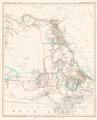 Karte vom Nilgebiet Platt 1848.pdf 2,337 × 2,887; 734 KB
-
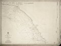
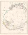 Nord Westafrica Platt 1848.pdf 2,337 × 2,887; 632 KB
-
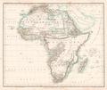 Übersichtskarte von Africa Platt 1848.pdf 2,872 × 2,425; 576 KB


