Category:1844 maps
Jump to navigation
Jump to search
| ← · 1840 · 1841 · 1842 · 1843 · 1844 · 1845 · 1846 · 1847 · 1848 · 1849 · → |
Deutsch: Karten mit Bezug zum Jahr 1844
English: Maps related to the year 1844
Español: Mapas relativos al año 1844
Français : Cartes concernant l’an 1844
Русский: Карты 1844 года
Subcategories
This category has the following 8 subcategories, out of 8 total.
Media in category "1844 maps"
The following 67 files are in this category, out of 67 total.
-
 BECHSTEIN(1844) p234 Plan von Leipzig.jpg 4,702 × 2,829; 6.9 MB
-
 BECHSTEIN(1844) p468 Plan der Grossherzoglichen Residenzstadt Weimar.jpg 4,666 × 3,022; 6.82 MB
-
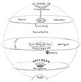 WHEATON(1844) The Cosmos in the Norse mythology.jpg 946 × 955; 140 KB
-
 WHEATON(1844) p669 Map.jpg 3,683 × 3,361; 4.7 MB
-
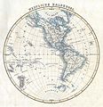
 1844 Flemming Map of the Eastern Hemisphere - Geographicus - EasternHemi-flemming-1844.jpg 2,500 × 2,579; 1.59 MB
-
-

-

-

-

-

-
 Antoine-Remy Frémin, Carte du Midi de la Judée ou Terre Sainte (FL83894166 2631836).jpg 4,607 × 3,294; 12.44 MB
-
 Antoine-Remy Frémin, Carte du royaume d'Herode (FL163904562 2631841).jpg 3,991 × 5,659; 12.01 MB
-
 Antoine-Remy Frémin, Palestine Selon le partage (FL49973406 4073141).jpg 10,025 × 7,422; 87.63 MB
-
 Belgien1844.png 1,455 × 878; 2.84 MB
-
 BockerterHeide1844(PreußischeUraufnahme).jpg 1,264 × 711; 1.27 MB
-
 Boehm Umgebungskarte von Berlin 1851 (Panke u Schönhauser Graben).jpg 1,627 × 1,299; 1.19 MB
-
 Boehm Umgebungskarte von Berlin 1851.jpg 9,500 × 6,462; 24.59 MB
-
 Bökel-Vennheide1844(PreußischeUraufnahme).jpg 800 × 450; 562 KB
-
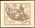 Carl Christian Franz Radefeld, Neueste Karte der Ostindischen Inseln (FL25569970 2467677).jpg 11,293 × 9,058; 147.55 MB
-

-
 Charles V. Monin, Egypte Syrie Phoenicia et Asia Mineure (FL49973361 4073140).jpg 7,425 × 10,236; 91.43 MB
-
 Chillum Wood. LOC 88690785.jpg 6,712 × 5,304; 4.2 MB
-
 Chillum Wood. LOC 88690785.tif 6,712 × 5,304; 101.85 MB
-
 China and Japan, John Nicaragua Dower (1844).jpg 7,297 × 5,945; 15.07 MB
-

-
 Dubourg's original view of Ancient Jerusalem A.D. 65 (FL6879617 2368050).jpg 2,900 × 2,146; 2.03 MB
-
 Frederick Catherwood, Plan of Jerusalem 1835 (FL6880550 2367920).jpg 2,100 × 2,932; 4.98 MB
-
 Giardini Cittadella di Alessandria.jpg 2,024 × 1,330; 2.5 MB
-
 Gunnlaugsson 1844 Iceland SE.djvu 7,943 × 6,140; 333 KB
-
 Gunnlaugsson 1844 Iceland SW.djvu 7,973 × 6,420; 462 KB
-
 Gunnlaugsson 1844 title page.djvu 8,059 × 6,341; 140 KB
-
 Hochbend1844(PreußischeUraufnahme).jpg 1,200 × 675; 235 KB
-
 Hogs Back to the Ottawa River.jpg 3,521 × 2,897; 2.5 MB
-

-
 Japan 1844.jpg 2,000 × 1,658; 3.54 MB
-
 Joseph Franz von Allioli, Karte von Palästina.nach den neuesten Hilfsquellen (FL197694312 1101768).jpg 10,816 × 12,838; 150.85 MB
-
 Joseph Franz von Allioli, Karte von Palästina.nach den neuesten Hilfsquellen (FL37105298 3886660).jpg 11,967 × 14,055; 219.08 MB
-

-
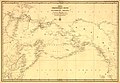 Karta Ledovitago mori︠a︡ i Vostochnago okeana LOC 99447835.jpg 11,078 × 7,660; 10.43 MB
-
 Karta Ledovitago mori︠a︡ i Vostochnago okeana LOC 99447835.tif 11,078 × 7,660; 242.78 MB
-
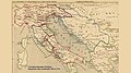 Karta-srbije.jpg 800 × 445; 81 KB
-
 L'Espagne 409 a 585 (Antoine Philippe Houze, 1844).jpg 5,787 × 4,502; 4.63 MB
-

-

-

-

-
 Map of the world (4587187528).jpg 2,000 × 1,661; 3.45 MB
-

-

-

-
-
 Morin Plan von Berlin 1844.jpg 2,274 × 1,613; 875 KB
-
 Neersen1844(PreußischeUraufnahme).jpg 1,440 × 810; 326 KB
-
 Neueste Karte vom Nord Pol (FL37810384 3146244).jpg 11,629 × 9,379; 142.14 MB
-
 Neueste Karte vom Süd-Pol (FL37810335 3146158).jpg 11,212 × 9,145; 134.92 MB
-
 Orléansville algérie map plan tripier 1844.jpg 345 × 294; 22 KB
-
 Plan de la ville de Mulhouse - 1844.jpg 9,276 × 7,554; 14 MB
-
 Plan til Regulering af Brandtomterne efter Ildebranden den 22de Januari 1842 (16401344925).jpg 21,724 × 13,392; 36.69 MB
-
 Planta da cidade de São Paulo, 1841.jpg 691 × 800; 263 KB
-

-
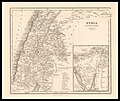
 Syria north part. Syria south part (FL37119431 3897587).jpg 2,711 × 4,622; 4.28 MB
-
 Syria South Part (FL35084128 3890475).jpg 6,336 × 5,342; 44.82 MB
-
 The American journal of science and arts (1844) (17533259134).jpg 3,222 × 2,416; 1.38 MB
-
 Vibe og Irgens kart over Christiania, 1844.jpg 2,594 × 2,800; 1.8 MB
-
 Viersen-Rintgen1844(PreußischeUraufnahme).jpg 800 × 450; 542 KB
-
 WinkelnGroßheide1844(PreußischeUraufnahme).jpg 1,024 × 576; 871 KB
_p234_Plan_von_Leipzig.jpg)
_p468_Plan_der_Grossherzoglichen_Residenzstadt_Weimar.jpg)
_The_Cosmos_in_the_Norse_mythology.jpg)
_p669_Map.jpg)


.jpg)

.jpg)
.jpg)
.jpg)

.jpg)
.jpg)

.jpg)
.jpg)
.jpg)
.jpg)

.jpg)
.jpg)
.jpg)

.jpg)


.jpg)
.jpg)
.jpg)


.jpg)

.jpg)
_(cropped).jpg)
.jpg)


.jpg)
.jpg)
.jpg)


.jpg)

.jpg)
.jpg)
_(17533259134).jpg)

.jpg)
.jpg)