Category:1842 maps
Jump to navigation
Jump to search
| ← · 1840 · 1841 · 1842 · 1843 · 1844 · 1845 · 1846 · 1847 · 1848 · 1849 · → |
Deutsch: Karten mit Bezug zum Jahr 1842
English: Maps related to the year 1842
Español: Mapas relativos al año 1842
Français : Cartes concernant l’an 1842
Русский: Карты 1842 года
Subcategories
This category has the following 9 subcategories, out of 9 total.
A
- 1842 maps of Africa (15 F)
E
G
N
O
- 1842 maps of Oceania (4 F)
S
- 1842 maps of South America (4 F)
Media in category "1842 maps"
The following 50 files are in this category, out of 50 total.
-

-
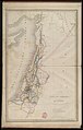
 Auguste Henri Dufour, Carte des Douze Tribus d'Israel (FL147430160 3948096).jpg 3,571 × 5,743; 15.51 MB
-
 Auguste Henri Dufour, Carte du Pays de Chanaan 01-map (FL49973653 4073160).jpg 7,943 × 12,463; 109.14 MB
-
 Auguste Henri Dufour, Carte du Pays de Chanaan 02-verso (FL49973654 4073160).jpg 12,213 × 7,664; 120.88 MB
-
 Auguste Henri Dufour, La Terre Sainte (FL83894799 4057312).jpg 6,276 × 8,084; 53.99 MB
-
-
 Barres mapa.jpg 1,519 × 1,200; 775 KB
-
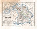 Bayern Karte 1842.jpg 3,750 × 3,000; 1.97 MB
-
 Bulletin de la Société Impériale des Naturalistes de Moscou (1842) (19813477944).jpg 3,280 × 3,584; 1.41 MB
-

-
 Carta da Capital de São Paulo (1842).jpg 7,136 × 5,366; 3.92 MB
-
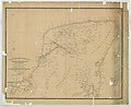
 Carta generale dell' America Settentrionale. NYPL434866.tiff 8,080 × 7,812; 180.61 MB
-
 Carte routière du département des Ardennes et des environs en 1842.jpg 8,697 × 7,887; 9.49 MB
-
 Carte topographique du département du Haut-Rhin - 1842.jpg 6,586 × 8,283; 11.12 MB
-
 Carte topographique et routière du département de la Charente - 1842.jpg 11,776 × 8,448; 9.84 MB
-

-

-
-

-
 E. Maineray, Carte de la Terre Sainte divise en 12 Tribus (FL200067272 2368745).jpg 3,593 × 4,380; 22.96 MB
-

-
 Fu sheng quan tu. LOC gm71002477.jpg 12,400 × 8,262; 13.74 MB
-
 Fu sheng quan tu. LOC gm71002477.tif 12,400 × 8,262; 293.11 MB
-
 General-Karte des Herzogthums Steyermark 1842 (II).jpg 10,104 × 10,180; 88.61 MB
-
 Géographie de la Bible (FL36555030 3899003).jpg 12,766 × 9,788; 176.86 MB
-
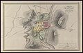
 Heinrich Kiepert, Plan von Jerusalem (FL6878585 2370022).jpg 2,220 × 2,783; 3.02 MB
-
 J. & C. Walker, The world as known to the ancients (FL158878724 2727122).jpg 15,975 × 10,780; 176.77 MB
-
 James Raymond Wellsted, Das Rothe Meer 1838 (FL35103482 3895290).jpg 9,846 × 9,777; 122.09 MB
-
 Kadaster 1842 Lutterade A2 uitsnede Drossaardhuis.jpg 2,482 × 2,229; 263 KB
-
 Karte von Palestina (FL199992210 2369220).jpg 3,680 × 4,275; 6.55 MB
-
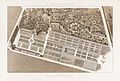
 Le Jardin des Plantes 1 - Paul Legrand.jpg 3,272 × 2,046; 9.31 MB
-
 Le Jardin des Plantes 2 - Paul Legrand.jpg 3,731 × 2,505; 10.5 MB
-
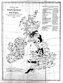 Map of mining districts of the U.K. 1842 Wellcome L0008343.jpg 1,194 × 1,584; 680 KB
-

-

-
 Mappa Tortona 1842.JPG 825 × 673; 227 KB
-

-
 Nathaniel Whittock, Jerusalem and the adjacent country (FL6881435 2368212).jpg 2,120 × 2,886; 3.53 MB
-
 Pierre M. Lapie, Carte de la Palestine ou Terre Sainte (FL35077247 3887370).jpg 11,693 × 15,981; 242.79 MB
-
 Plan af Kjøbenhavn - no-nb krt 00772.jpg 7,809 × 6,799; 16.77 MB
-
 Plan of Albion Estate by Edward McGeachy, 1842.jpg 1,005 × 773; 150 KB
-
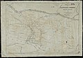
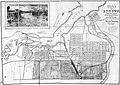 Plan of Bytown - 1842.jpg 6,009 × 4,235; 5.95 MB
-
 Plan of the town of Madras Wellcome L0026304.jpg 1,120 × 1,831; 827 KB
-
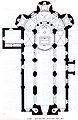 Plan église Bigot.jpg 1,995 × 3,066; 948 KB
-
 Plano del Departmento de Yucatan 1842.jpg 9,717 × 7,908; 3.84 MB
-
 Planul Vladimir de Blaremberg - 1842.jpg 2,567 × 1,623; 2.56 MB
-
 Report to Her Majesty's principal secretary of state... Wellcome L0067887.jpg 5,300 × 4,210; 6.98 MB
-
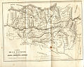
 Route of the Albany and West Stockbridge Rail Road (10176174055).jpg 800 × 561; 93 KB
-

-
 Übersichts-Blatt Afghanistan und den Ländern an der Nord-West Grenze Von Indien. LOC 2003627035.tif 6,680 × 6,115; 116.87 MB
.jpg)
.jpg)
.jpg)
.jpg)
.jpg)
.jpg)


_(19813477944).jpg)
.jpg)
.jpg)


.jpg)
.jpg)
.jpg)


.jpg)
.jpg)
.jpg)
.jpg)
.jpg)

.jpg)


_(14790029773).jpg)
.jpg)
.jpg)


.jpg)
